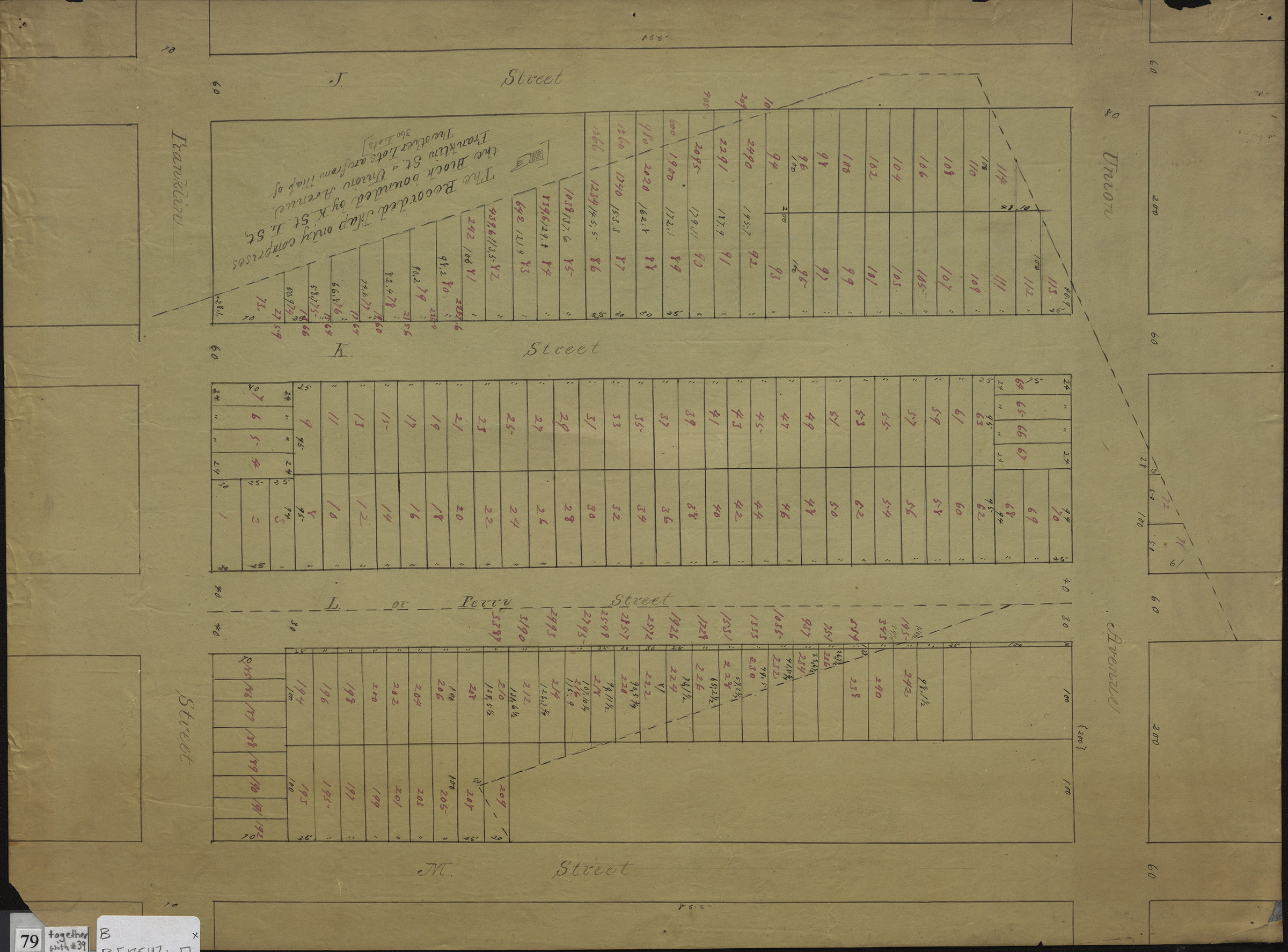

Map of property belonging to N. Bliss, situate[d] at Green Point, Kings Co., N.Y.: recorded in Kings County Registers Office in … [text illegible] April 12th, 1854 [1854]
Map No. B P-[1854]b.Fl
Cadastral map covering area bounded by J. Street, Franklin St., M. Street, and Union Ave. (modern-day Greenpoint). Shows property (including lot numbers and dimensions). Verso title. “The map entitled & recorded as above comprises only the block bounded by Franklin St., Union Ave., K. St., and L. St. The lots in the same correspond with the within”–Verso.
Map area shown
Relation
Full catalog recordSize
32 × 43 cmDownload
Low Resolution Image
Creator
Publisher
Brooklyn Historical SocietyCitation
Map of property belonging to N. Bliss, situate[d] at Green Point, Kings Co., N.Y.: recorded in Kings County Registers Office in … [text illegible] April 12th, 1854; [1854], Map Collection, B P-[1854]b.Fl; Brooklyn Historical Society.Scale
Scale not givenLoading zoom image... 