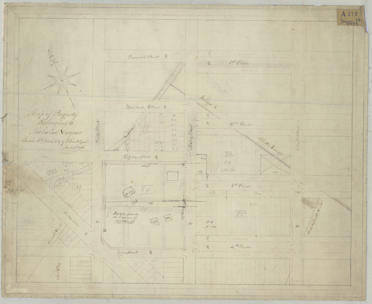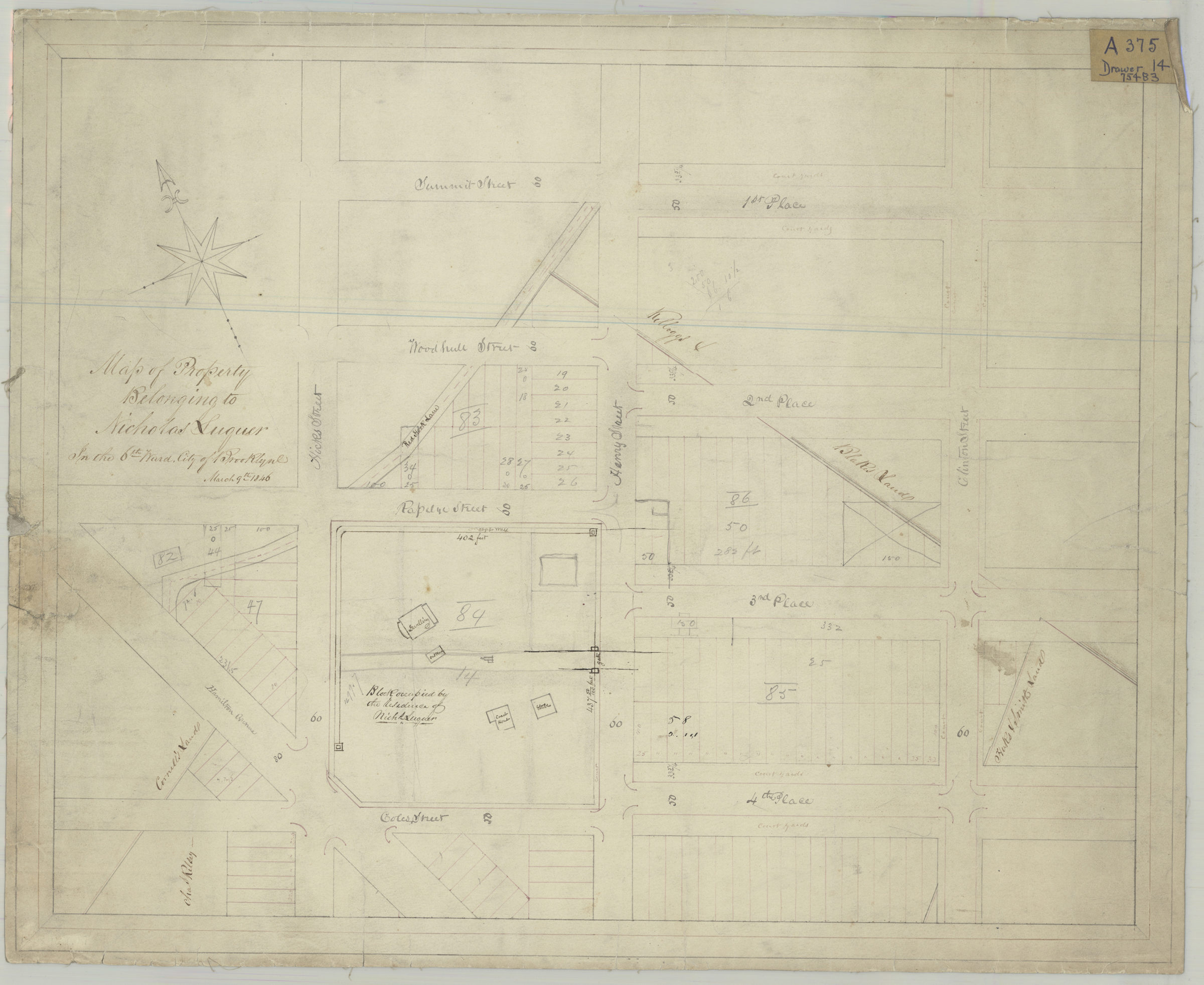
Map of property belonging to Nicholas Luquer in the Sixth Ward, city of Brooklyn March 9, 1846
Map No. Luquer-1846.Fl
Cadastral map covering area bounded by Hamilton Ave., Coles St., Clinton St., 1st Pl., and Hicks St. (modern-day Carroll Gardens). Shows property (including lot numbers, dimensions, and buildings). Oriented with north to the upper left.
Map area shown
Relation
Full catalog recordSize
43 × 53 cmDownload
Low Resolution Image
Creator
Publisher
Brooklyn Historical SocietyCitation
Map of property belonging to Nicholas Luquer in the Sixth Ward, city of Brooklyn; March 9, 1846, Map Collection, Luquer-1846.Fl; Brooklyn Historical Society.Scale
Scale not givenLoading zoom image...