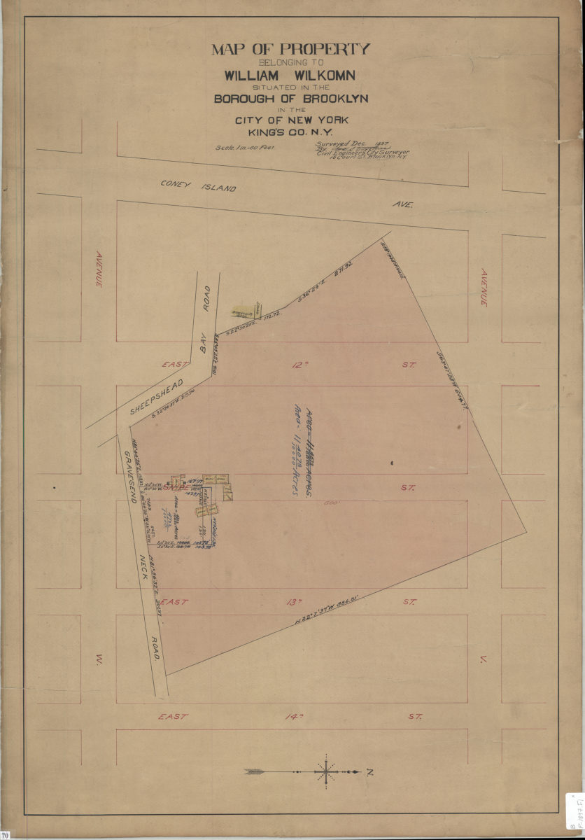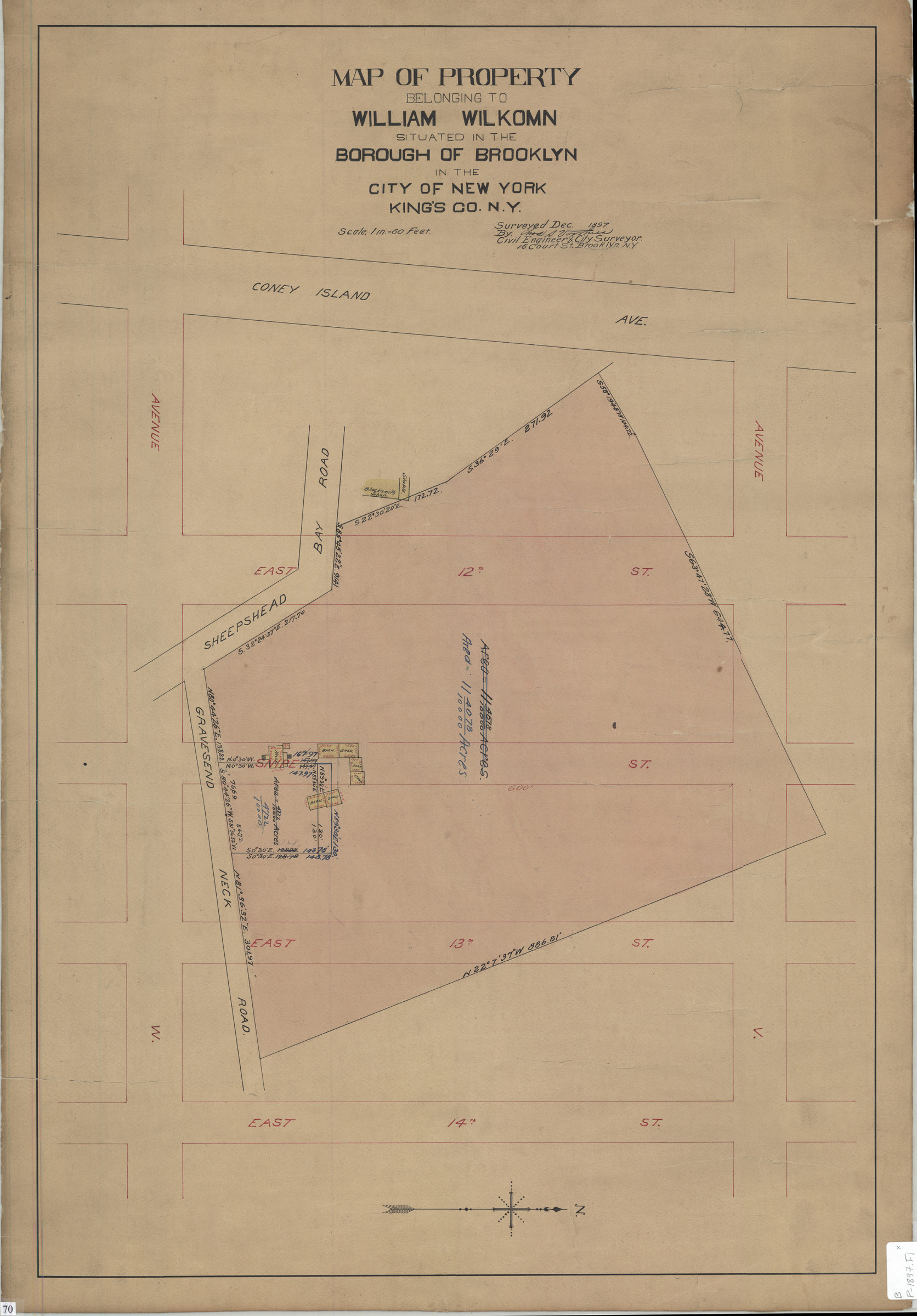
Map of property belonging to William Wilkomn, situated in the borough of Brooklyn in the city of New York, Kings County, N.Y.: surveyed Dec. 1897: by Chas. S. Voorhies, civil engineer & city surveyor December 1897
Map No. B P-1897.Fl
Cadastral map covering area bounded by Ave. V., Coney Island Ave., Ave. W., and E 14th St. (modern-day Sheepshead Bay). Shows property (including acreages and buildings). Oriented with north to the right.
Map area shown
Relation
Full catalog recordSize
77 × 52 cmDownload
Low Resolution Image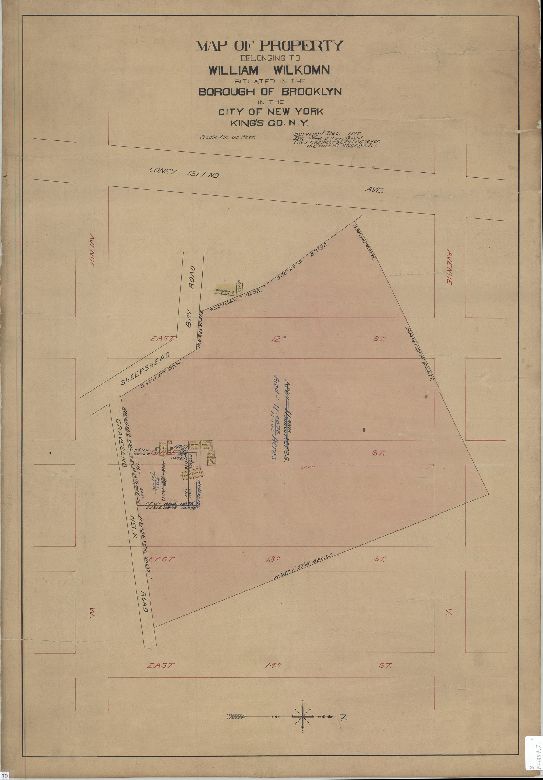
Creator
Voorhies, Chas S.,Publisher
Brooklyn Historical SocietyCitation
Map of property belonging to William Wilkomn, situated in the borough of Brooklyn in the city of New York, Kings County, N.Y.: surveyed Dec. 1897: by Chas. S. Voorhies, civil engineer & city surveyor; December 1897, Map Collection, B P-1897.Fl; Brooklyn Historical Society.Scale
Scale [1:720] 1 in to 60Loading zoom image...