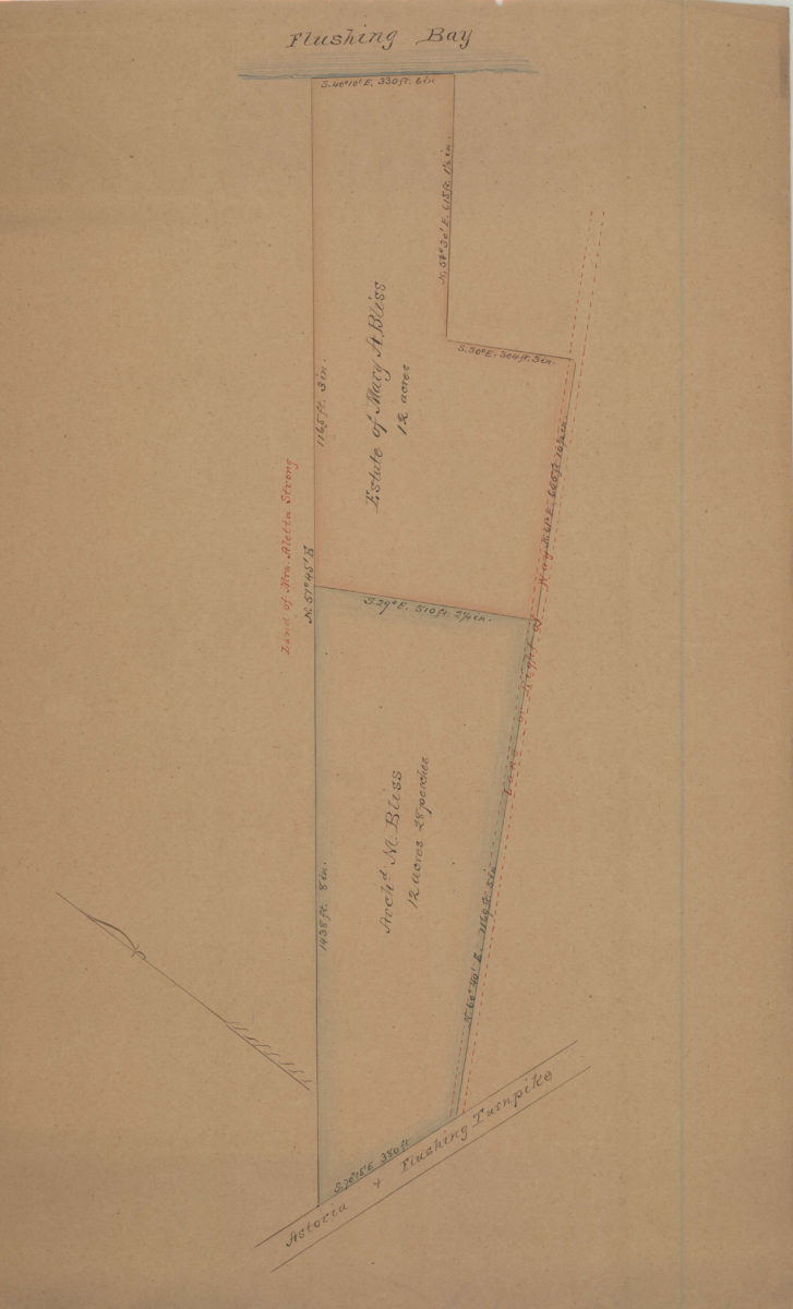
[Map of property between Astoria & Flushing Turnpike and Flushing Bay] [18??]
Map No. Q-[18--?]c.Fl
Cadastral map covering area in modern-day East Elmhurst. Shows property (including dimensions), and names of landowners. Title devised by cataloger. Oriented with north to the upper right.
Map area shown
Relation
Full catalog recordSize
36 × 61 cmDownload
Low Resolution Image
Creator
Publisher
Brooklyn Historical SocietyCitation
[Map of property between Astoria & Flushing Turnpike and Flushing Bay]; [18??], Map Collection, Q-[18--?]c.Fl; Brooklyn Historical Society.Scale
Scale not givenLoading zoom image...