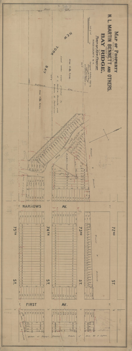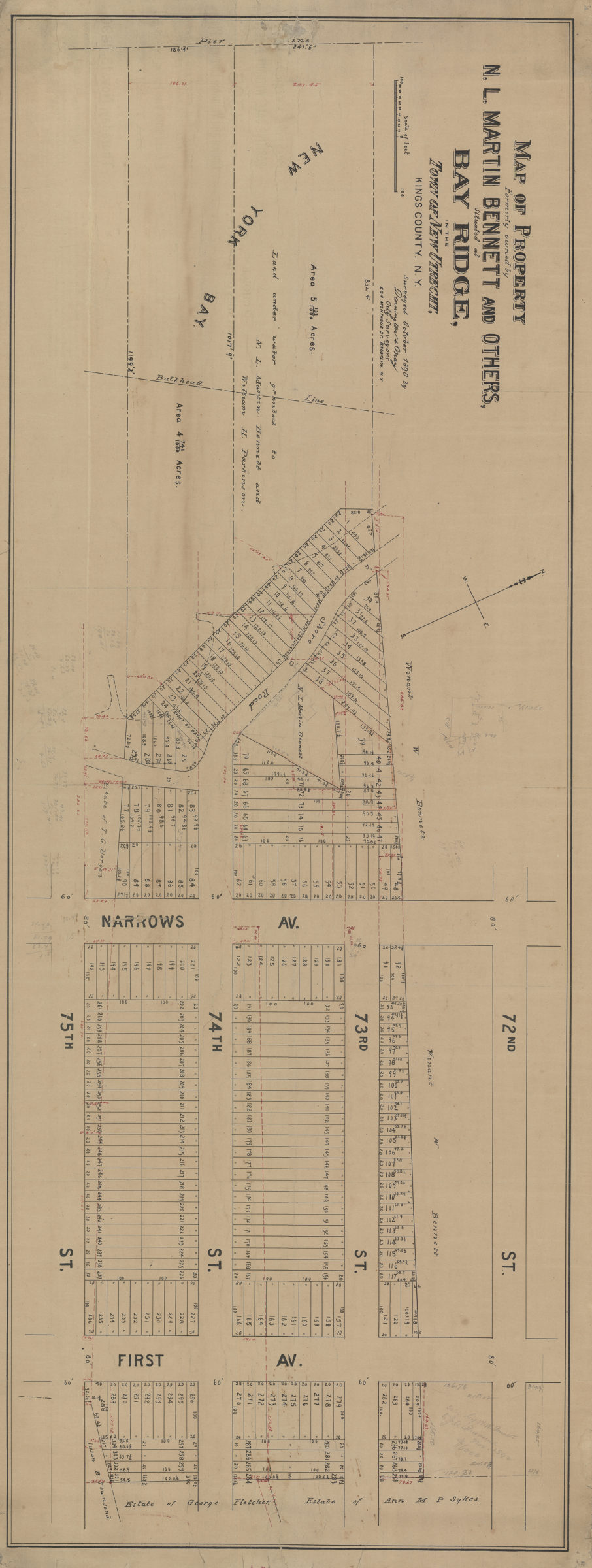
Map of property formerly owned by N.L. Martin Bennett and others, situated at Bay Ridge in the town of New Utrecht, Kings County, N.Y.: surveyed … by Dennington & May, city surveyors [1890]
Map No. B P-[1890].Fl.O
Cadastral map covering area east from New York Bay to 1st Ave. between 72nd St. and 75th St. (modern-day Bay Ridge). Shows property (including lot numbers and dimensions), names of landowners, and grants of land under water. Oriented with north to the upper left. BHS copy annotated in gray pencil.
Subjects
Places
Map area shown
Genre
Cadastral mapsRelation
Full catalog recordSize
42 × 115 cmDownload
Low Resolution Image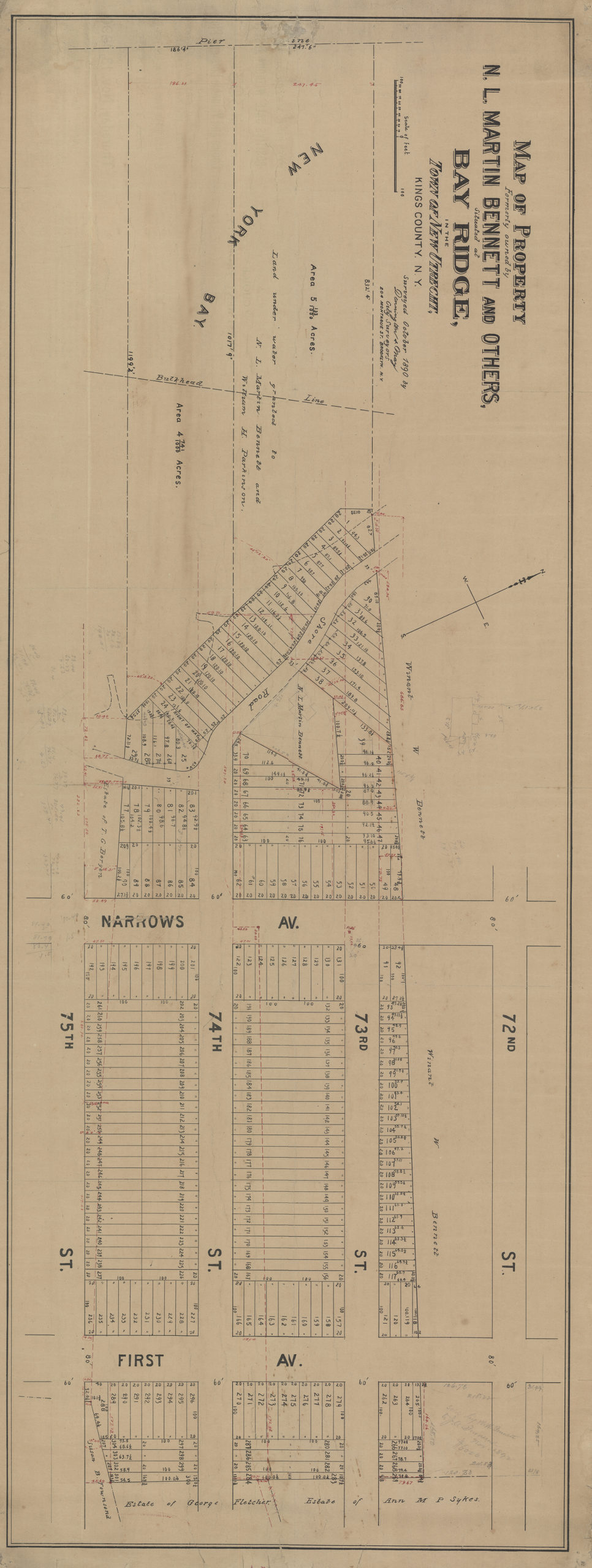
Creator
Dennington, Frederick C.,Publisher
Brooklyn Historical SocietyCitation
Map of property formerly owned by N.L. Martin Bennett and others, situated at Bay Ridge in the town of New Utrecht, Kings County, N.Y.: surveyed … by Dennington & May, city surveyors; [1890], Map Collection, B P-[1890].Fl.O; Brooklyn Historical Society.Scale
Scale [ca. 1:738]Loading zoom image...