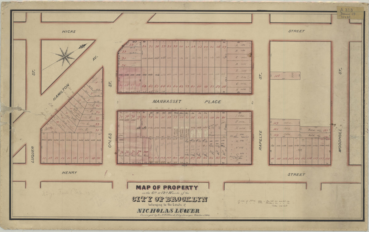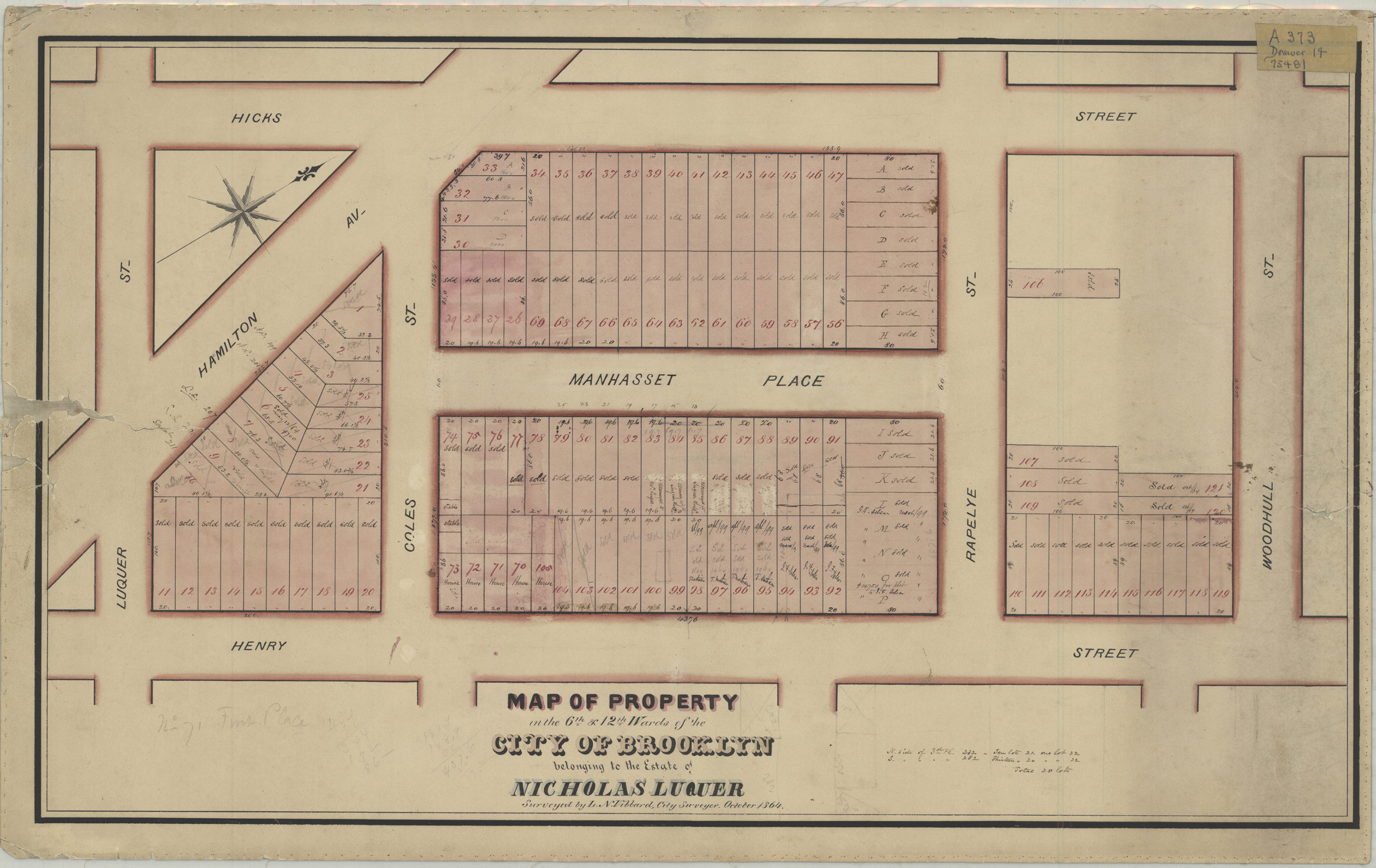
Map of property in the 6th & 12th Wards of the city of Brooklyn belonging to the estate of Nicholas Luquer: surveyed by L.N. Vibbard, city surveyor October 1864
Map No. Luquer-1864.Fl
Cadastral map covering area bounded by Hicks St., Luquer St., Henry St. and Woodhull St. (modern-day Carroll Gardens). Shows property (including lot numbers and measurements), and indictes when lots were sold. Oriented with north to the upper right.
Map area shown
Relation
Full catalog recordSize
42 × 72 cmDownload
Low Resolution Image
Creator
Vibbar, L. N.,Publisher
Brooklyn Historical SocietyCitation
Map of property in the 6th & 12th Wards of the city of Brooklyn belonging to the estate of Nicholas Luquer: surveyed by L.N. Vibbard, city surveyor; October 1864, Map Collection, Luquer-1864.Fl; Brooklyn Historical Society.Scale
Scale not givenLoading zoom image...