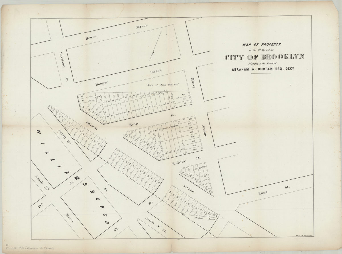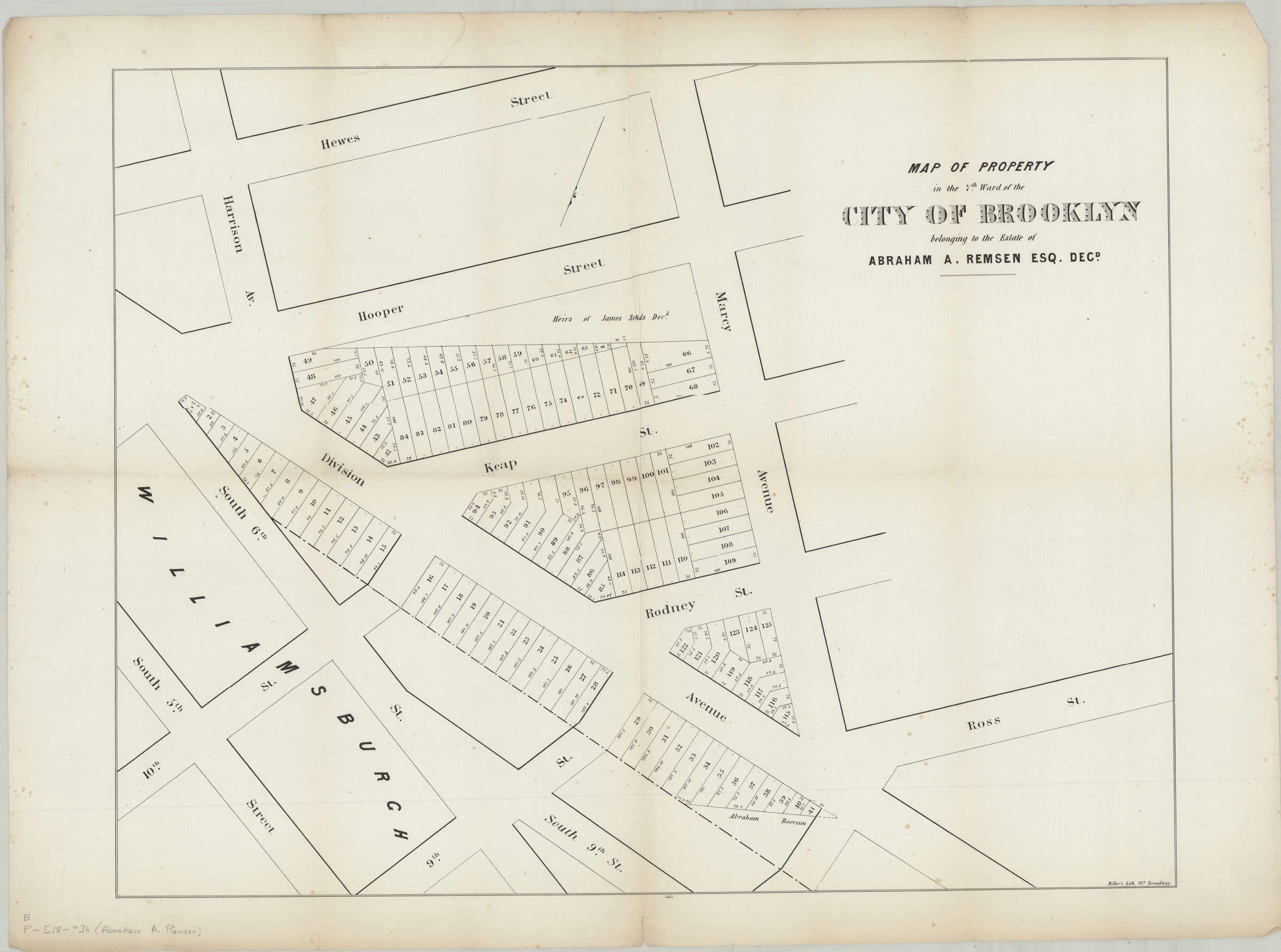
Map of property in the 7th Ward of the city of Brooklyn, belonging to the estate of Abraham A. Remsen, Esq., decd [184?]
Map No. B P-[184-?]c.Fl;B P-[184-?]c.Fl c.2;B P-[184-?]c.Fl c.3
Cadastral map covering area north from Hewes St. to S. 5th St. and east from approximately Marcy Ave. to Harrison Ave. (modern-day Williamsburg). Shows property (including lot numbers and dimensions), and names of landowners. Oriented with north to the lower left. “1441”–Lower center margin. BHS has 3 copies.
Map area shown
Genre
Cadastral mapsRelation
Full catalog recordSize
35 × 68 cmDownload
Low Resolution Image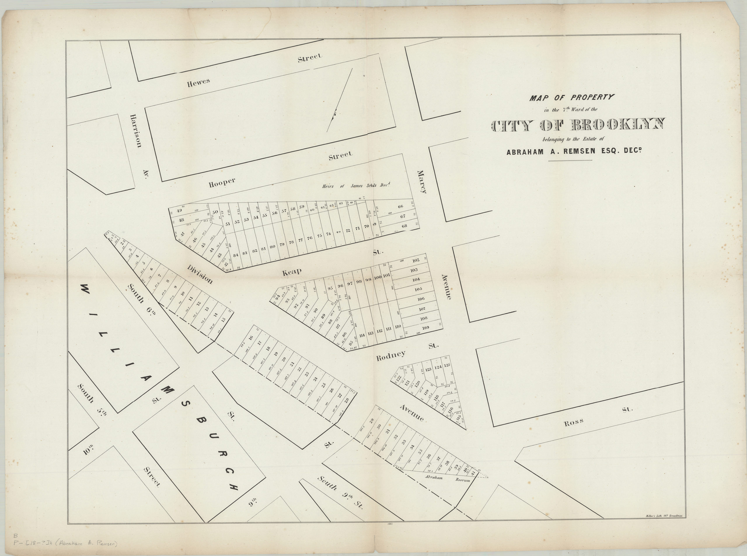
Creator
Miller & Co.,Publisher
Brooklyn Historical SocietyCitation
Map of property in the 7th Ward of the city of Brooklyn, belonging to the estate of Abraham A. Remsen, Esq., decd; [184?], Map Collection, B P-[184-?]c.Fl;B P-[184-?]c.Fl c.2;B P-[184-?]c.Fl c.3; Brooklyn Historical Society.Scale
Scale not givenLoading zoom image...