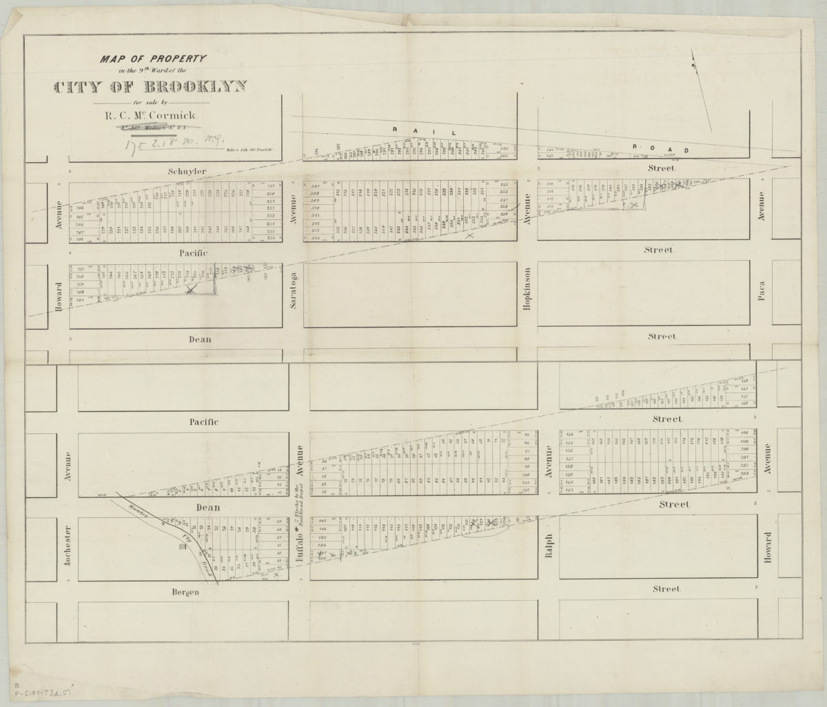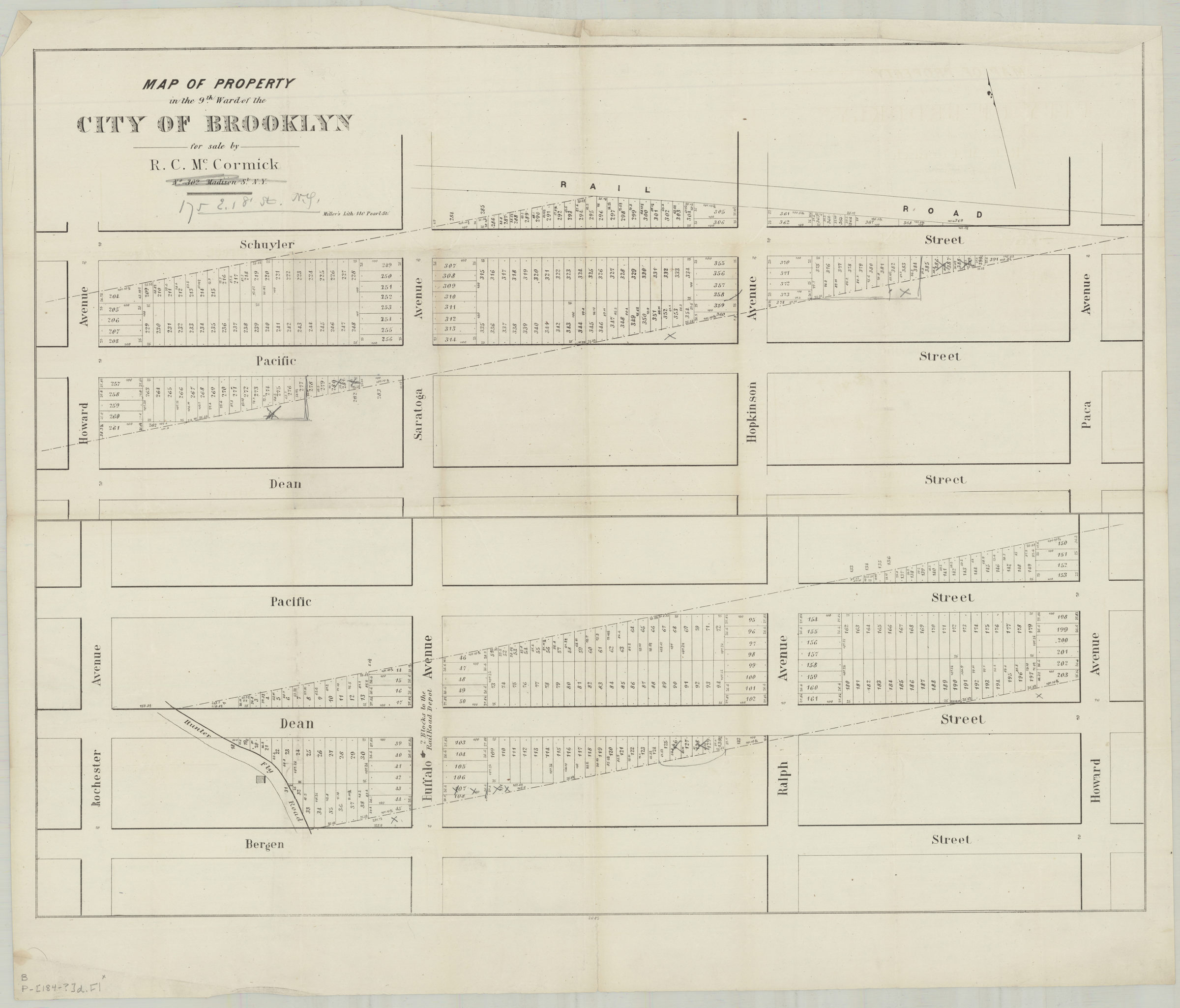
Map of property in the 9th Ward of the city of Brooklyn, for sale by R.C. McCormick, No. 302 Madison St., N.Y. [184?]
Map No. B P-[1841].Fl
Cadastral map covering area north from Bergen St. to Schuyler St. and east from Rochester Ave. to Paca Ave. (modern-day Bedford-Stuyvesant, formerly Weeksville). Shows property (including lot numbers and dimensions). Oriented with north to the upper left. Composed of 2 segments. “2085”–Lower center margin. BHS copy annotated in gray pencil.
Subjects
Places
Map area shown
Genre
Cadastral mapsRelation
Full catalog recordSize
54 × 69 cmDownload
Low Resolution Image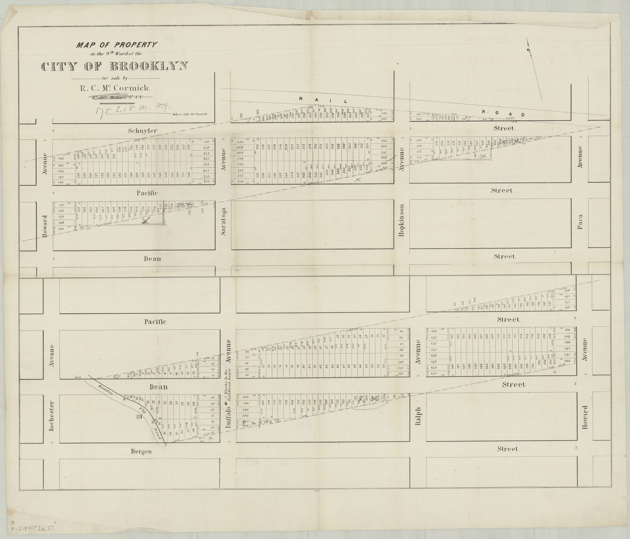
Creator
Miller & Co.,Publisher
Brooklyn Historical SocietyCitation
Map of property in the 9th Ward of the city of Brooklyn, for sale by R.C. McCormick, No. 302 Madison St., N.Y.; [184?], Map Collection, B P-[1841].Fl; Brooklyn Historical Society.Scale
Scale not givenLoading zoom image...