Map of property in the 9th Ward of the city of Brooklyn [1865]
Map No. B P-[1865?].Fl.F
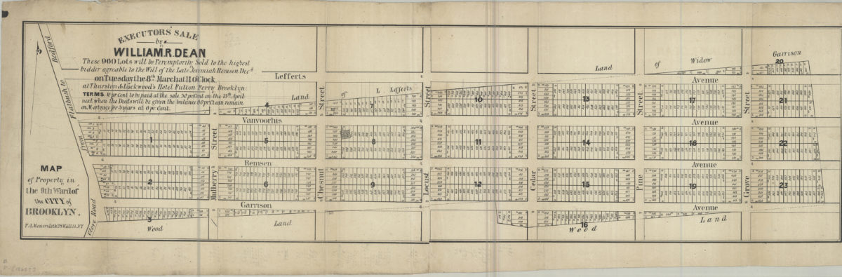
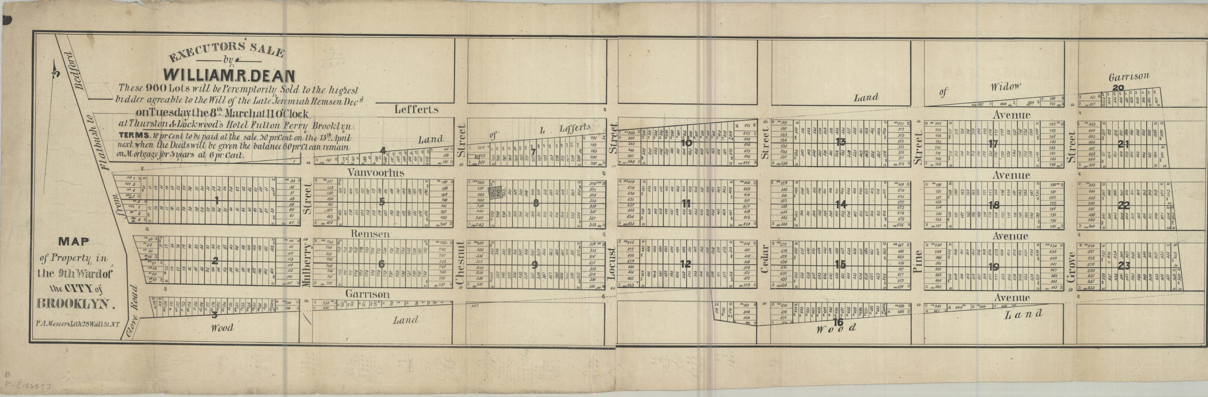
Cadastral map covering area bounded by Garrison Ave., Grove St., Lefferts Ave., and the Road from Flatbush to Bedford (modern-day Prospect Lefferts Gardens). Shows property (including lot numbers and dimensions), names of landowners, and woodlands. Includes text.
Subjects
Places
Map area shown
Genre
Cadastral mapsRelation
Full catalog recordSize
25 × 92 cmDownload
Low Resolution Image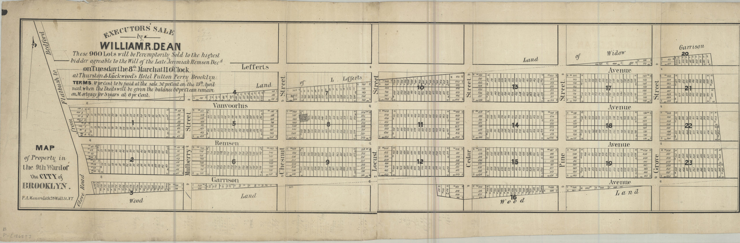
Creator
Mesier's Lith,Publisher
Brooklyn Historical SocietyCitation
Map of property in the 9th Ward of the city of Brooklyn; [1865], Map Collection, B P-[1865?].Fl.F; Brooklyn Historical Society.Scale
Scale not givenLoading zoom image...