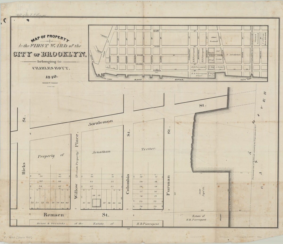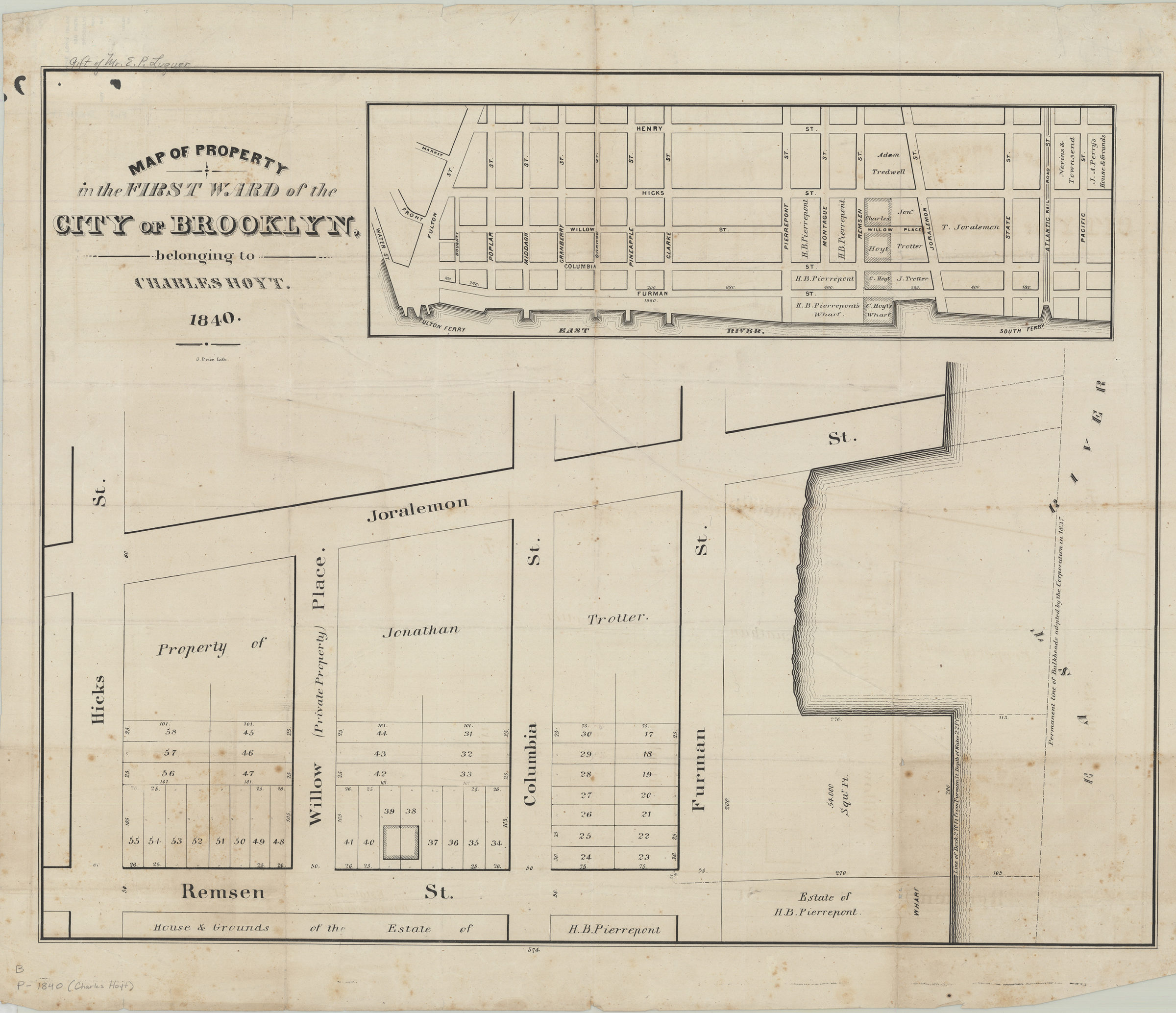
Map of property in the First Ward of the city of Brooklyn belonging to Charles Hoyt 1840
Map No. B P-1840.Fl
Cadastral map covering area north from Joralemon St. to Remsen St. and east from the East River to Hicks St. (modern-day Brooklyn Heights). Shows property (including lot numbers, dimensions, and buildings), names of landowners, and bulkhead lines. Oriented with north to the bottom. Includes location map. “574”–Lower center margin.
Map area shown
Genre
Cadastral mapsRelation
Full catalog recordSize
52 × 67 cmDownload
Low Resolution Image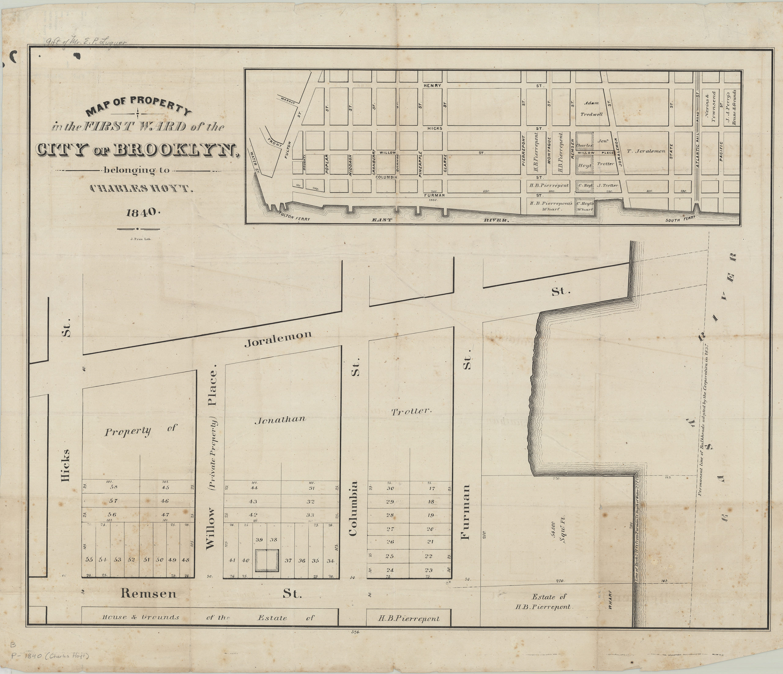
Creator
Price, J.,Publisher
Brooklyn Historical SocietyCitation
Map of property in the First Ward of the city of Brooklyn belonging to Charles Hoyt; 1840, Map Collection, B P-1840.Fl; Brooklyn Historical Society.Scale
Scale not givenLoading zoom image...