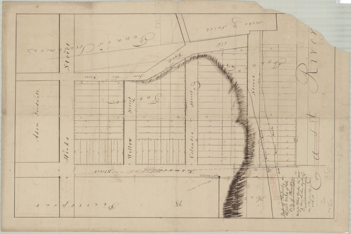
Map of property in the First Ward of the city of Brooklyn: made for Robert Carter Jan. 1833: by Isaac Ludlam, city surveyor ; Henry E. Pierrepont (copy), 1836 Mar. 10th March 10, 1836
Map No. B P-1836.Fl.Folio
Cadastral map covering area near the intersection of Remsen St. and Hicks St. (modern-day Brooklyn Heights). Shows property (including lots and dimensions), names of landowners, and high/low water marks. Relief shown by hachures. Oriented with north to the lower left. Includes notes.
Map area shown
Relation
Full catalog recordSize
93 × 60 cmDownload
Low Resolution Image
Creator
Ludlam, Isaac T.,Publisher
Brooklyn Historical SocietyCitation
Map of property in the First Ward of the city of Brooklyn: made for Robert Carter Jan. 1833: by Isaac Ludlam, city surveyor ; Henry E. Pierrepont (copy), 1836 Mar. 10th; March 10, 1836, Map Collection, B P-1836.Fl.Folio; Brooklyn Historical Society.Scale
Scale not givenLoading zoom image...