[Map of property in village of Flatlands] [186?]
Map No. B P-[186-?].Fl
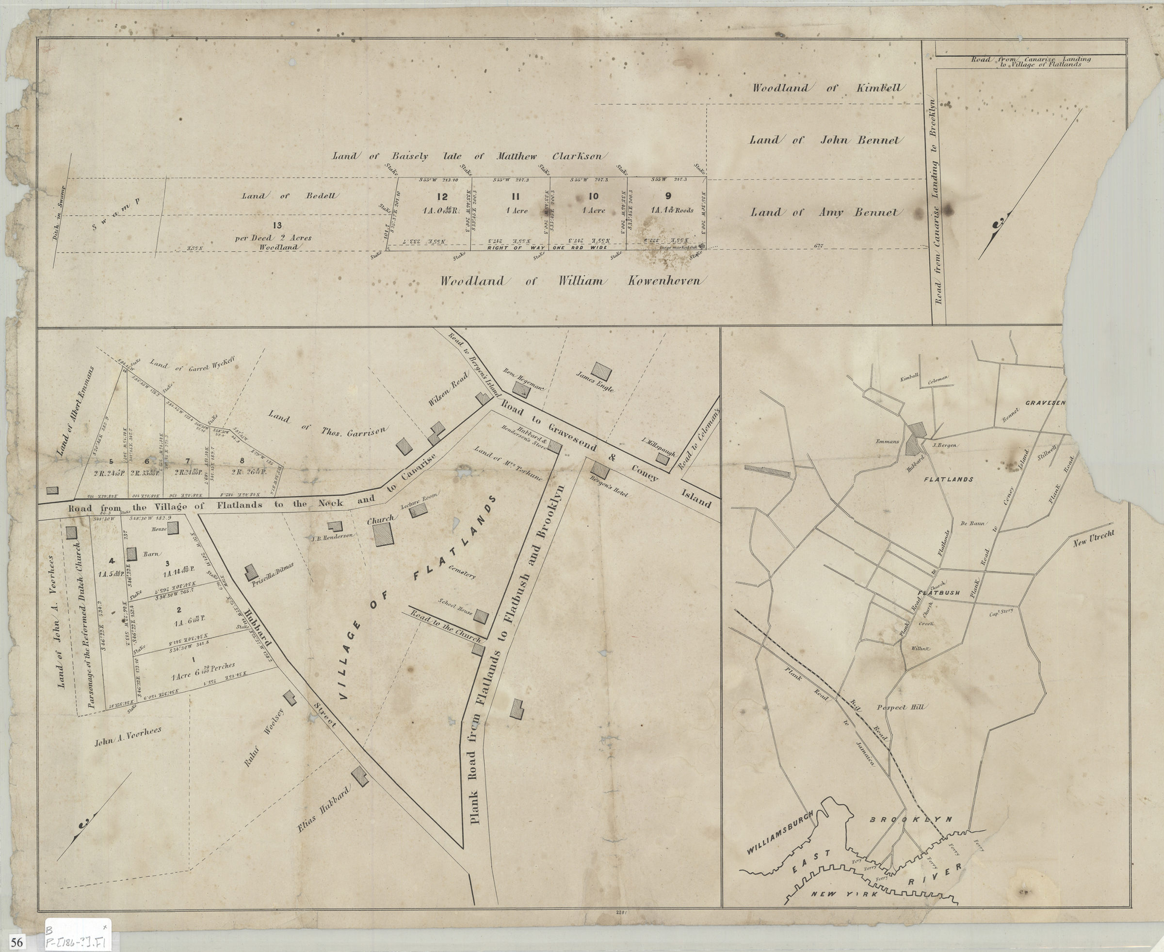
Cadastral map. Shows property (including acreages, lot numbers, and buildings), and names of landowners. Title devised by cataloger. Oriented with north to the lower left. Includes location map and inset of the woodland of William Kowenhoven. “2281”–Lower center margin. BHS copy imperfect missing portion of right center margin, measuring approx. 4 cm. from the right neat line, possible affecting description.
Map area shown
Genre
Cadastral mapsRelation
Full catalog recordSize
48 × 61 cmDownload
Low Resolution Image
Creator
Publisher
Brooklyn Historical SocietyCitation
[Map of property in village of Flatlands]; [186?], Map Collection, B P-[186-?].Fl; Brooklyn Historical Society.Scale
Scale not givenLoading zoom image... 