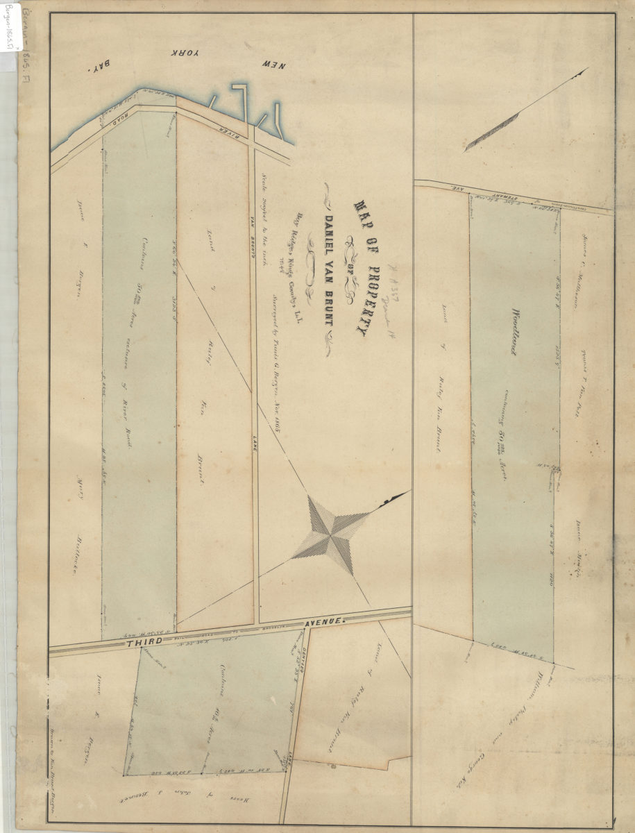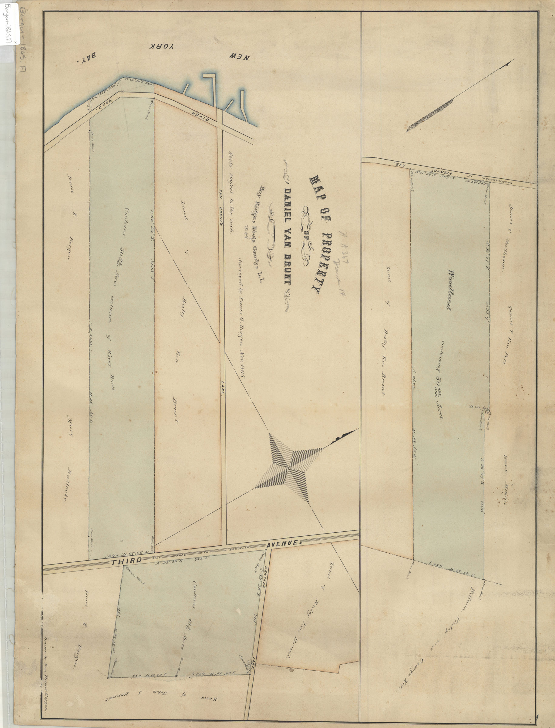
Map of property of Daniel Van Brunt: Bay Ridge, Kings County, L.I.: surveyed by Tunis G. Bergen ; drawn by Van Brunt Bergen November 1865
Map No. Bergen-1865.Fl
Cadastral map covering area east from New York Bay to Stewart Ave. at Van Brunt’s Lane. Shows property, names of landowners, and woodlands. Oriented with north to the upper left. Composed of 2 segments.
Map area shown
Relation
Full catalog recordSize
27 × 118 cmDownload
Low Resolution Image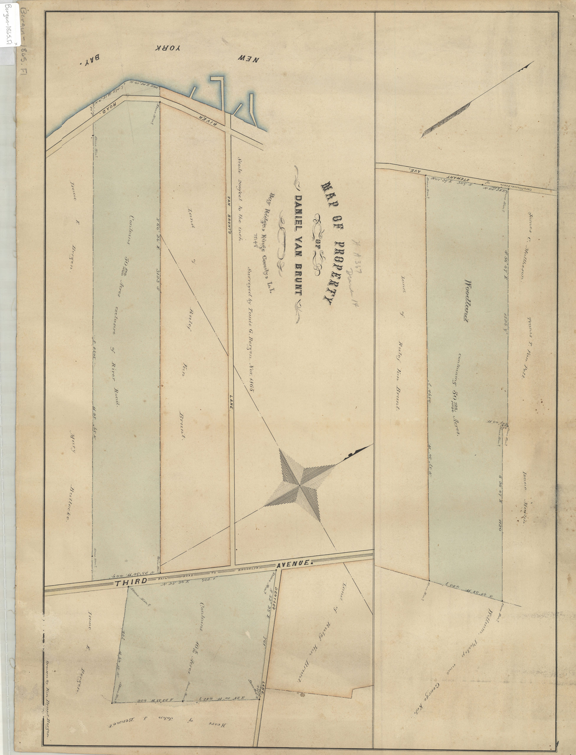
Creator
Bergen, Teunis G.; Bergen, Van Brunt,Publisher
Brooklyn Historical SocietyCitation
Map of property of Daniel Van Brunt: Bay Ridge, Kings County, L.I.: surveyed by Tunis G. Bergen ; drawn by Van Brunt Bergen; November 1865, Map Collection, Bergen-1865.Fl; Brooklyn Historical Society.Scale
Scale [1:2,400] 1 in to 2Loading zoom image...