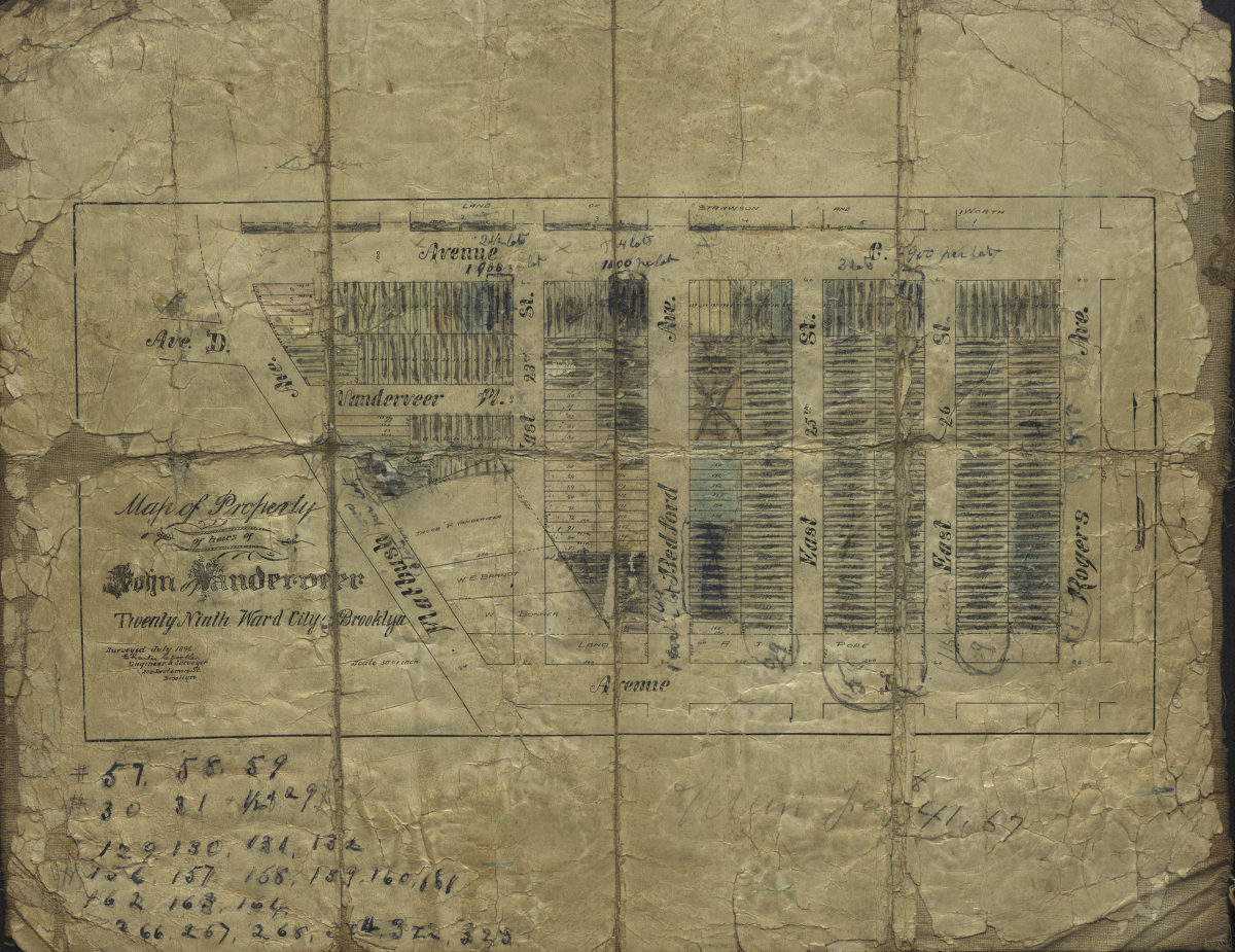
Map of property of heirs of John Vanderveer, Twenty-Ninth Ward, city of Brooklyn: surveyed July 1896 [by] Charles Crooke, city surveyor [1896]
Map No. B P-1896c.Fl
Cadastral map covering area bounded by Ave. D, Rogers Ave., Ave. C., and Flatbush Ave. (modern-day Flatbush). Shows property (including lot numbers and dimensions), and names of landowners.
Subjects
Places
Map area shown
Relation
Full catalog recordSize
13 × 26 cmDownload
Low Resolution Image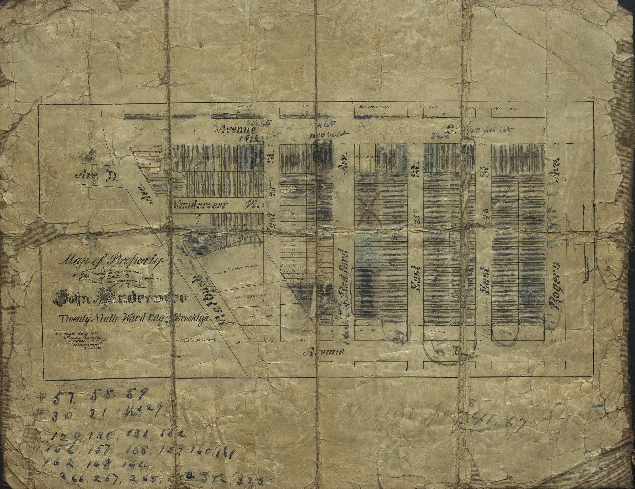
Creator
Crooke, Charles,Publisher
Brooklyn Historical SocietyCitation
Map of property of heirs of John Vanderveer, Twenty-Ninth Ward, city of Brooklyn: surveyed July 1896 [by] Charles Crooke, city surveyor; [1896], Map Collection, B P-1896c.Fl; Brooklyn Historical Society.Scale
Scale not givenLoading zoom image...