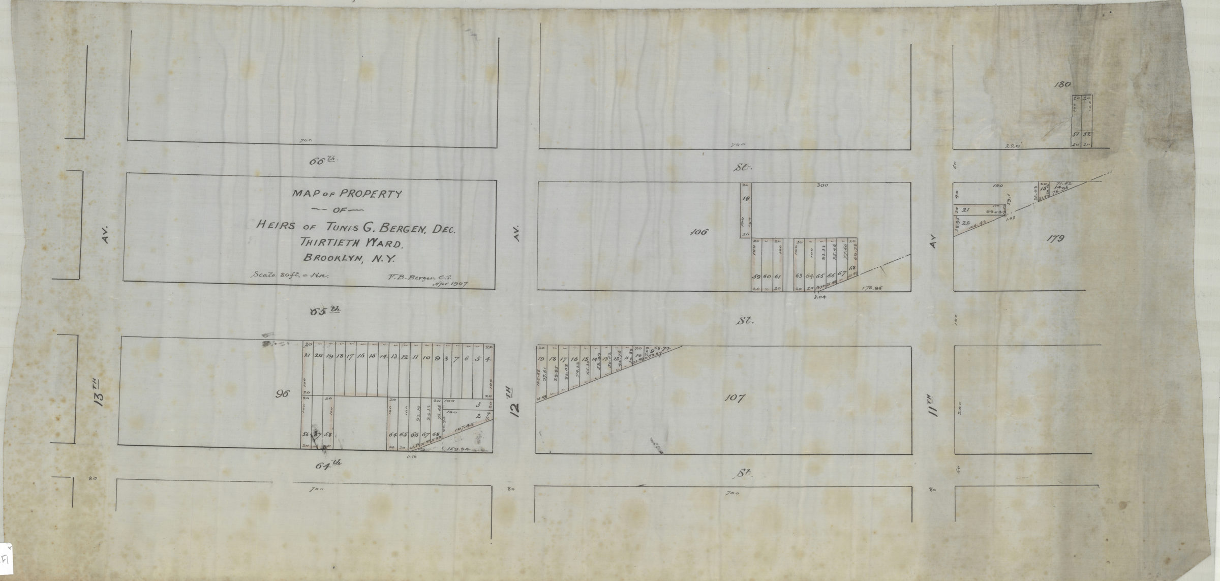
Map of property of heirs of Tunis G. Bergen, dec., Thirtieth Ward, Brooklyn, N.Y.: V.B. Bergen, C.E. April 1907
Map No. Bergen-1907.Fl
Cadastral map covering area bounded by 13th Ave., 64th St., 11th Ave., and 66th St. (modern-day Dyker Heights and Borough Park). Shows property (including lot numbers and dimensions).
Subjects
Places
Map area shown
Relation
Full catalog recordSize
34 × 70 cmDownload
Low Resolution Image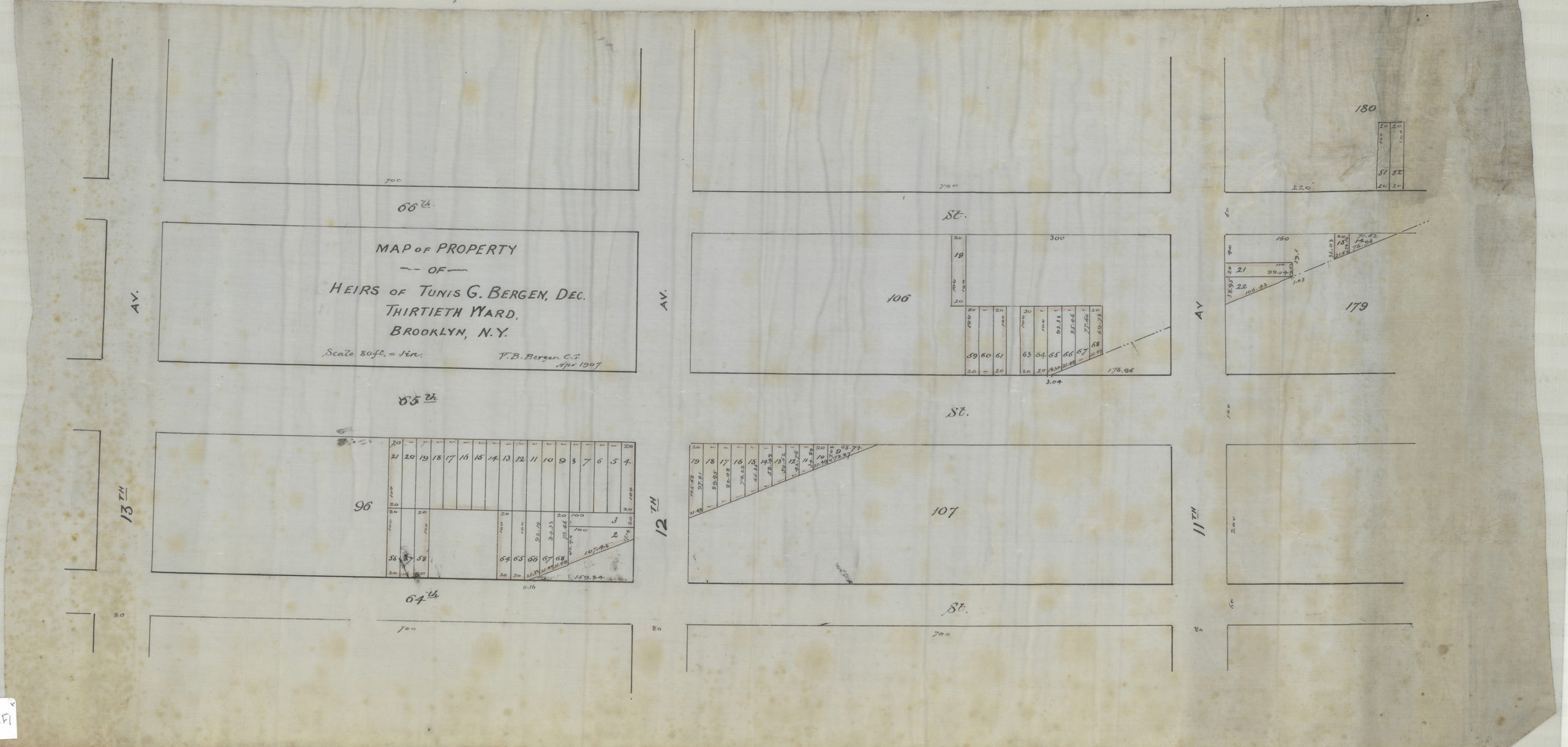
Creator
Bergen, Van Brunt,Publisher
Brooklyn Historical SocietyCitation
Map of property of heirs of Tunis G. Bergen, dec., Thirtieth Ward, Brooklyn, N.Y.: V.B. Bergen, C.E.; April 1907, Map Collection, Bergen-1907.Fl; Brooklyn Historical Society.Scale
Scale [1:960] 1 in to 80Loading zoom image... 