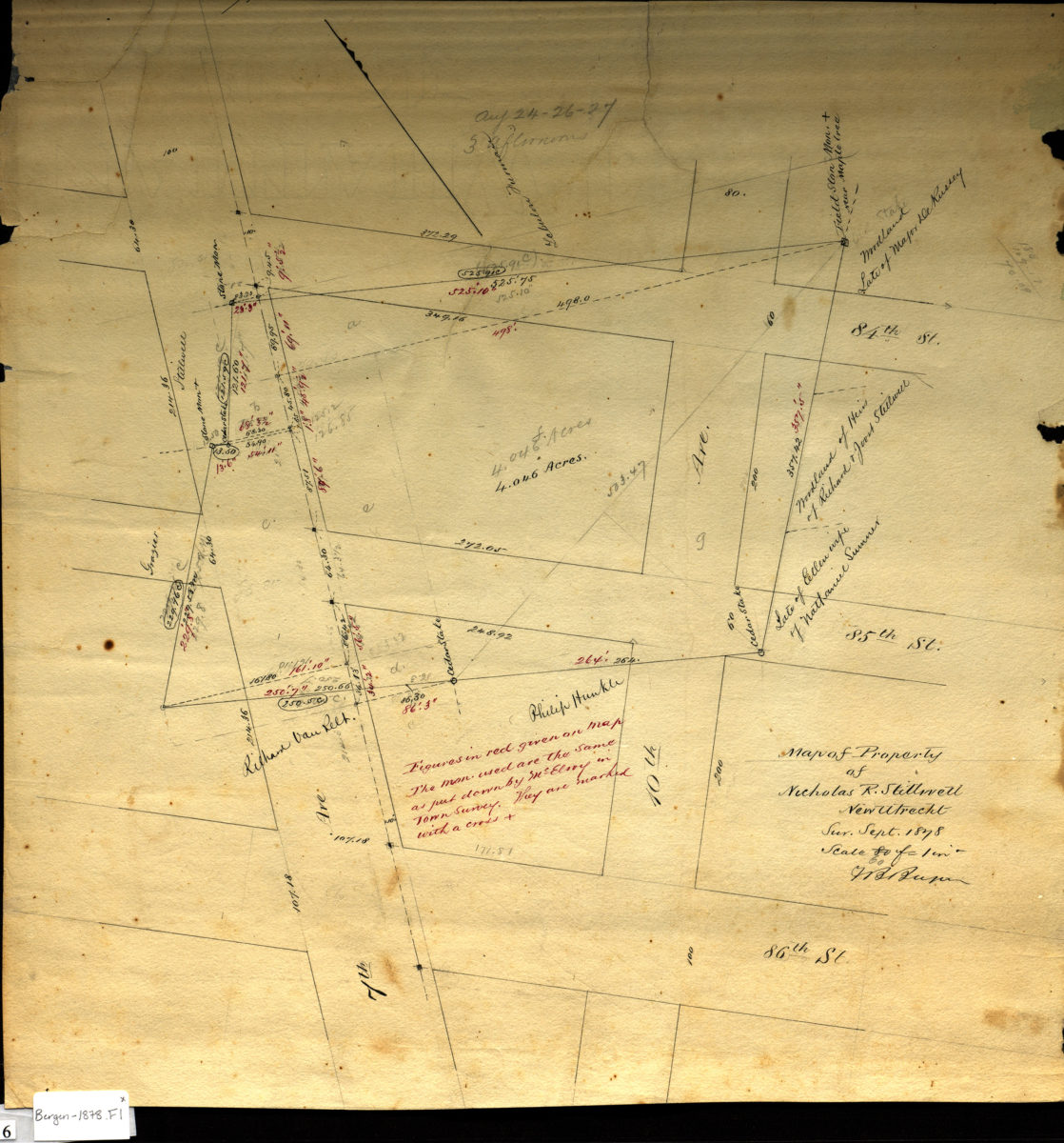
Map of property of Nicholas R. Stillwell, New Utrecht: V.B. Bergen Sept. 1878
Map No. Bergen-1878.Fl
Cadastral map covering area bounded by 7th Ave., 86th St., 10th Ave., and 84th St. (modern-day Dyker Heights). Shows property (including acreages), names of landowners, and stone monuments. Scale corrected in pencil. Originally [1:960]. 80 ft. = 1 in. Oriented with north to the upper left. Includes notes and calculations. Watermark: J Whatman 1860.
Map area shown
Relation
Full catalog recordSize
41 × 39 cmDownload
Low Resolution Image
Creator
Bergen, Van Brunt,Publisher
Brooklyn Historical SocietyCitation
Map of property of Nicholas R. Stillwell, New Utrecht: V.B. Bergen; Sept. 1878, Map Collection, Bergen-1878.Fl; Brooklyn Historical Society.Scale
Scale [1:720] 1 in to 60Loading zoom image...