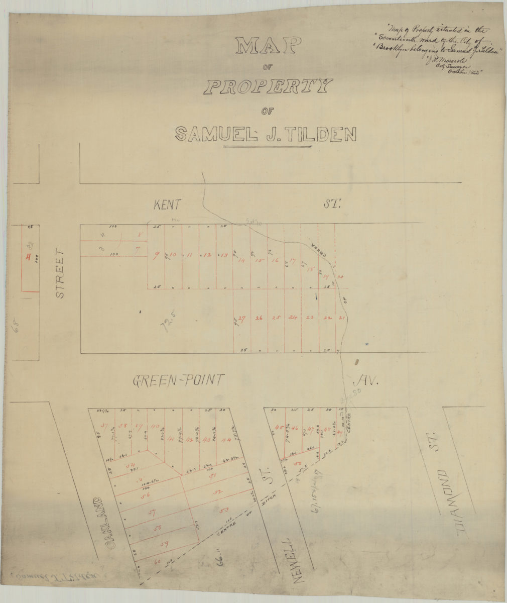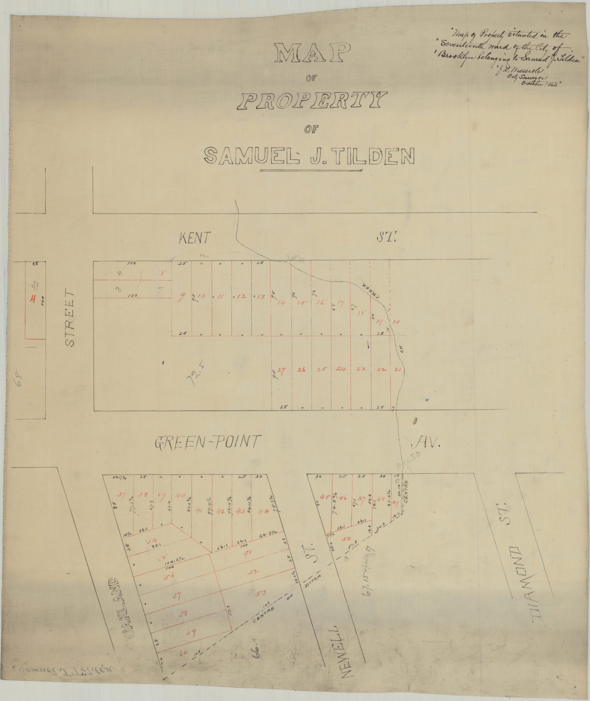
Map of property of Samuel J. Tilden: J.V. Meserole, city surveyor October 1863
Map No. B P-1863.Fl
Cadastral map covering the intersections of Oakland St. with Kent St. and Green-Point Ave. (modern-day Greenpoint). Shows property (including lot numbers, and dimensions).
Map area shown
Genre
Cadastral mapsRelation
Full catalog recordSize
55 × 47 cmDownload
Low Resolution Image
Creator
Meserole, J. V.,Publisher
Brooklyn Historical SocietyCitation
Map of property of Samuel J. Tilden: J.V. Meserole, city surveyor; October 1863, Map Collection, B P-1863.Fl; Brooklyn Historical Society.Scale
Scale not givenLoading zoom image...