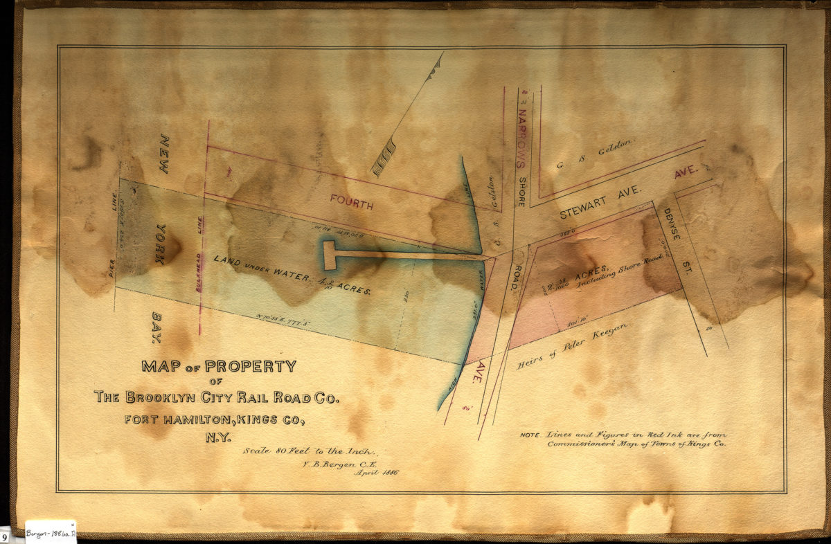
Map of property of the Brooklyn City Rail Road Co., Fort Hamilton, Kings Co., N.Y.: V.B. Bergen, C.E. April 1886
Map No. Bergen-1886a.Fl
Cadastral map covering 4th Ave. from New York Bay to Denyse St. (modern-day Fort Hamilton). Shows property (including acreages), names of landowners, land under water, high water lines, pier lines, and bulkhead lines. Oriented with north to the upper right. “Note: Lines and Figures in Red Ink are from Commissioner’s Map of Towns of Kings Co.”
Subjects
Places
Map area shown
Relation
Full catalog recordSize
31 × 50 cmDownload
Low Resolution Image
Creator
Bergen, Van Brunt,Publisher
Brooklyn Historical SocietyCitation
Map of property of the Brooklyn City Rail Road Co., Fort Hamilton, Kings Co., N.Y.: V.B. Bergen, C.E.; April 1886, Map Collection, Bergen-1886a.Fl; Brooklyn Historical Society.Scale
Scale [1:960] 1 in to 80Loading zoom image...