
Map of property of Winant W. Bennett, Bay Ridge, Kings Co., N.Y.: surveyed by V.B. Bergen, C.E. January 1882
Map No. B P-1882.Fl
Cadastral map covering area bounded by 73rd St., 1st Ave., MacKay St. and New York Bay. Shows property (including buildings and dimensions), names of landowners, bulkhead lines, and pier lines. Includes chart showing acreages of areas on map.
Map area shown
Relation
Full catalog recordSize
53 × 66 cmDownload
Low Resolution Image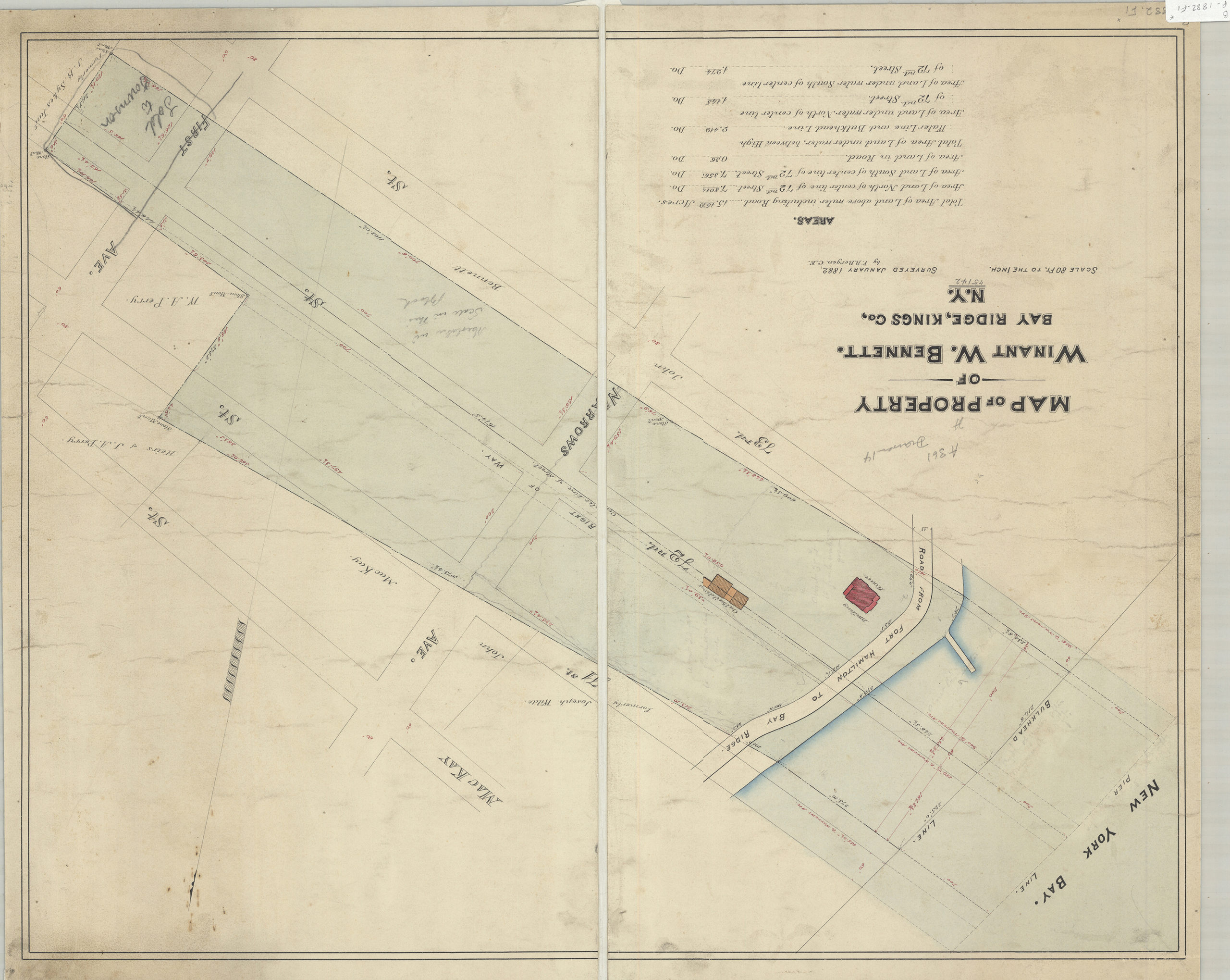
Creator
Bergen, Van Brunt,Publisher
Brooklyn Historical SocietyCitation
Map of property of Winant W. Bennett, Bay Ridge, Kings Co., N.Y.: surveyed by V.B. Bergen, C.E.; January 1882, Map Collection, B P-1882.Fl; Brooklyn Historical Society.Scale
Scale [1:960] 1 in to 80Loading zoom image... 