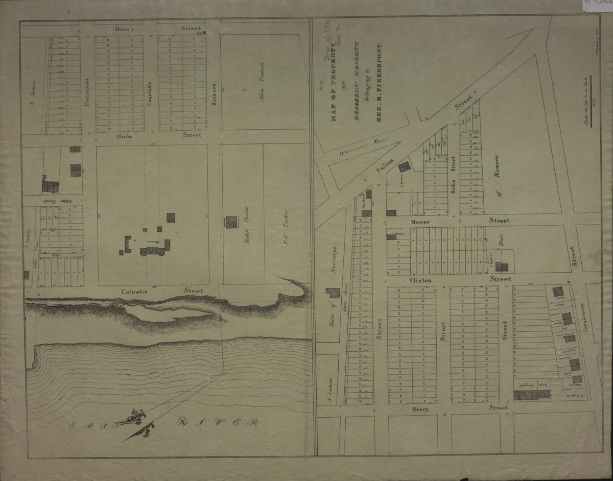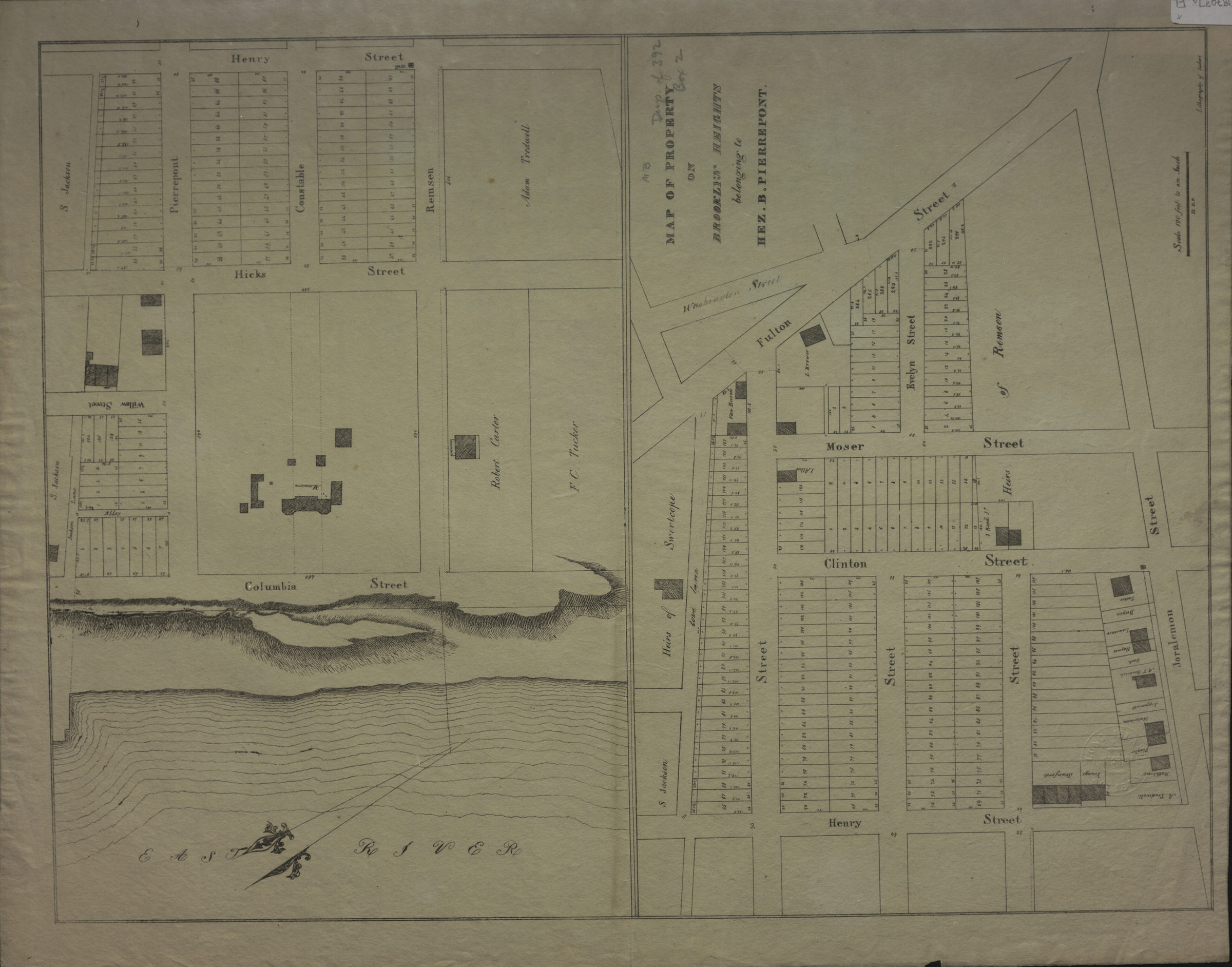
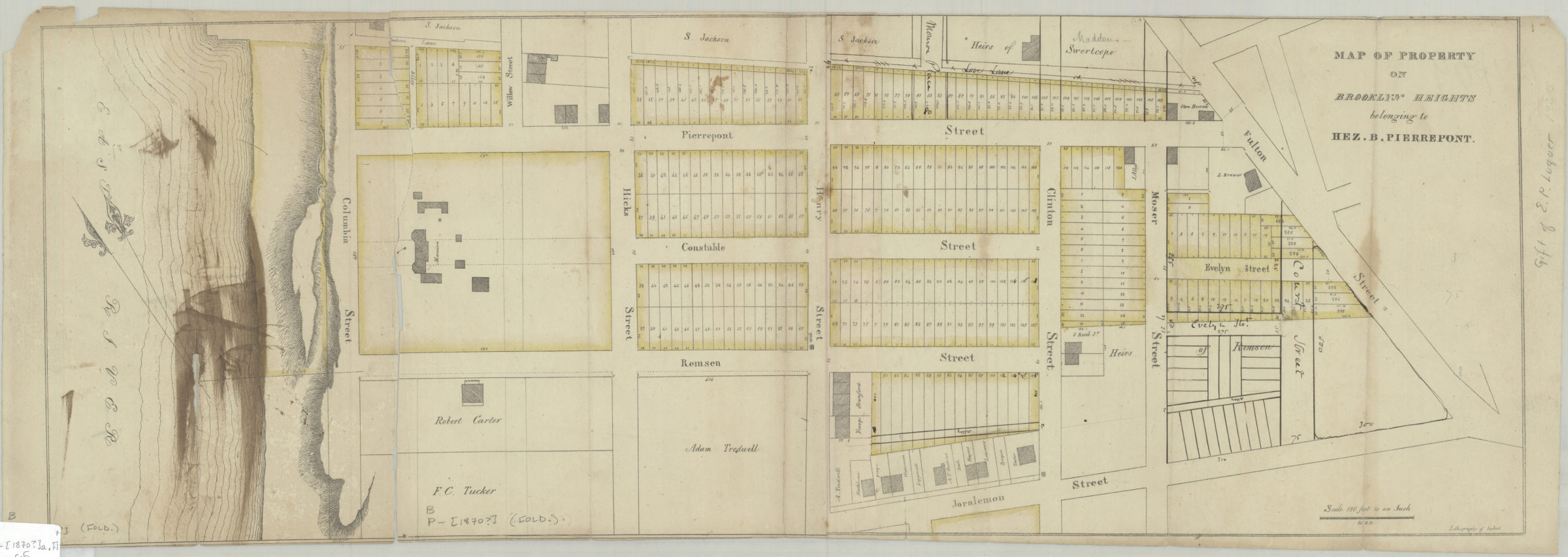
Map of property on Brooklyn Heights belonging to Hez. B. Pierrepont [1870]
Map No. B P-[1870?]a.Fl
Cadastral map covering area south from Pierrepont St. to Joralemon St., and east from the East River to Fulton St. Shows property (including lot numbers and dimensions), landmarks and names of landowners. Relief shown by hachures. BHS copy 5 both sides pasted together into continuous sheet and trimmed, hand colored and annotated. Gift of E.P. Laquer. Map in 2 segments. “H.E.P.”
Map area shown
Genre
Cadastral mapsRelation
Full catalog recordSize
50 × 76 cmDownload
Low Resolution Image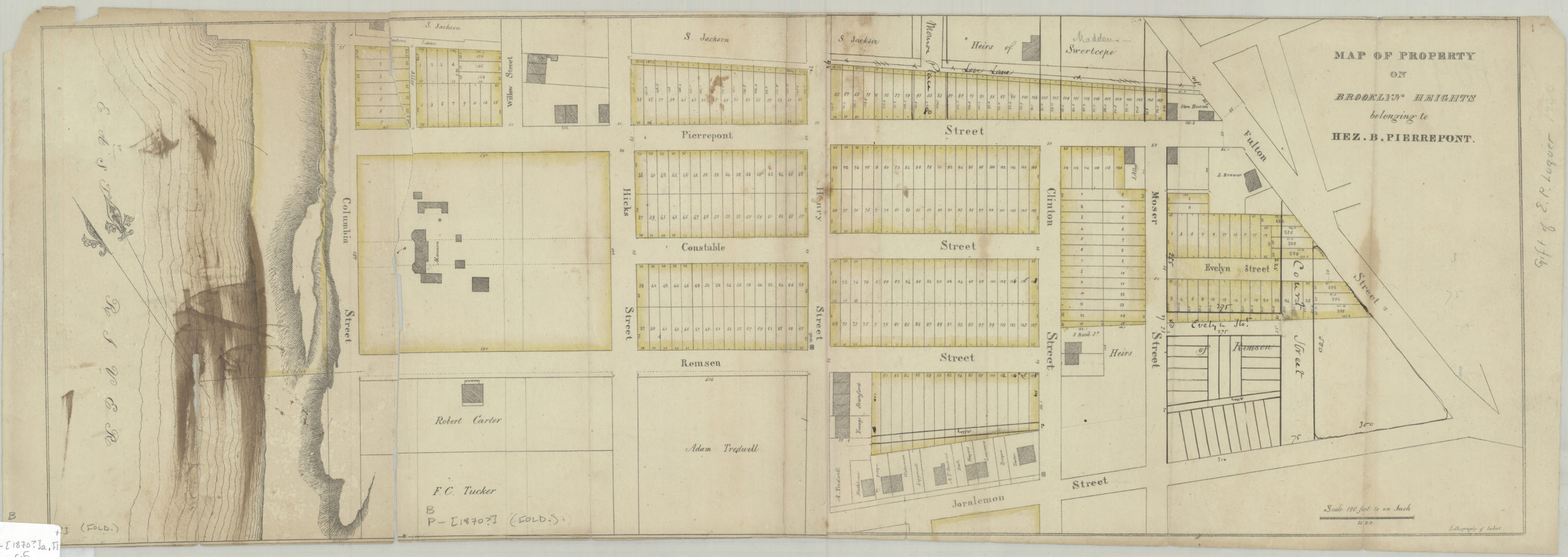
Creator
Imbert's Lithographic Office,Publisher
Brooklyn Historical SocietyCitation
Map of property on Brooklyn Heights belonging to Hez. B. Pierrepont; [1870], Map Collection, B P-[1870?]a.Fl; Brooklyn Historical Society.Scale
Scale [1:1,440] 1 in to 1Loading zoom image...