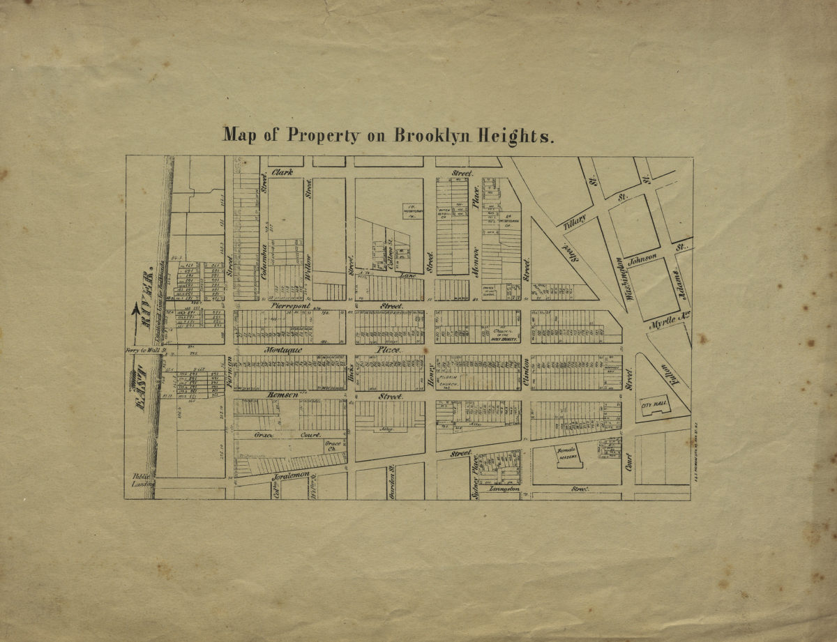
Map of property on Brooklyn Heights [1846-1849]
Map No. B P-[1846-1849].Fl
Cadastral map covering area east from the East River to approximately Adams St. and north from Livingston St. to Clark St. Shows property (including lot numbers and dimensions), churches, City Hall, a female academy (later the Packer Collegiate Institute), bulkead lines, and landings. Relief shown by hachures. Date of publication based on active years of F. & S. Palmers Lith.
Map area shown
Genre
Cadastral mapsRelation
Full catalog recordSize
30 × 38 cmDownload
Low Resolution Image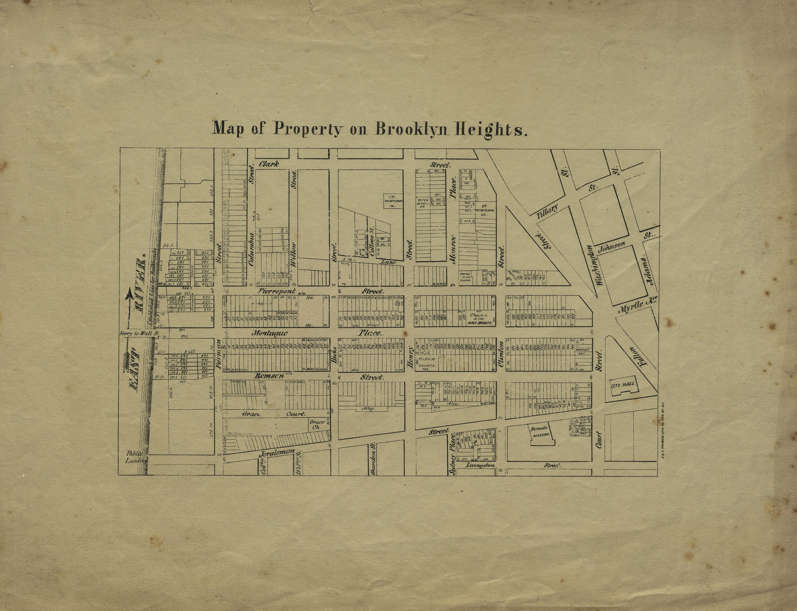
Creator
F. & S. Palmer (Firm),Publisher
Brooklyn Historical SocietyCitation
Map of property on Brooklyn Heights; [1846-1849], Map Collection, B P-[1846-1849].Fl; Brooklyn Historical Society.Scale
Scale not givenLoading zoom image...