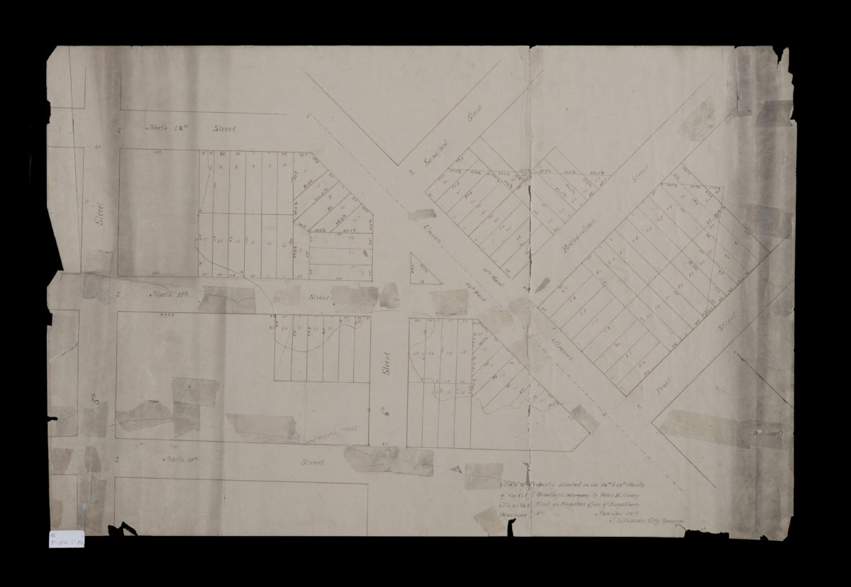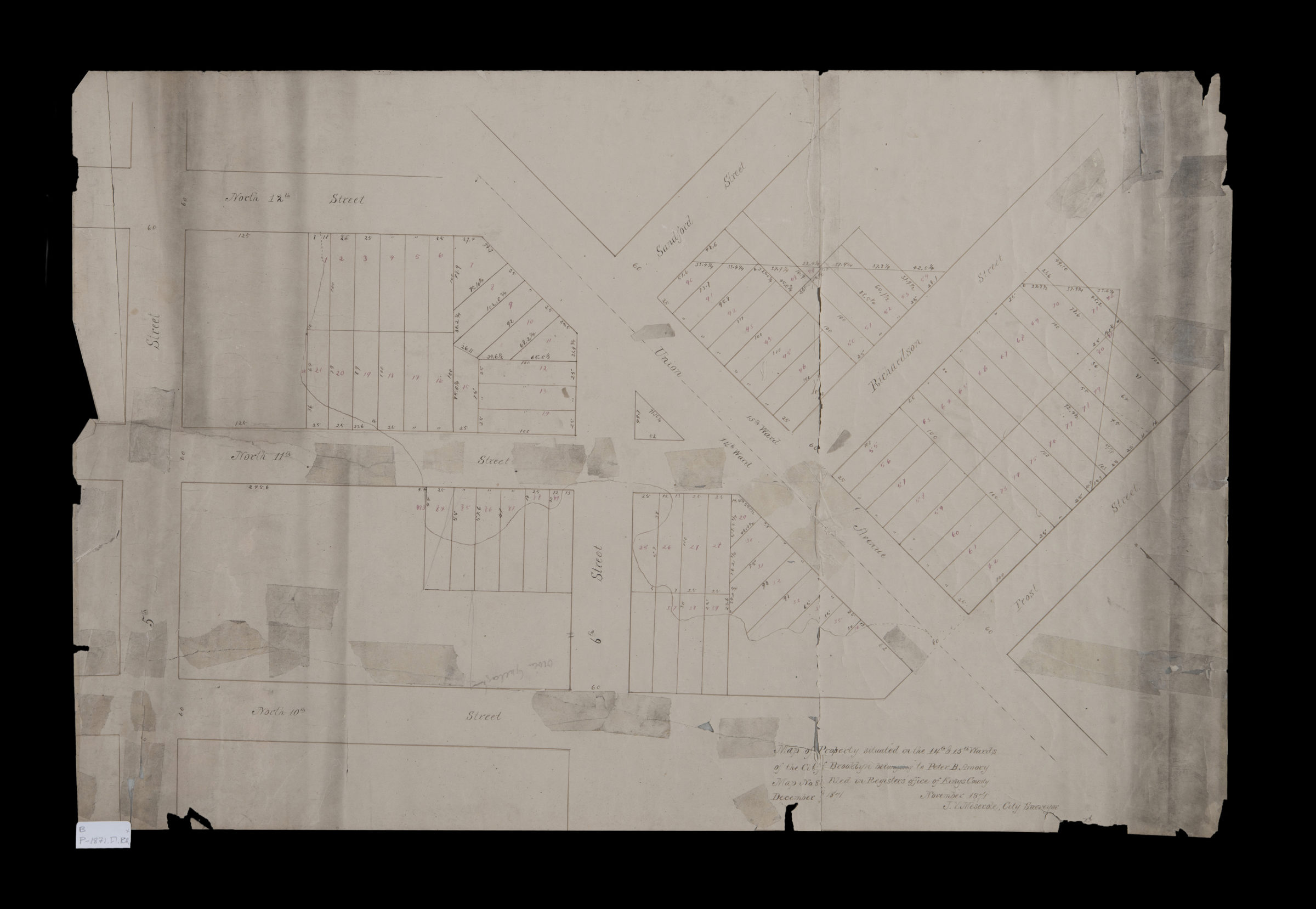
Map of property situated in the 14th & 15th Wards of the city of Brooklyn, belonging to Peter B. Amory: J.V. Meserole, city surveyor November 1871
Map No. B P-1871.Fl.RA
Cadastral map covering Union Ave. between N. 10th St. and N. 12th St. (modern-day Williamsburg and Greenpoint). Shows property (including lot numbers and dimensions), and ward boundaries. Oriented with north to the upper left. “Map No. 86. Filed in Registers office of Kings County December … [text illegible] 1871.”
Subjects
Places
Map area shown
Relation
Full catalog recordSize
50 × 75 cmDownload
Low Resolution Image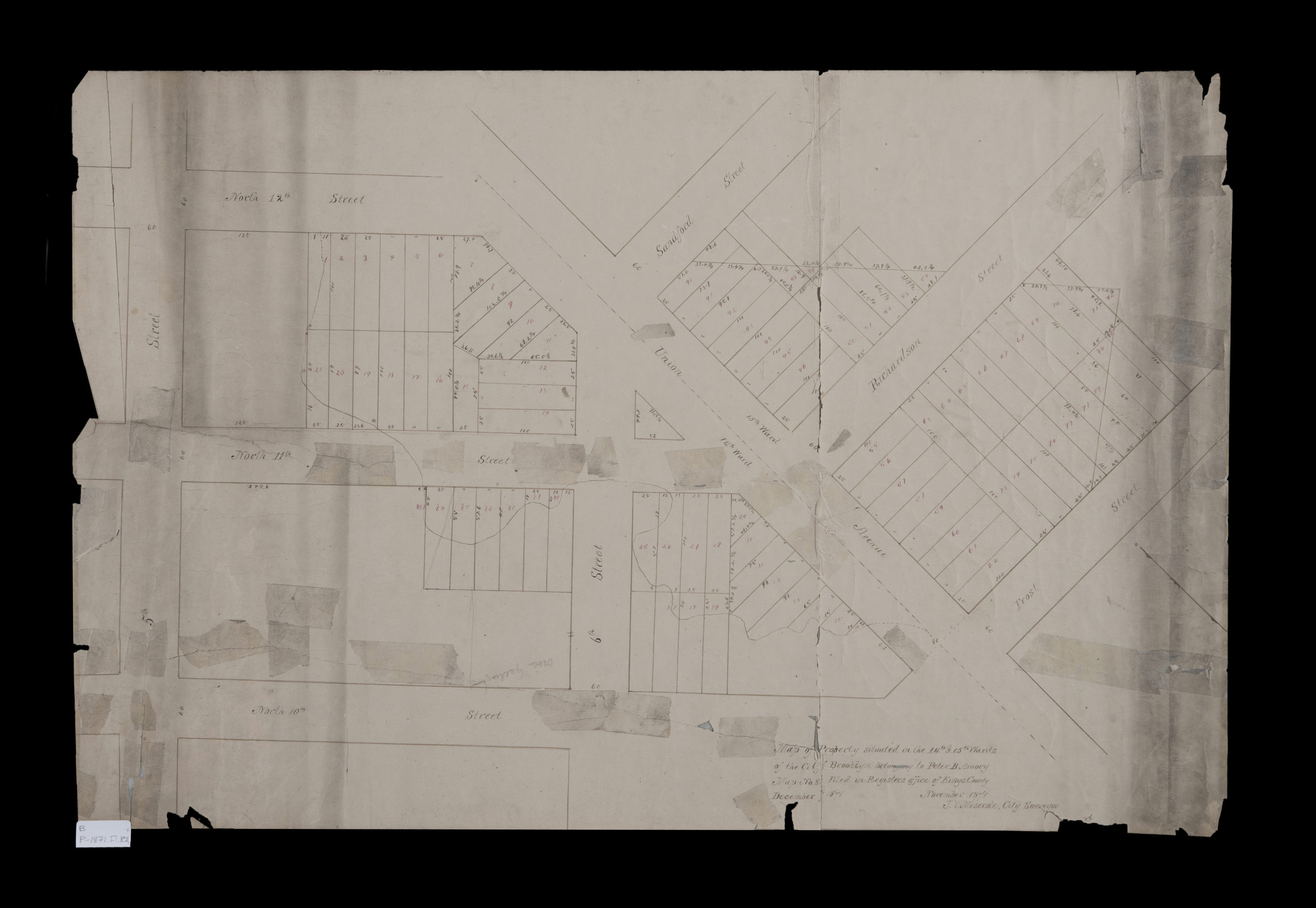
Creator
Meserole, J. V.,Publisher
Brooklyn Historical SocietyCitation
Map of property situated in the 14th & 15th Wards of the city of Brooklyn, belonging to Peter B. Amory: J.V. Meserole, city surveyor; November 1871, Map Collection, B P-1871.Fl.RA; Brooklyn Historical Society.Scale
Scale not givenLoading zoom image...