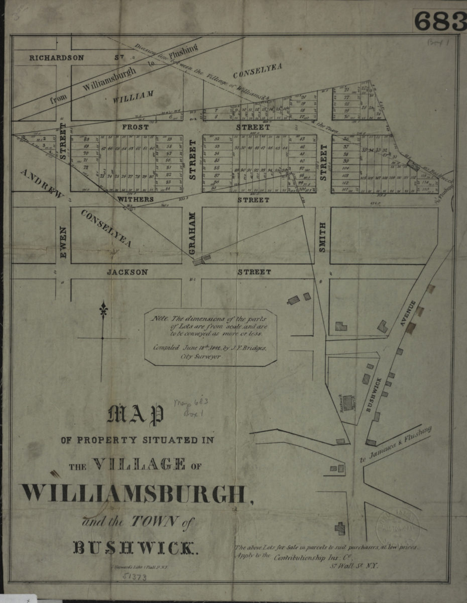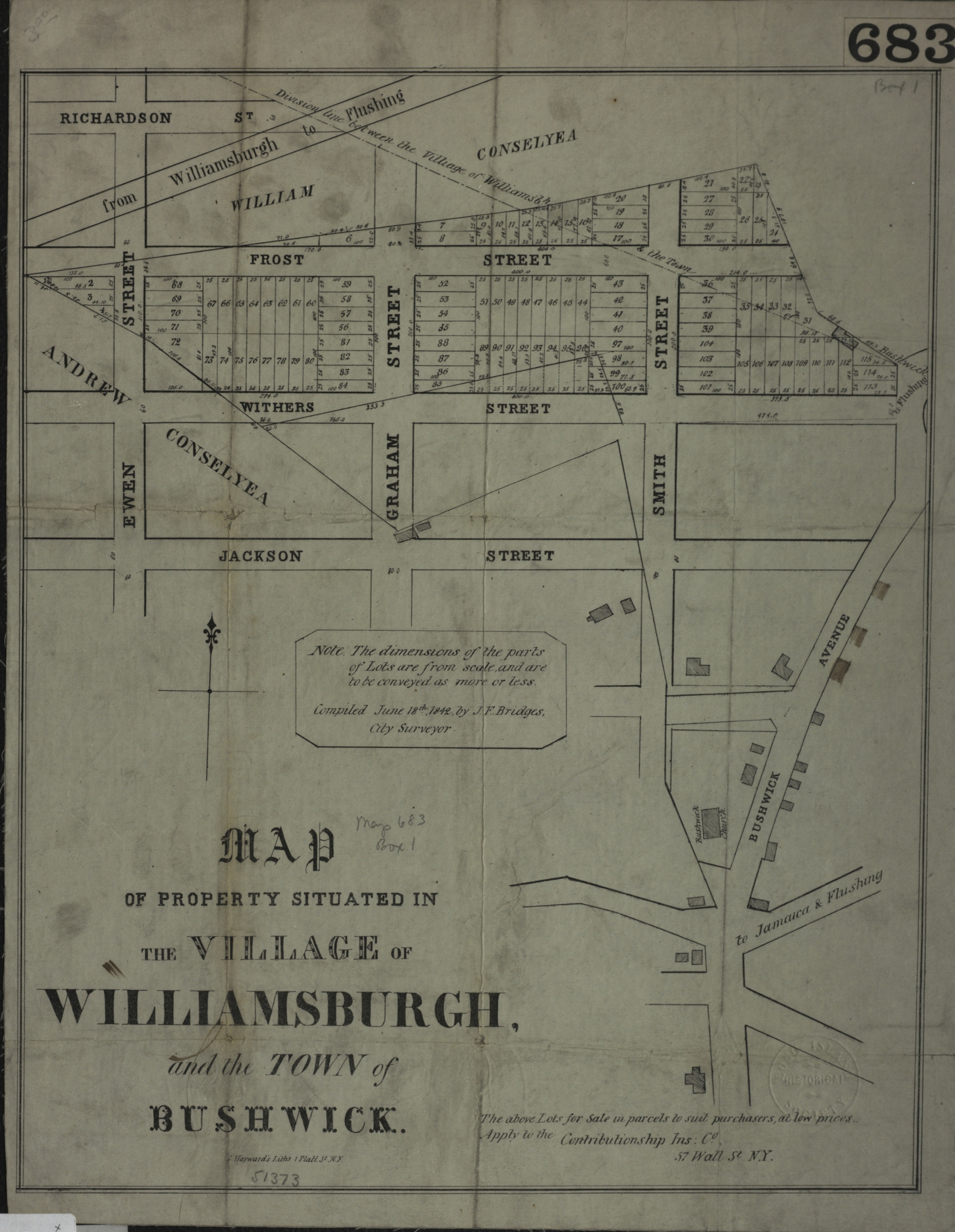
Map of property situated in the village of Williamsburgh and the town of Bushwick: compiled June 18th, 1842, by J.F. Bridges, city surveyor [1842]
Map No. B P-[1842].Fl
Cadastral map covering area north from approximately Jackson St. to Richardson St. and east from Ewen St. to Bushwick Ave. Shows property (including lot numbers and dimensions), buildings, names of property owners, and the division line between the village of Williamsburgh and the town of Bushwick. Does not cover modern-day Bushwick. Includes notes.
Map area shown
Genre
Cadastral mapsRelation
Full catalog recordSize
37 × 30 cmDownload
Low Resolution ImageCreator
Bridges, J. F.,Publisher
Brooklyn Historical SocietyCitation
Map of property situated in the village of Williamsburgh and the town of Bushwick: compiled June 18th, 1842, by J.F. Bridges, city surveyor; [1842], Map Collection, B P-[1842].Fl; Brooklyn Historical Society.Scale
Scale not givenLoading zoom image...