Map of Rosevale & Lakeland villages & farms [1853]
Map No. L.I.-[1853].Fl
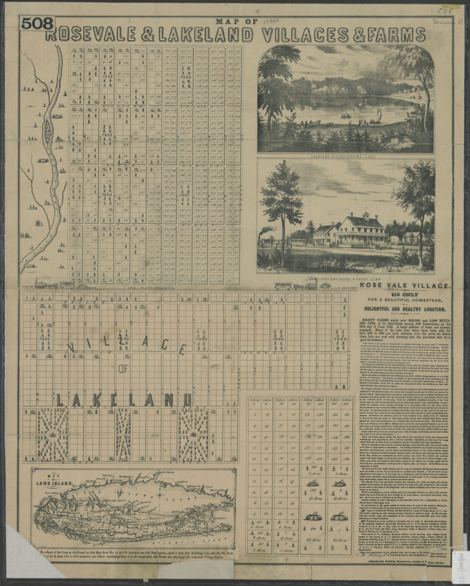
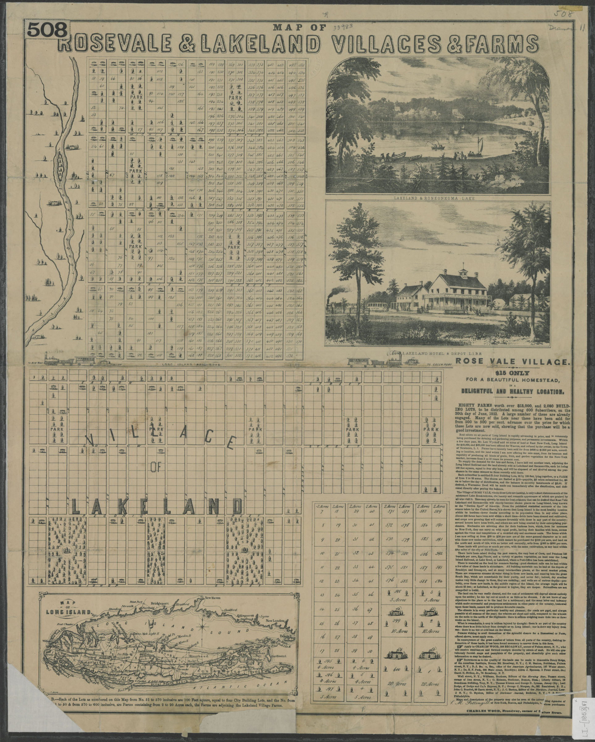
Cadastral map covering area north from Bishop St. to approximately Michigan St. and east from 15th Ave. to approximately 1st Ave. Shows property (including lot numbers and buildings), parks, and the Long Island Rail Road. Relief shown pictorially. Includes text, ill. (titled and untitled), inset continuation maps, and “Map of Long Island.” “Map of Long Island” attributed to T. Wood. Titled ill: Lakeland & Ronkonkoma Lake — Lakeland Village hotel & depot, L.I.R.R.
Map area shown
Genre
Cadastral mapsRelation
Full catalog recordSize
58 × 46 cmDownload
Low Resolution Image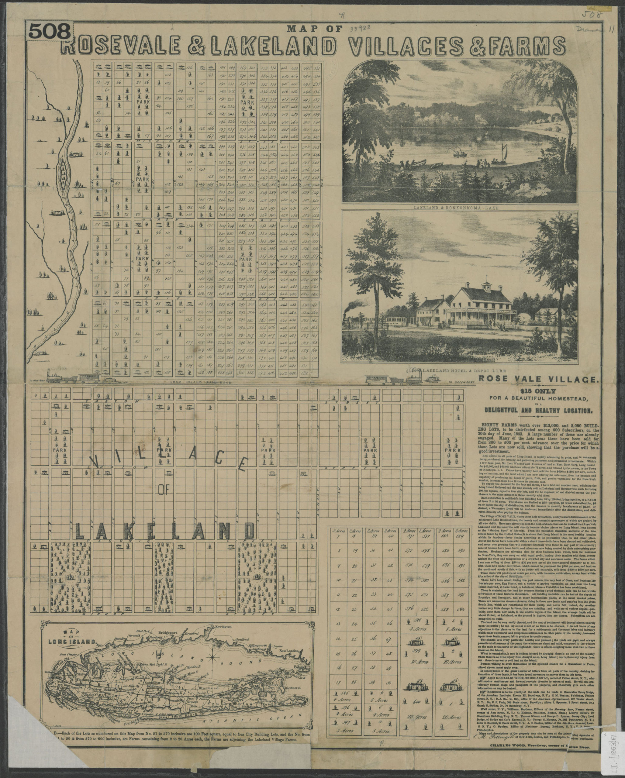
Creator
Wood, T.,Publisher
Brooklyn Historical SocietyCitation
Map of Rosevale & Lakeland villages & farms; [1853], Map Collection, L.I.-[1853].Fl; Brooklyn Historical Society.Scale
Scale not givenLoading zoom image...