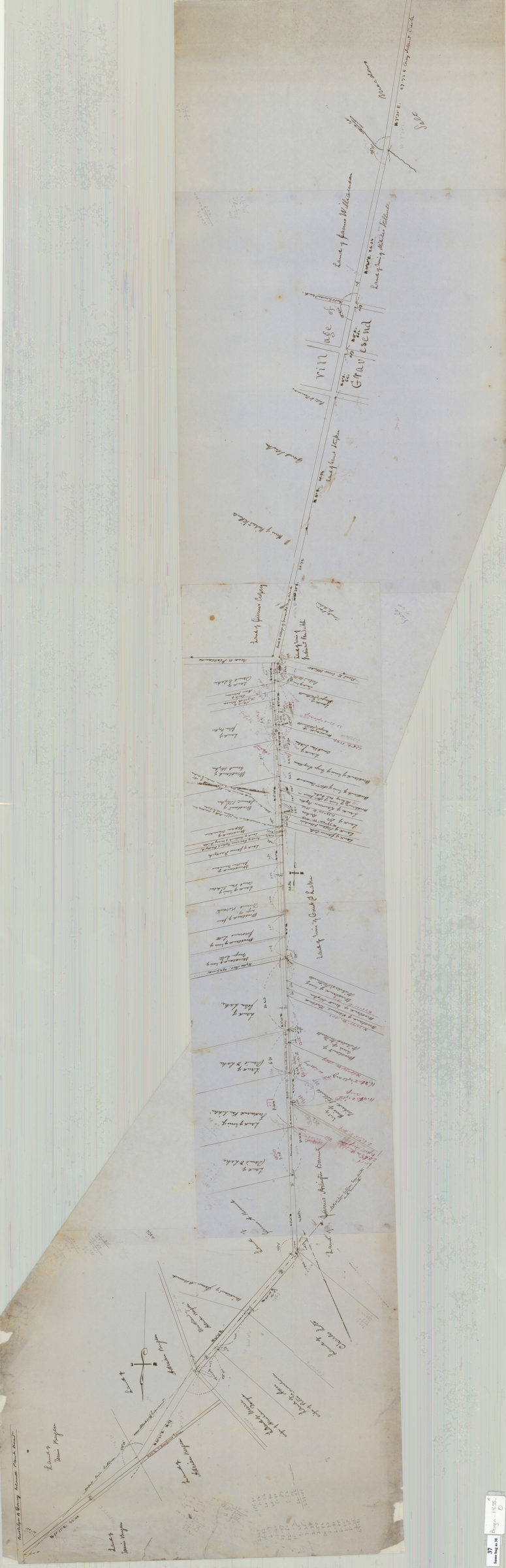
Map of route for a plank road from Coney Island Bridge Road to blacksmith shop, & therein along Wood Road. Patent line d[ivided] to mean: Teunis Bergen May 1855
Map No. Bergen-1855.O
Survey map covering area from the New Utrecht-Gravesend border through the village of Gravesend in modern-day Midwood and Gravesend. Shows proposed route, properties, and names of landowners. Verso title. Oriented with north to the left. Irregularly shaped. Map found with: Map of 73rd Street between 3rd Avenue and 4th Avenue (Bergen-1892.Fl etc.) in BHS Archives.
Subjects
Places
Map area shown
Relation
Full catalog recordSize
41 × 154 cmDownload
Low Resolution Image
Creator
Bergen, Teunis G.,Publisher
Brooklyn Historical SocietyCitation
Map of route for a plank road from Coney Island Bridge Road to blacksmith shop, & therein along Wood Road. Patent line d[ivided] to mean: Teunis Bergen; May 1855, Map Collection, Bergen-1855.O; Brooklyn Historical Society.Scale
Scale [1:792] 1 in to 4 cLoading zoom image... 