

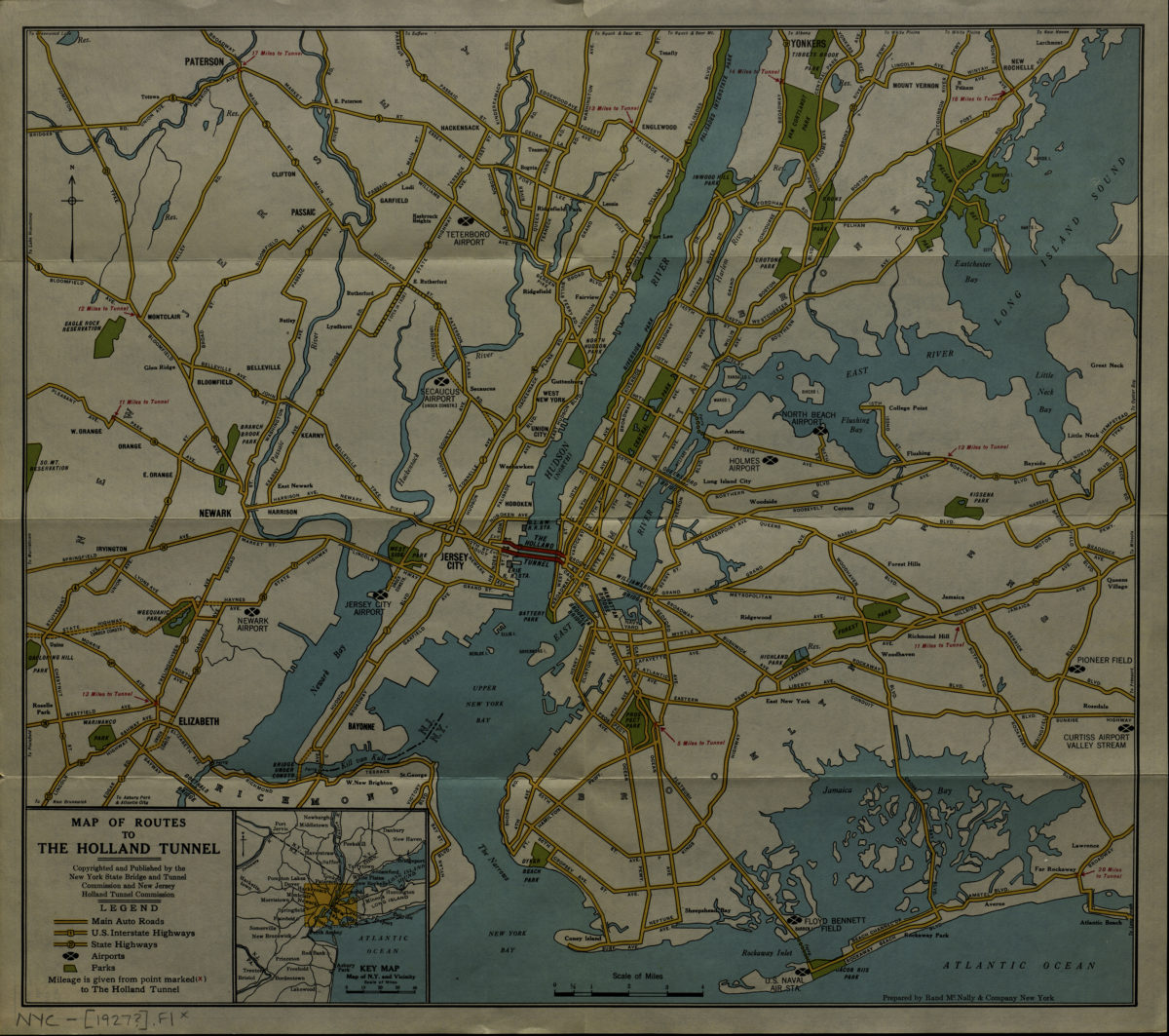
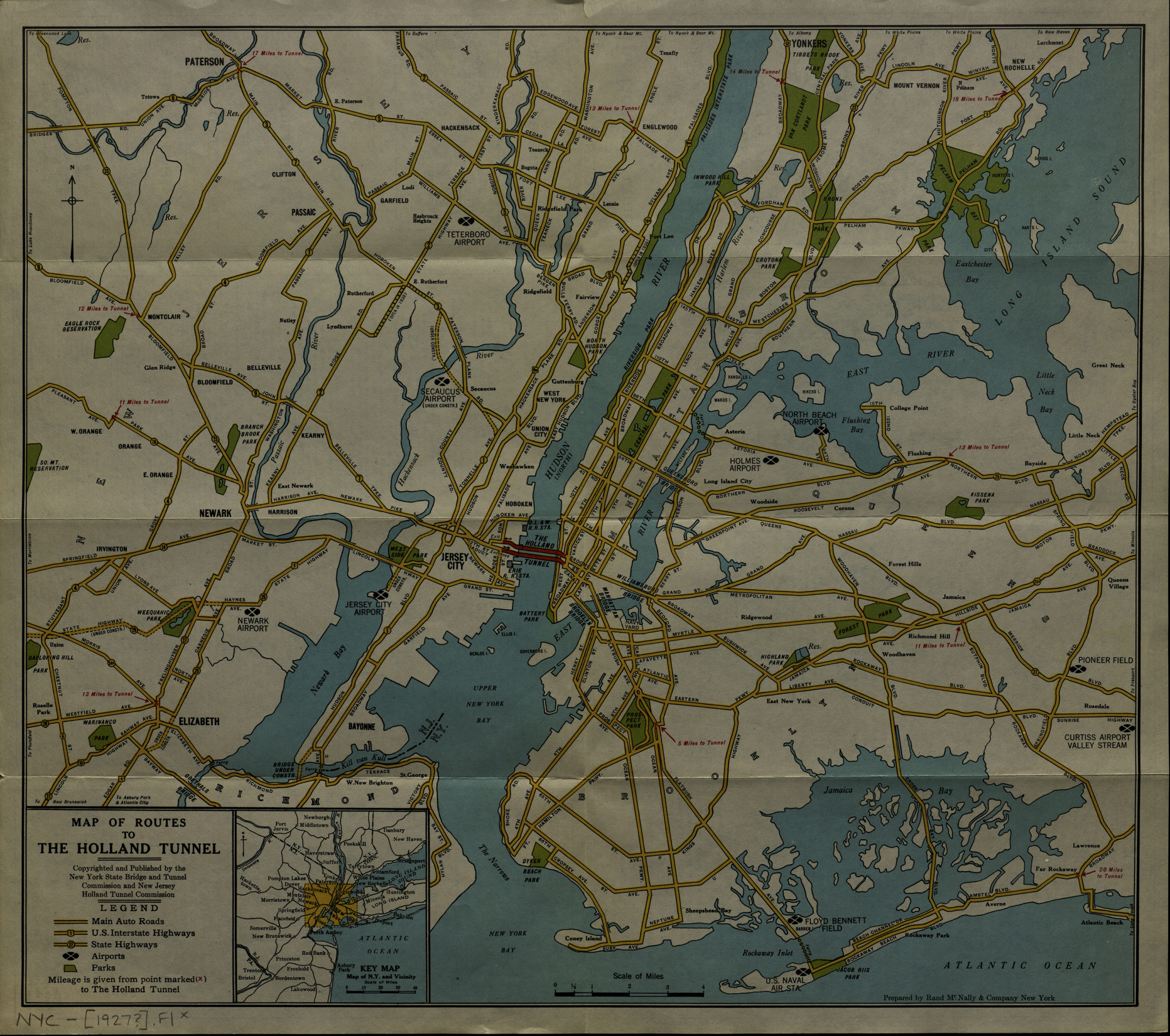
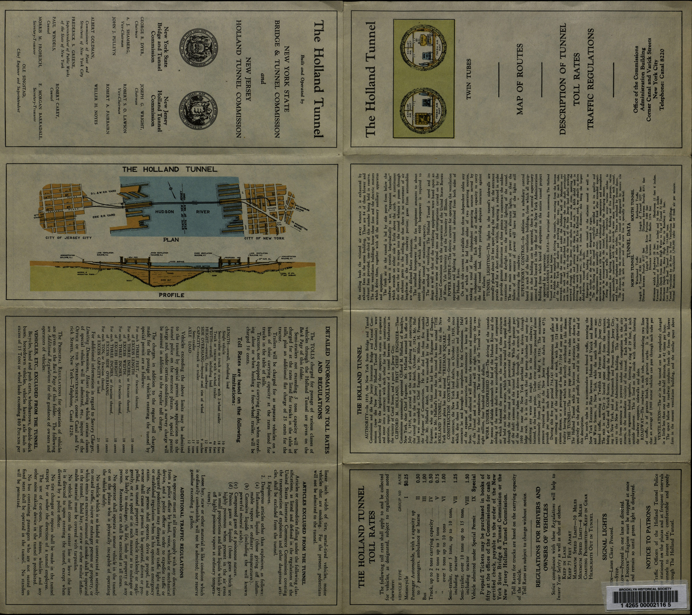
Map of routes to the Holland Tunnel: prepared by Rand McNally & Company, New York [192?]
Map No. NYC-[1927?].Fl
Shows major motor routes in New York City and northern New Jersey. Includes inset location map. Text, plan, and profile on verso. BHS copy originally part of the collection of Everett and Evelyn Ortner papers and photographs (ARC.306).
Map area shown
Genre
MapRelation
Full catalog recordSize
39 × 44 cmDownload
Low Resolution Image
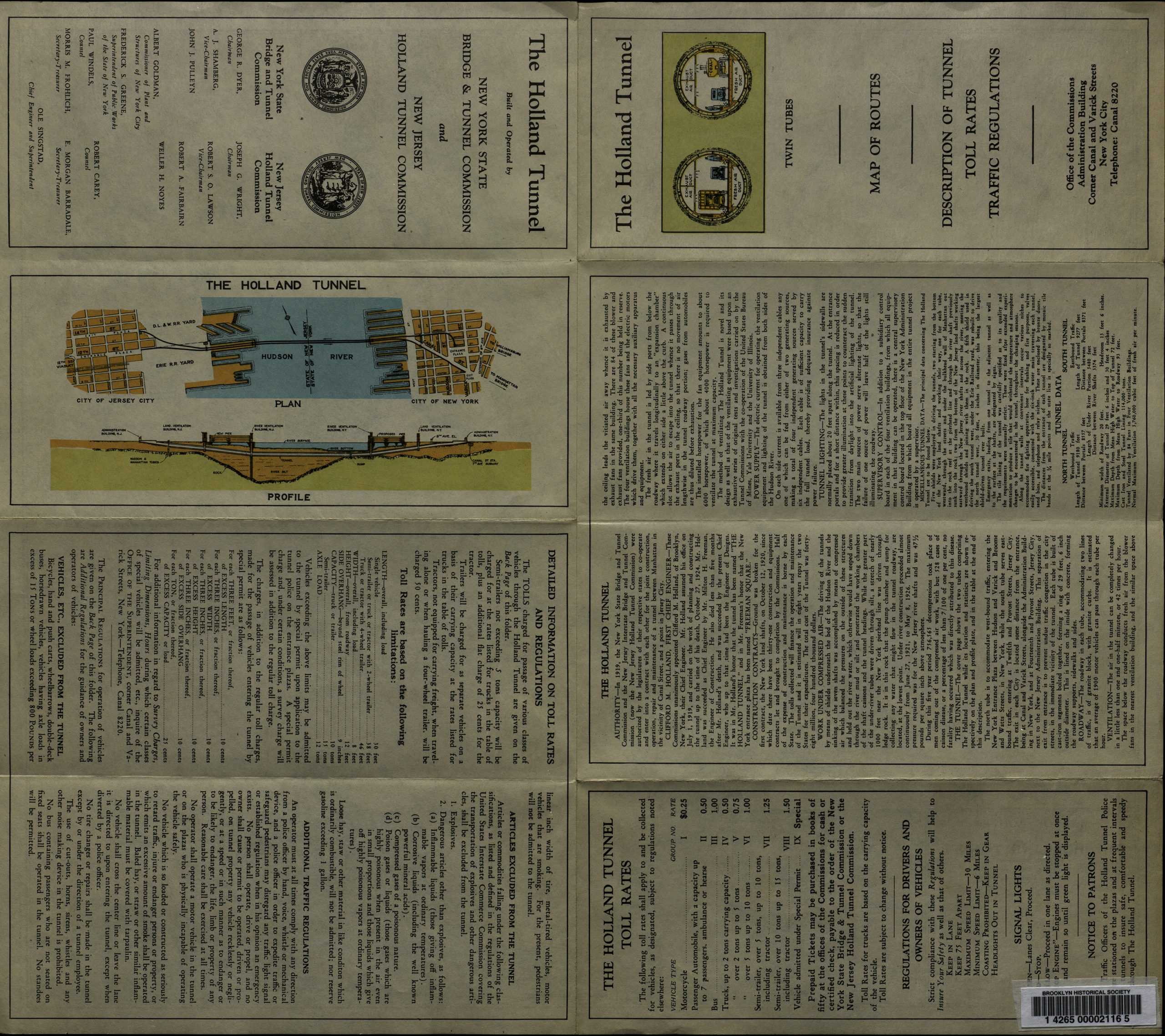
Creator
Rand McNally and Company,Publisher
Brooklyn Historical SocietyCitation
Map of routes to the Holland Tunnel: prepared by Rand McNally & Company, New York; [192?], Map Collection, NYC-[1927?].Fl; Brooklyn Historical Society.Scale
Scale [ca. 1:111,000]Loading zoom image... 
