
[Map of shore line adjoining land under water from 18th Street to 20th Street, between 3rd Avenue and the water line in Gowanus Bay] 1866
Map No. Bergen-1866b.Fl
Cadastral map covering area in modern-day Sunset Park. Shows property, lots, high water mark, and names of some landowners. Title devised by cataloger. Stained. Stain obscures Teunis G. Bergen’s sworn statement for the Commissioner’s Office.
Subjects
Places
Map area shown
Relation
Full catalog recordSize
24 × 67 cmDownload
Low Resolution Image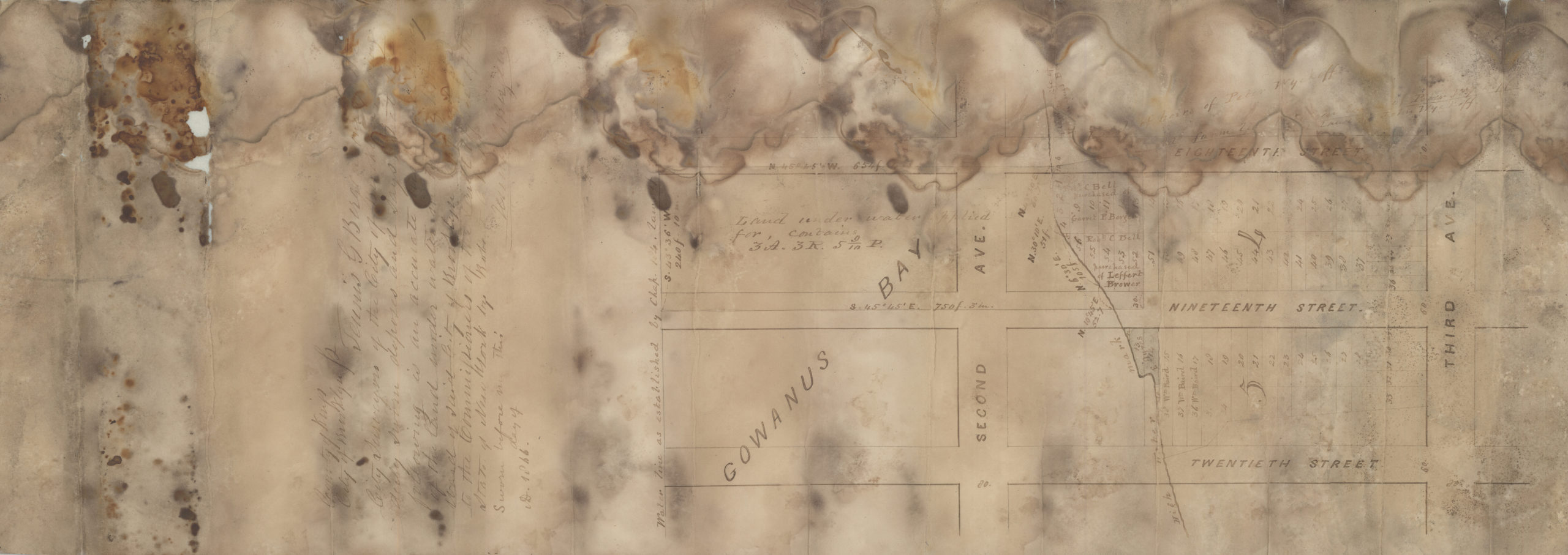
Creator
Bergen, Teunis G.,Publisher
Brooklyn Historical SocietyCitation
[Map of shore line adjoining land under water from 18th Street to 20th Street, between 3rd Avenue and the water line in Gowanus Bay]; 1866, Map Collection, Bergen-1866b.Fl; Brooklyn Historical Society.Scale
Scale not givenLoading zoom image... 