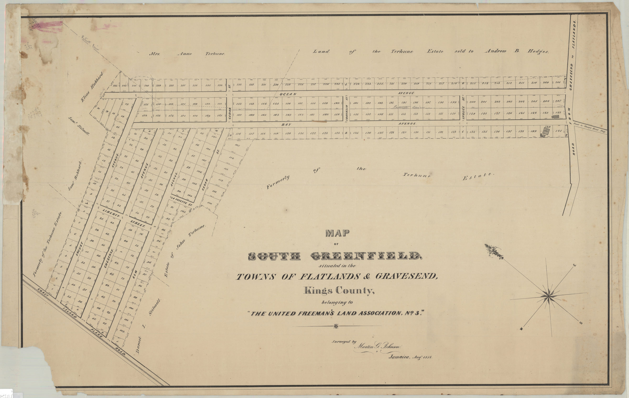
Map of South Greenfield, situated in the towns of Flatlands & Gravesend, Kings County, belonging to the United Freeman’s Land Assocation, no. 3: surveyed by Martin G. Johnson, Jamaica, Aug. 1854 [1854]
Map No. B P-[1854?].Fl.Folio
Cadastral map covering area bounded roughly by Ocean Ave., Locust St., Coney Island Plank Rd., Cedar St., Bay Ave., and the Road from Gravesend to Flatlands (modern-day Midwood). Shows property (including lot numbers, dimensions, and buildings), and names of landowners. Oriented with north to the upper left. BHS copy missing 8 x 8 cm. piece of left corner, possibly affecting description.
Subjects
Places
Map area shown
Genre
Cadastral mapsRelation
Full catalog recordSize
58 × 91 cmDownload
Low Resolution Image
Creator
Johnson, Martin G.,Publisher
Brooklyn Historical SocietyCitation
Map of South Greenfield, situated in the towns of Flatlands & Gravesend, Kings County, belonging to the United Freeman’s Land Assocation, no. 3: surveyed by Martin G. Johnson, Jamaica, Aug. 1854; [1854], Map Collection, B P-[1854?].Fl.Folio; Brooklyn Historical Society.Scale
Scale not givenLoading zoom image... 