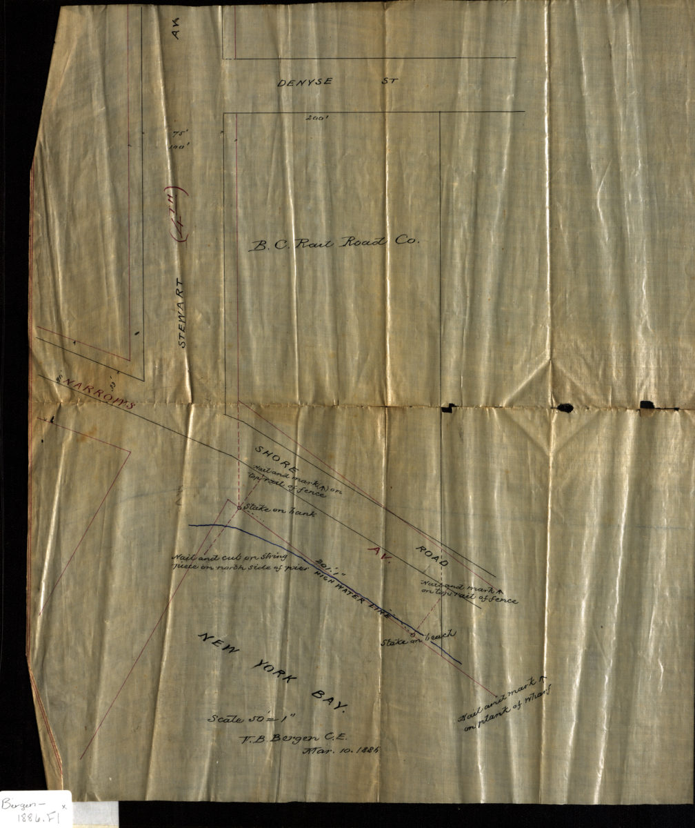
[Map of Stewart Ave. at Narrows Ave. and Shore Rd.]: V.B. Bergen, C.E. March 10, 1886
Map No. Bergen-1886.Fl
Survey map covering area in modern-day Fort Hamilton. Also shows the high water line and land belonging to the B.C. Railroad Co. Title devised by cataloger.
Map area shown
Genre
Manuscript mapsRelation
Full catalog recordSize
38 × 32 cmDownload
Low Resolution Image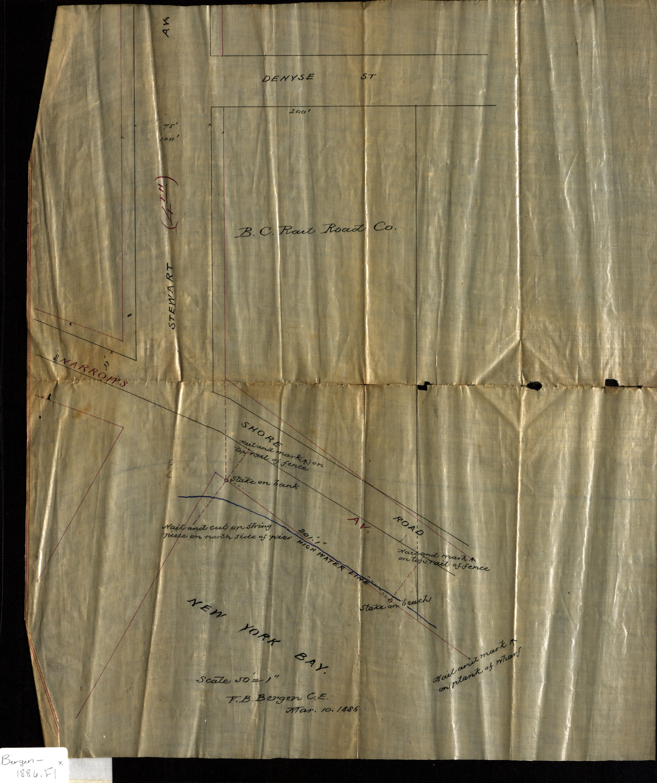
Creator
Bergen, Van Brunt,Publisher
Brooklyn Historical SocietyCitation
[Map of Stewart Ave. at Narrows Ave. and Shore Rd.]: V.B. Bergen, C.E.; March 10, 1886, Map Collection, Bergen-1886.Fl; Brooklyn Historical Society.Scale
Scale [1:600] 1 in to 50Loading zoom image...