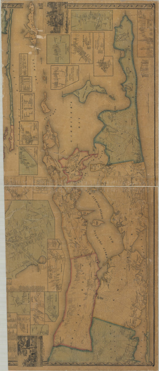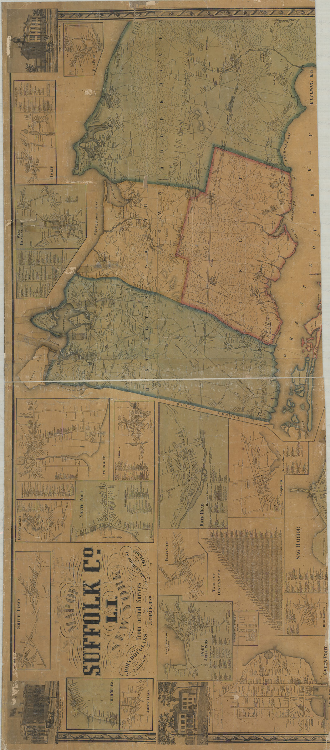
Map of Suffolk Co., L.I., New York: from actual surveys: by J. Chace Junr [1858]
Shows administrative divisions and railroads. Relief shown by hachures. “Entered according to Act of Congress in the Year 1858 by Robert Pearsall Smith in the Clerks Office of the District Court of the Eastern District of Pennslyvania”–Lower right margin. Includes 32 insets, titled ill., business directories, table of distances, agricultural statistics for 1855, decorative border, and lists of religious societies and newspapers. Insets: Bellport — Islip — West Huntington — Babylon — Northport — Patchogue — East Setauket — Riverhead — Southold — Sag Harbor — Bridgehampton — Port Jefferson — Greenport — Penataquit — Cold Spring — Amityville — Amagansett — Southport — East Hampton — Sayville — Southampton — Cutchogue — Orient — Marion — Stoneybrook — New Suffolk — Aquebogue — East Moriches — Miller’s Place — Comac — Centre Moriches — Mattituck. Titled ill.: Court House, Riverhead, L.I. — Residence of Stephen Haynes, Esqr., Scuttle Hole, L.I. — Wyandank House, Greenport, L.I., Jeremiah Terry, propr. — Summer residence of Messrs. C.W. & J.T. Moore, Aquebogue, L.I. — Farm house of Elisha King, Esqr., Good Ground, L.I.
Map area shown
Genre
Cadastral mapsRelation
Full catalog recordSize
127 × 149 cmDownload
Low Resolution Image
Creator
Chace, J.,Publisher
Brooklyn Historical SocietyCitation
Map of Suffolk Co., L.I., New York: from actual surveys: by J. Chace Junr; [1858], Map Collection, L.I.-[1858].Fl; Brooklyn Historical Society.Scale
Scale [1:63,360]