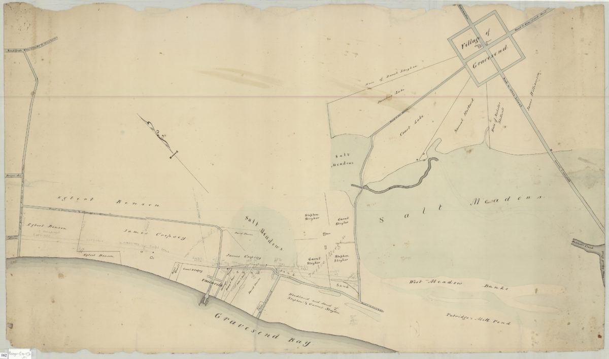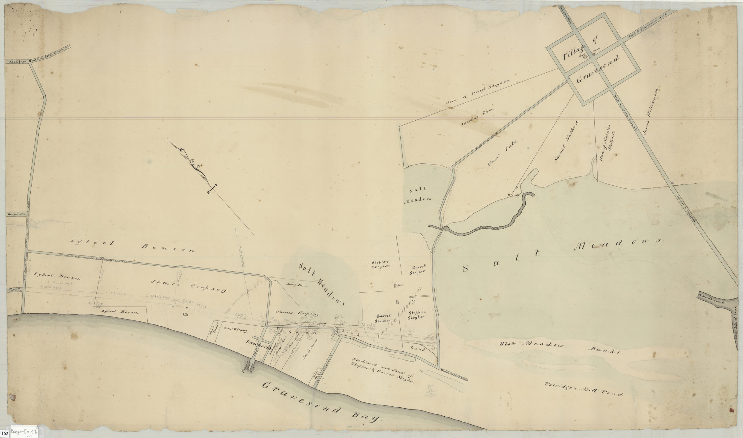
Map of territory near the Bay from the Village of New Utrecht to Gravesend & Coney Island [18??]
Map No. Bergen-[18--?]r.Fl
Verso title. Cadastral map covering area from Old Bath Road known as De Brunt Lane to Coney Island Creek in modern-day Gravesend. Shows creeks, salt meadows, property and names of landowners. Attributed to Teunis G. Bergen, based on handwriting. Oriented with north to the upper left.
Subjects
Places
Map area shown
Relation
Full catalog recordSize
58 × 99 cmDownload
Low Resolution Image
Creator
Bergen, Teunis G.,Publisher
Brooklyn Historical SocietyCitation
Map of territory near the Bay from the Village of New Utrecht to Gravesend & Coney Island; [18??], Map Collection, Bergen-[18--?]r.Fl; Brooklyn Historical Society.Scale
Scale not givenLoading zoom image...