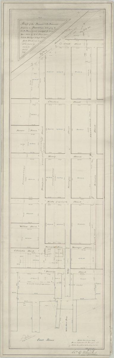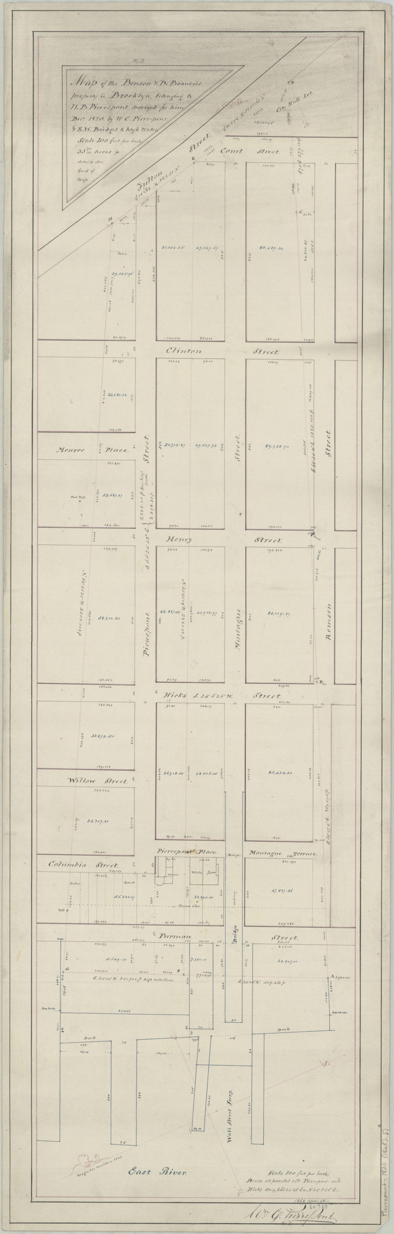
Map of the Benson & DeBeauvois property in Brooklyn belonging to H.B. Pierrepont: surveyed for him Dec. 1820 by W.C. Pierrepont & E.W. Bridges to high water: [copied by] Wm. C. Pierrepont, 1868 April 28 April 28, 1868
Map No. Pierrepont-1820 (1868).Fl
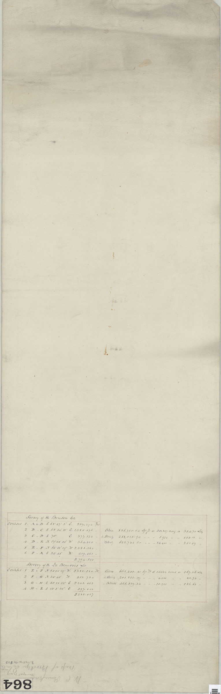
Cadastral map covering area north from Remsen St. to Pierrepont St. and east from Fulton St. to the East River (modern-day Brooklyn Heights). Shows property (including lots, dimensions, and buildings), piers, and the Wall St. Ferry. Oriented with north to the lower left. H.B. Pierrepont mentioned in title likely refers to Hezekiah Beers Pierrepont, but could also be Henry B. Pierrepont cataloger unable to determine which. On verso: Notes.
Map area shown
Relation
Full catalog recordSize
87 × 24 cmDownload
Low Resolution Image
Creator
Pierrepont, W. C.,Publisher
Brooklyn Historical SocietyCitation
Map of the Benson & DeBeauvois property in Brooklyn belonging to H.B. Pierrepont: surveyed for him Dec. 1820 by W.C. Pierrepont & E.W. Bridges to high water: [copied by] Wm. C. Pierrepont, 1868 April 28; April 28, 1868, Map Collection, Pierrepont-1820 (1868).Fl; Brooklyn Historical Society.Scale
Scale [1:1,200] 1 in to 1Loading zoom image...