Map of the Borough of Brooklyn, City of New York, 1960 1960
Map No. B A-1960.Fl
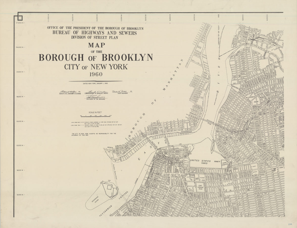
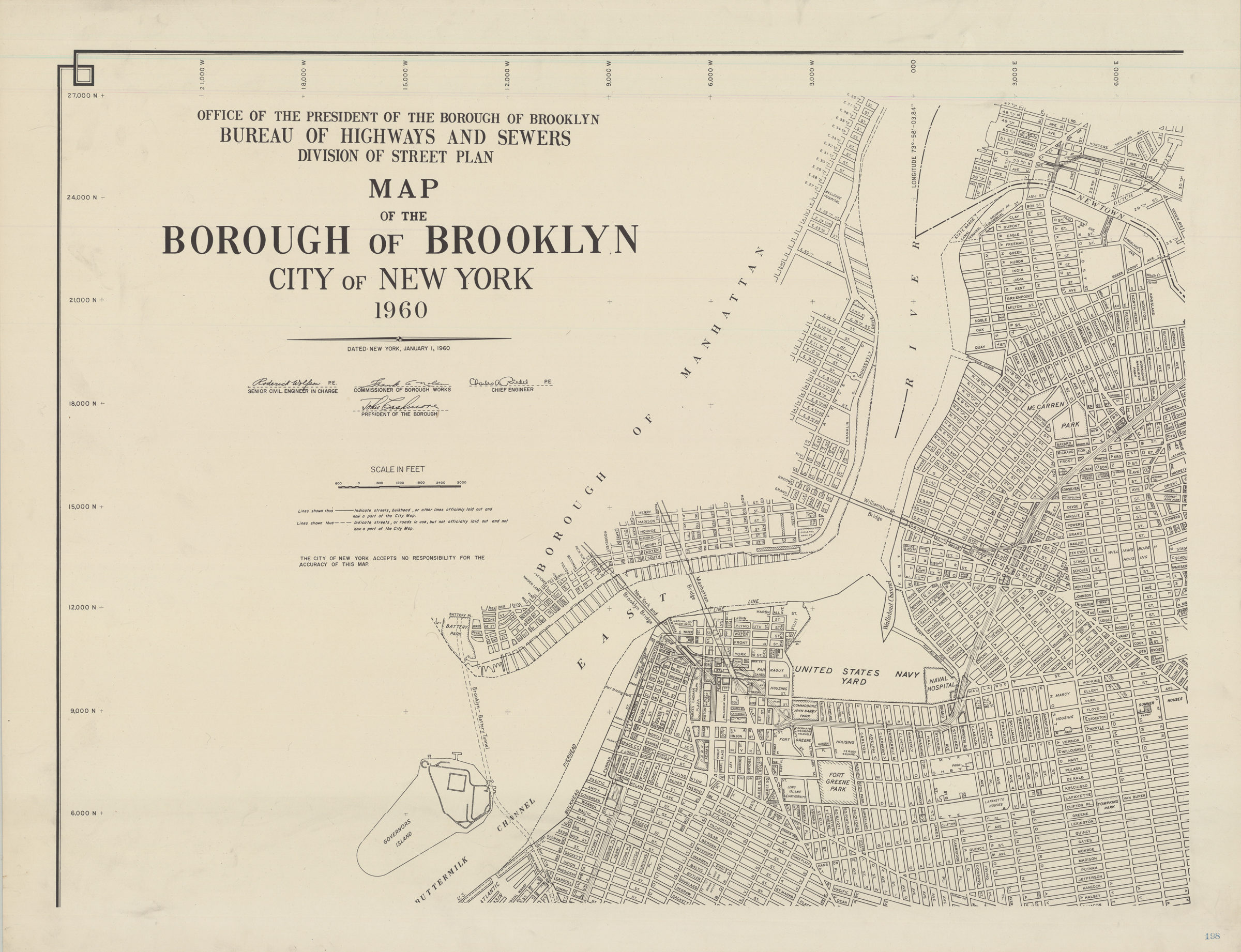
Map covers Brooklyn Heights, Downtown Brooklyn, Brooklyn Navy Yard, Fort Greene, Clinton Hill, Williamsburg, Greenpoint, and a portion of Boerum Hill. Also covers a portion of southeastern Manhattan, showing the complete span of the East River bridges. Shows streets names, parks, and public housing developments. One sheet of a larger set.
Places
Map area shown
Genre
MapRelation
Full catalog recordSize
64 × 84 cmDownload
Low Resolution Image
Creator
Brooklyn (New York, N.Y.).; Bureau of Highways and Sewers.; Division of Street Plan,Publisher
Brooklyn Historical SocietyCitation
Map of the Borough of Brooklyn, City of New York, 1960; 1960, Map Collection, B A-1960.Fl; Brooklyn Historical Society.Scale
Scale approximately 1:12,Loading zoom image...