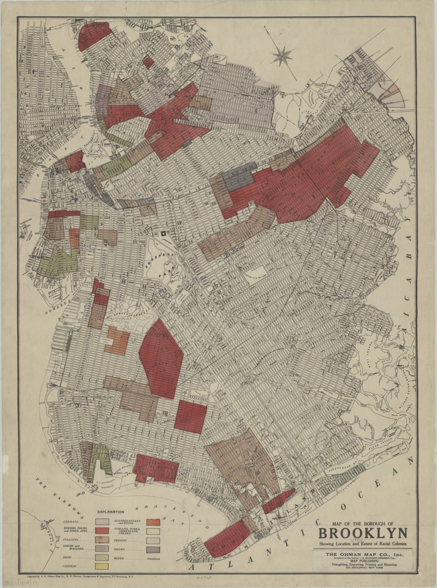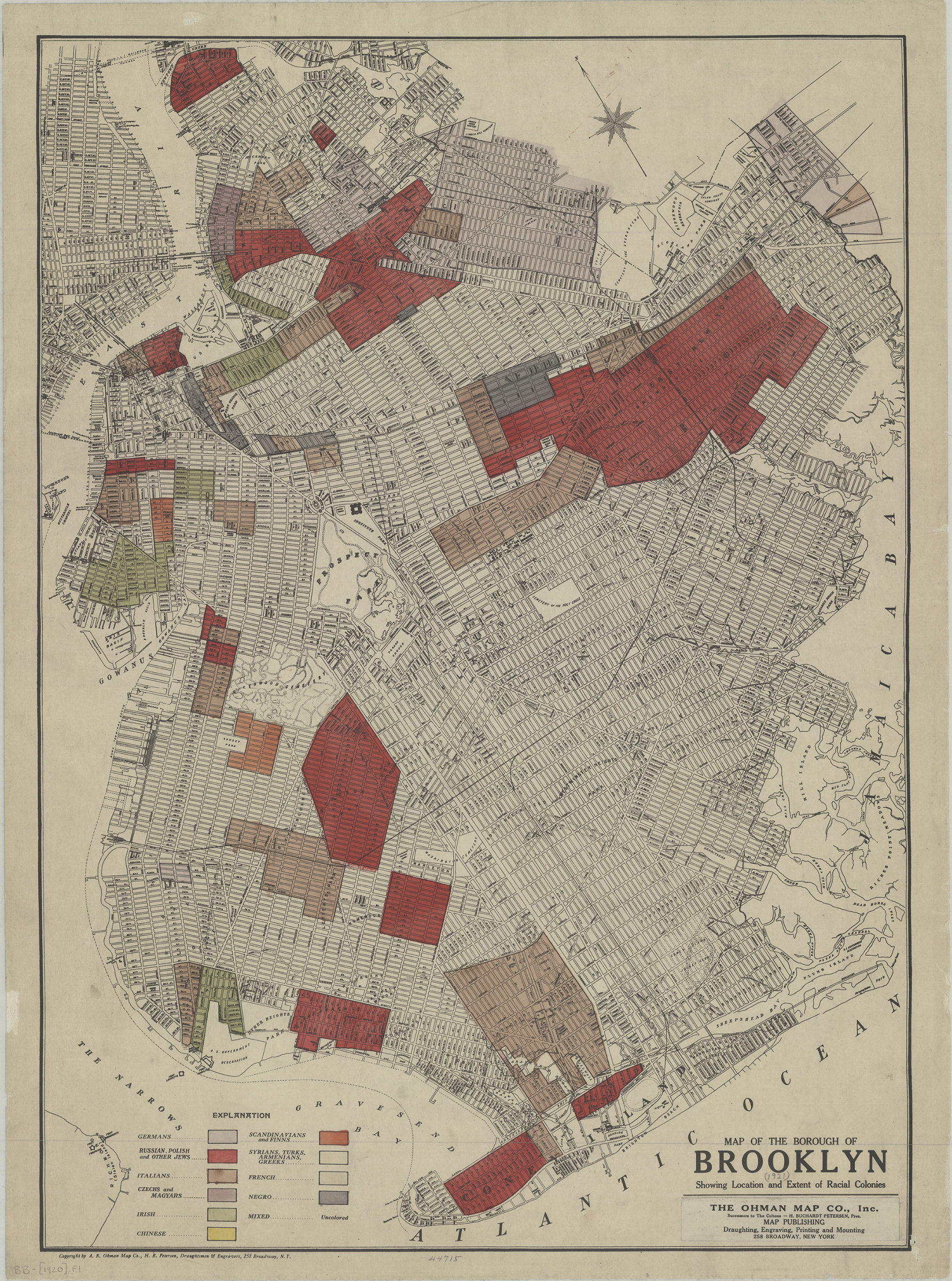
Map of the borough of Brooklyn: showing location and extent of racial colonies: Ohman Map Co., Inc [1920]
Map No. B B-[1920].Fl
Color block demographic map showing ethnic neighborhoods.
Map area shown
Genre
Population mapsRelation
Full catalog recordSize
67 × 48 cmDownload
Low Resolution Image
Creator
Ohman Map Co.,Publisher
Brooklyn Historical SocietyCitation
Map of the borough of Brooklyn: showing location and extent of racial colonies: Ohman Map Co., Inc; [1920], Map Collection, B B-[1920].Fl; Brooklyn Historical Society.Scale
Scale not givenLoading zoom image...