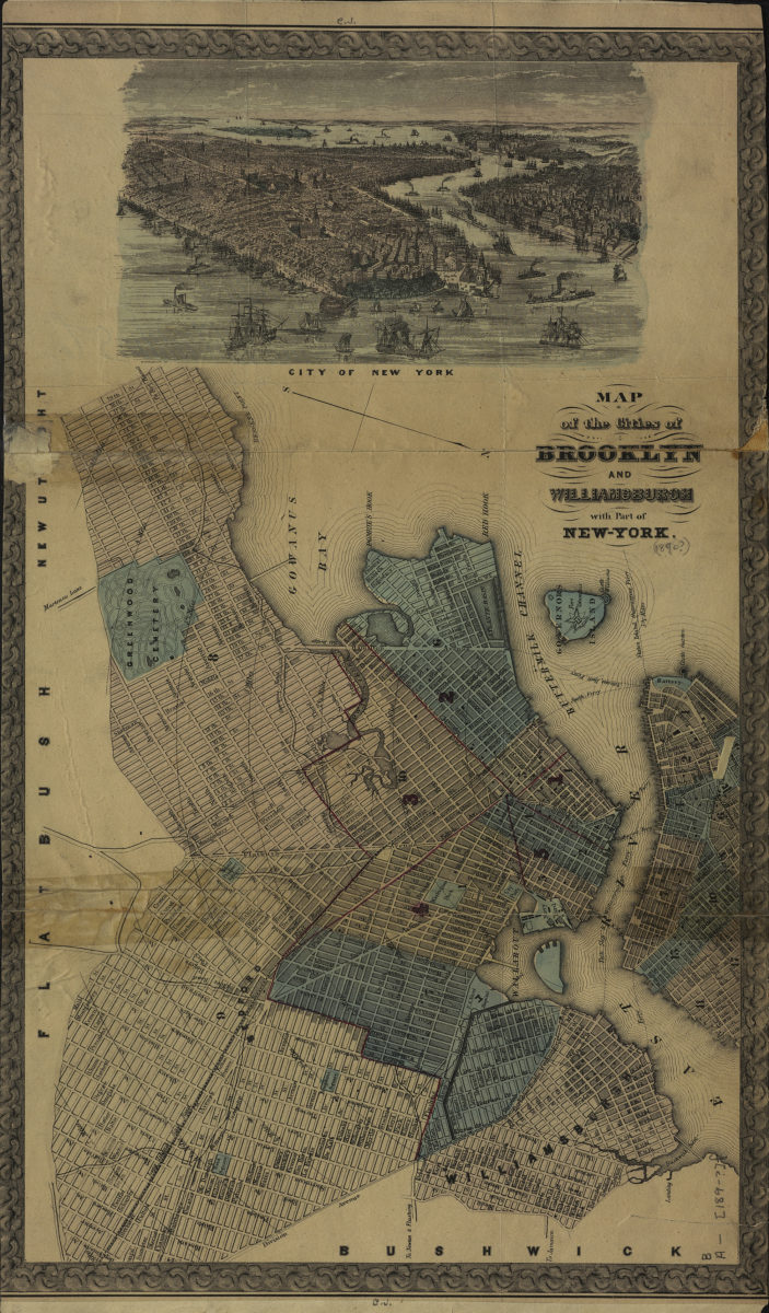
Map of the cities of Brooklyn and Williamsburgh with part of New York [189?]
Map No. B A-[189-?]f.Fl
Covers the city of Brooklyn north from 59th St. to the borders with Williamsburgh and Bushwick and east to the borders with Flatbush and New Utrecht shows all of Williamsburgh. Minimally details portions of New Utrecht, Flatbush, and Bushwick. Also covers Governors Island and a portion of Lower Manhattan. Shows wards, ferry lines, and distances from the Brooklyn Heights waterfront. Oriented with north to the lower right. Includes bird’s eye view of “City of New York” and decorative border. BHS copy annotated in red ink. On verso: Removed from Eugene Armbuster’s album “Views of Bushwick.1.” in 1964 to preserve.
Map area shown
Genre
Aerial viewsRelation
Full catalog recordSize
48 × 28 cmDownload
Low Resolution Image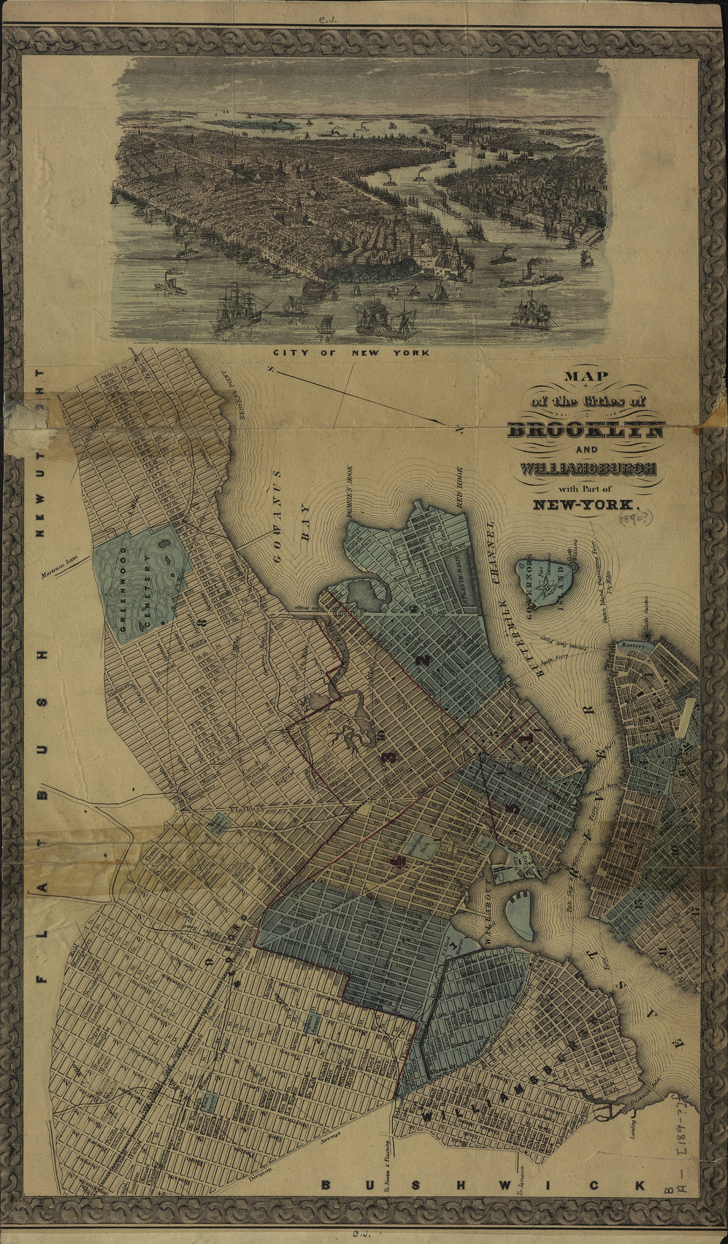
Creator
Publisher
Brooklyn Historical SocietyCitation
Map of the cities of Brooklyn and Williamsburgh with part of New York; [189?], Map Collection, B A-[189-?]f.Fl; Brooklyn Historical Society.Scale
Scale not givenLoading zoom image...