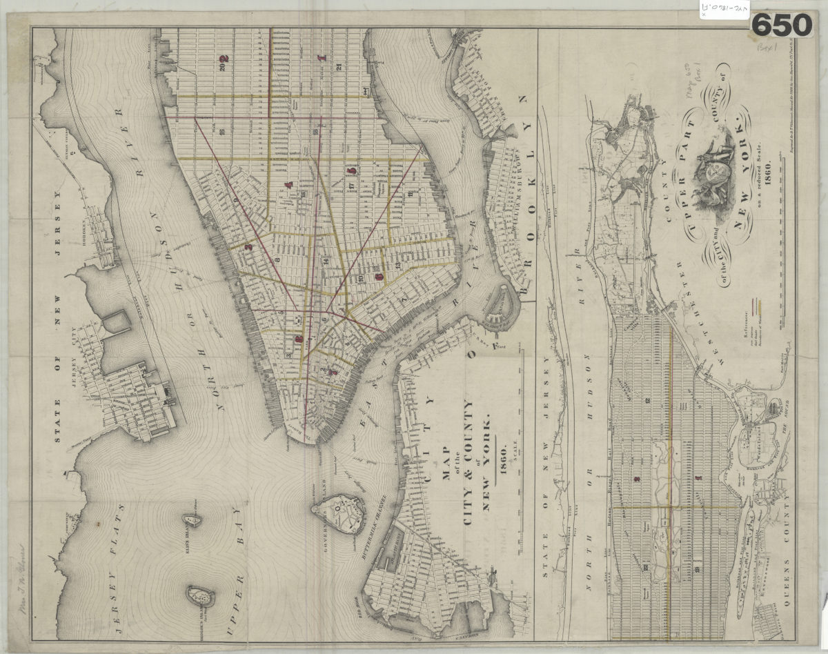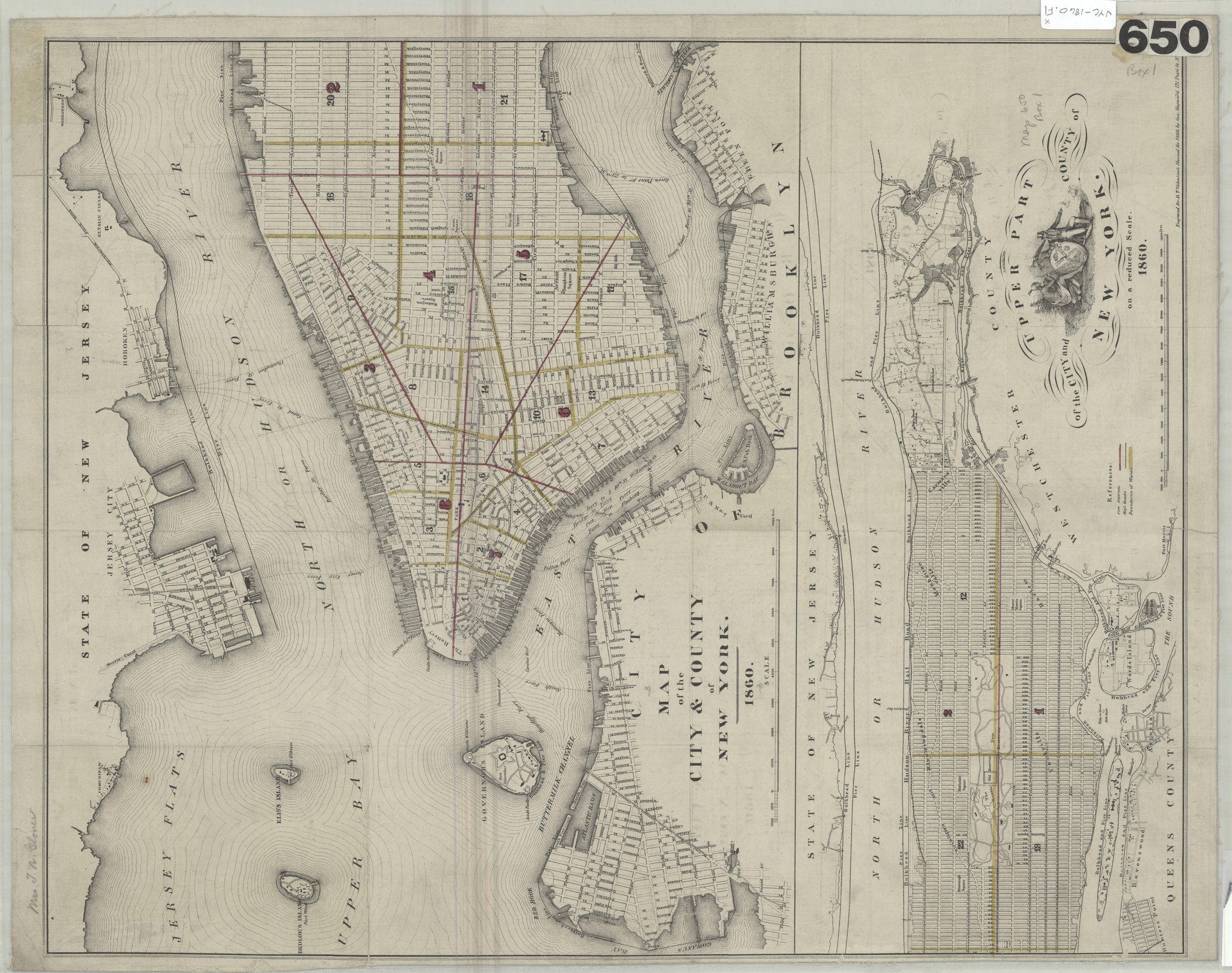
Map of the city & county of New York: engraved for D.T. Valentine’s Manual for 1860 by Geo. Hayward 1860
Map No. NYC-1860.Fl
Covers the entirety of Manhattan and portions of Brooklyn and Queens, as well as Governor’s Island, Bedloe’s Island, Elis’s Island, Blackwells Island, Wards Island, Randalls Island, Sunken Meadow and a portion of New Jersey. Shows railroads, ward boundaries, pier and bulkhead lines, fire districts, and ferry lines. Oriented with north to the upper right. Includes key, ill., and inset continuation map. Inset continuation map: Upper part of the city and county of New York on a reduced scale (Scale [ca. 1:48,000]). BHS copy mounted on linen.
Map area shown
Genre
MapRelation
Full catalog recordSize
34 × 41 cmDownload
Low Resolution Image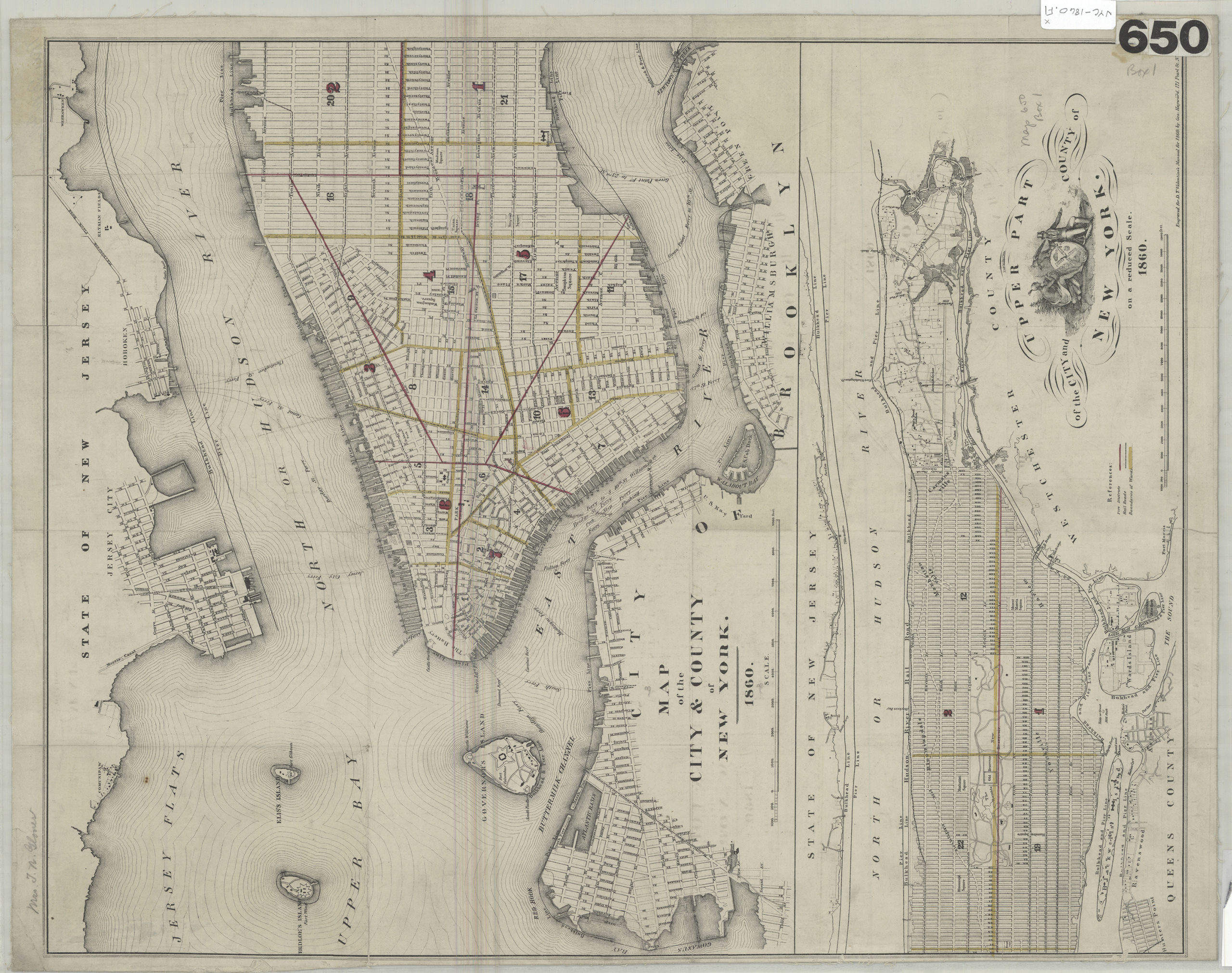
Creator
Hayward, George,Publisher
Brooklyn Historical SocietyCitation
Map of the city & county of New York: engraved for D.T. Valentine’s Manual for 1860 by Geo. Hayward; 1860, Map Collection, NYC-1860.Fl; Brooklyn Historical Society.Scale
Scale [ca. 1:24,000]Loading zoom image...