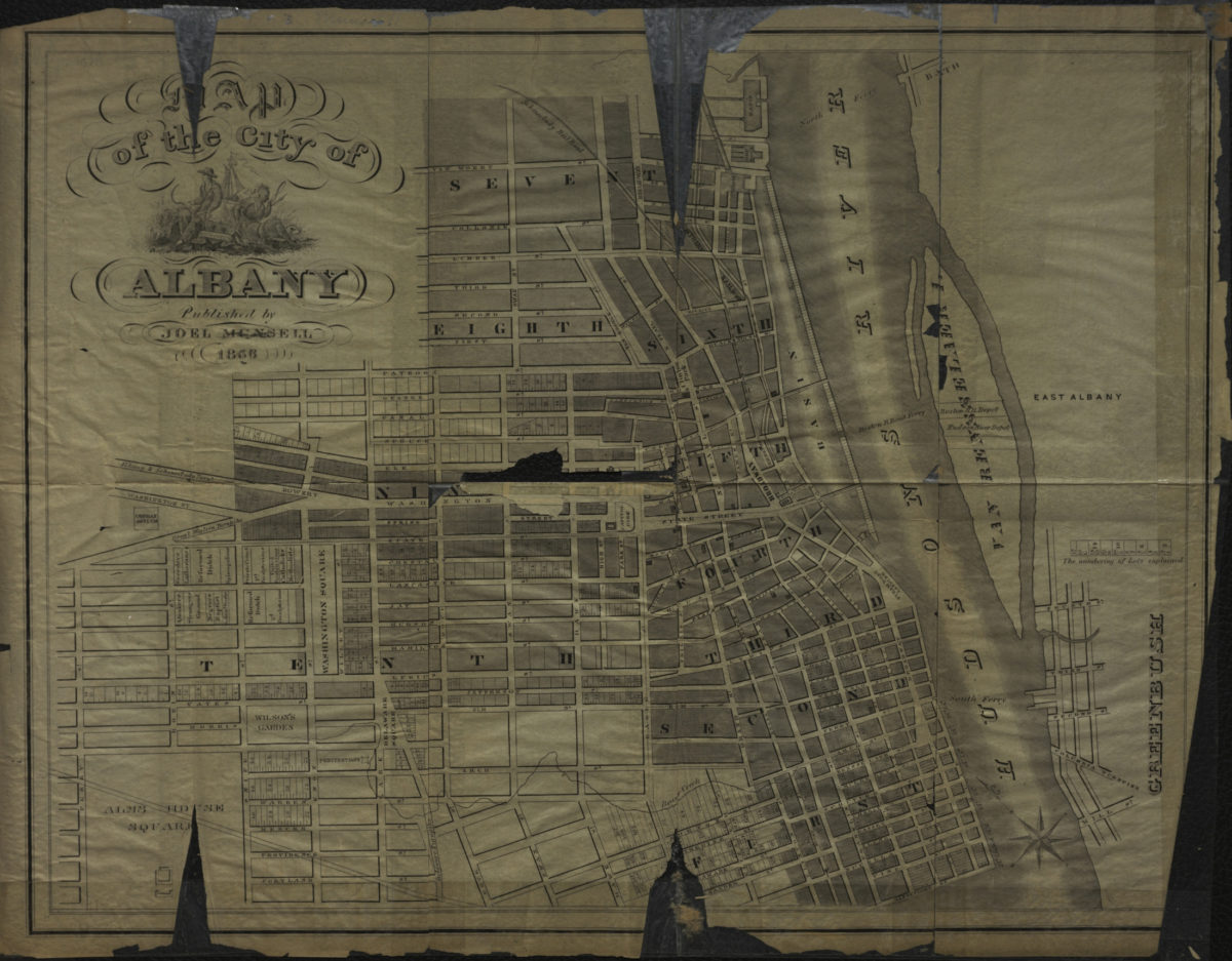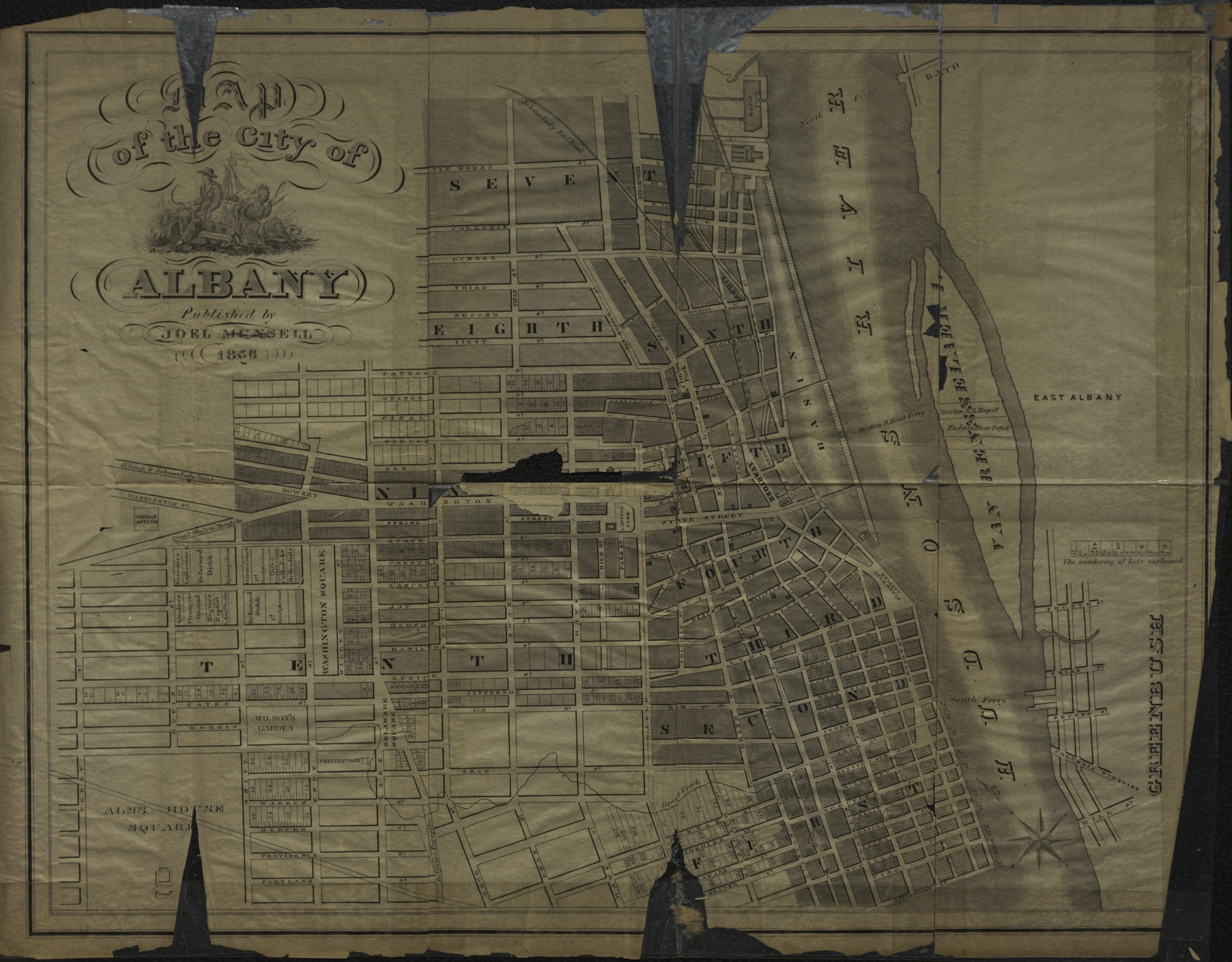
Map of the city of Albany 1856
Map No. NYS-1856a.Fl
Shows wards, lots, railroads, and ferry lines. Also covers part of Greenbush. Oriented with north to the upper left. Includes ill. (bracketing title) and explanation of lot numbering.
Places
Map area shown
Genre
MapRelation
Full catalog recordSize
31 × 40 cmDownload
Low Resolution ImageCreator
Munsell, Joel,Publisher
Brooklyn Historical SocietyCitation
Map of the city of Albany; 1856, Map Collection, NYS-1856a.Fl; Brooklyn Historical Society.Scale
Scale not givenLoading zoom image...