Map of the city of Brooklyn [188?]
Map No. B A-[188-?].Fl
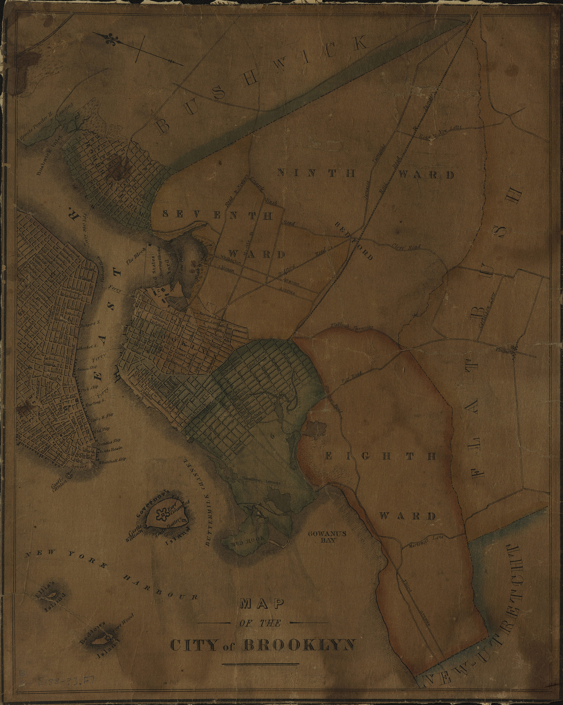
Covers the city of Brooklyn north from Union Ave to the Navy Yard and east to Gownus Rd also shows a portion of Lower Manhattan. Minimally details Governor’s Island, Ellis Island, and Bedlow’s Island (modernly known as Liberty Island), as well as parts of Bushwick, Flatbush, and New-Utrecht. Shows Brooklyn wards. Oriented with north to the upper left.
Map area shown
Genre
MapRelation
Full catalog recordSize
32 × 25 cmDownload
Low Resolution Image
Creator
Publisher
Brooklyn Historical SocietyCitation
Map of the city of Brooklyn; [188?], Map Collection, B A-[188-?].Fl; Brooklyn Historical Society.Scale
Scale not givenLoading zoom image... 