
Map of the city of Brooklyn and village of Williamsburgh: showing the size of blocks and width of streets as laid out by the commissioners, the old farm lines, water line, and all recent changes in streets 1846
Map No. B A-1846a.Fl;B A-1846a.Fl c.2
Subjects
Places
Map area shown
Genre
Cadastral mapsDownload
Low Resolution Image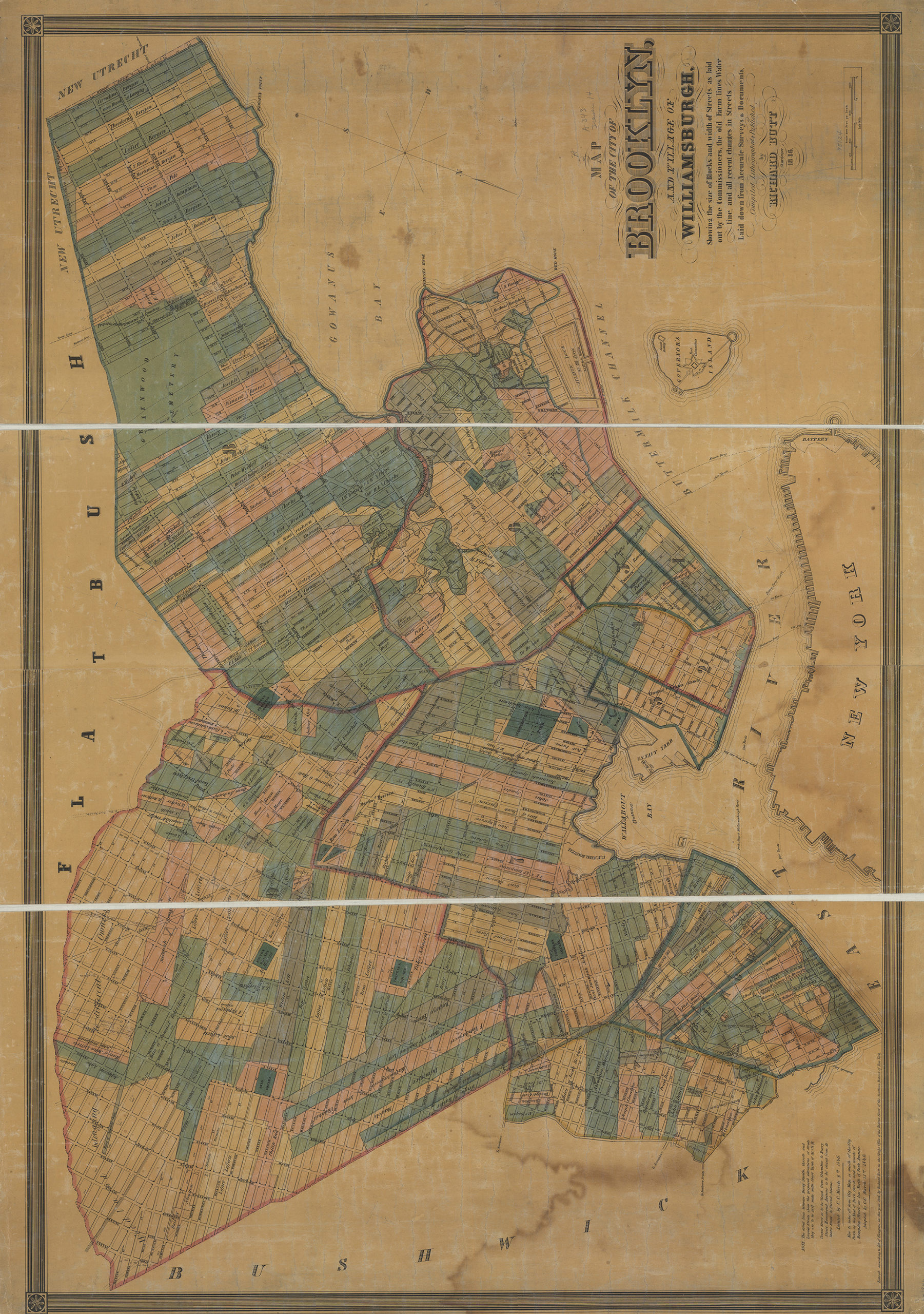
Citation
Map of the city of Brooklyn and village of Williamsburgh: showing the size of blocks and width of streets as laid out by the commissioners, the old farm lines, water line, and all recent changes in streets; , , ; Brooklyn Historical Society.Loading zoom image... 