
Map of the city of Brooklyn and village of Williamsburgh: showing the size of blocks and width of streets as laid out by the commissioners, the old farm lines, water line, and all recent changes in streets 1846
Map No. B A-1846a.Fl;B A-1846a.Fl c.2
Cadastral map. Covers Brooklyn (N.Y.) between North 13th Street in Williamsburg and 60th Street in Bay Ridge, and as far east as Greenwood Cemetery and Cemetery of the Evergreens, Brooklyn, New York (N.Y.). Shows property lines and owners’ names, existing and proposed streets, parks and shoreline fill. Oriented with north to the bottom of sheet. NYHS copy 1 frayed, stained and discolored. Mounted on and edgebound with cloth. Copy 2 frayed, shellacked and discolored. Mounted on cloth. BHS copy 1 is 3 assembled sheets on a linen back. BHS copy 2 is a black and white print, composed of 4 sheets assembled on linen back. M009382, M008719
Subjects
Places
Map area shown
Genre
Cadastral mapsRelation
Full catalog recordSize
75 × 111 cmDownload
Low Resolution Image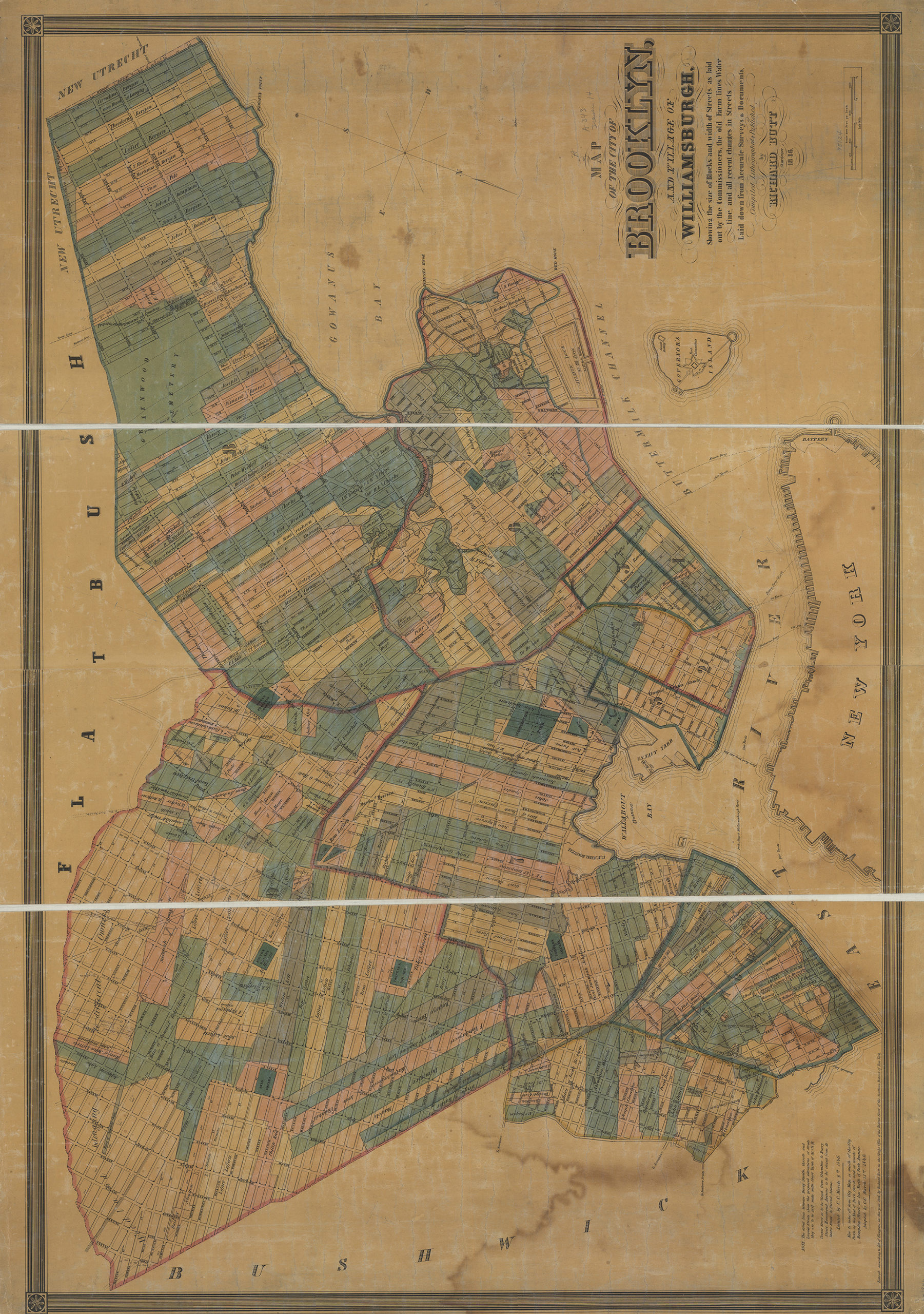
Creator
Butt, Richard,Publisher
Brooklyn Historical SocietyCitation
Map of the city of Brooklyn and village of Williamsburgh: showing the size of blocks and width of streets as laid out by the commissioners, the old farm lines, water line, and all recent changes in streets; 1846, Map Collection, B A-1846a.Fl;B A-1846a.Fl c.2; Brooklyn Historical Society.Scale
Scale [1:9,600] 1 in to 8Loading zoom image... 