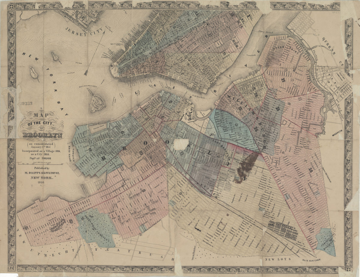
Map of the city of Brooklyn (as consolidated January 1st, 1855), incorporated as a village 1816, as a city 1834, popln. abt. 200,000 1856
Map No. B A-1856a.Fl
Covers the city of Brooklyn north from 60th St. to Green Point and east to the Cemetery of the Evergreens. Also covers Governor’s Island, Ellis Island, Bedlow’s Island (modernly known as Liberty Island) and portions of southern Queens, Lower Manhattan, and Jersey City. Shows ferry lines and wards (outlined in red). Relief shown by hachures. Oriented with north to the upper right. Includes decorative border.
Map area shown
Genre
LithographsRelation
Full catalog recordSize
43 × 56 cmDownload
Low Resolution Image
Creator
Dripps, M.,Publisher
Brooklyn Historical SocietyCitation
Map of the city of Brooklyn (as consolidated January 1st, 1855), incorporated as a village 1816, as a city 1834, popln. abt. 200,000; 1856, Map Collection, B A-1856a.Fl; Brooklyn Historical Society.Scale
Scale [1:21,600] 1 in toLoading zoom image...