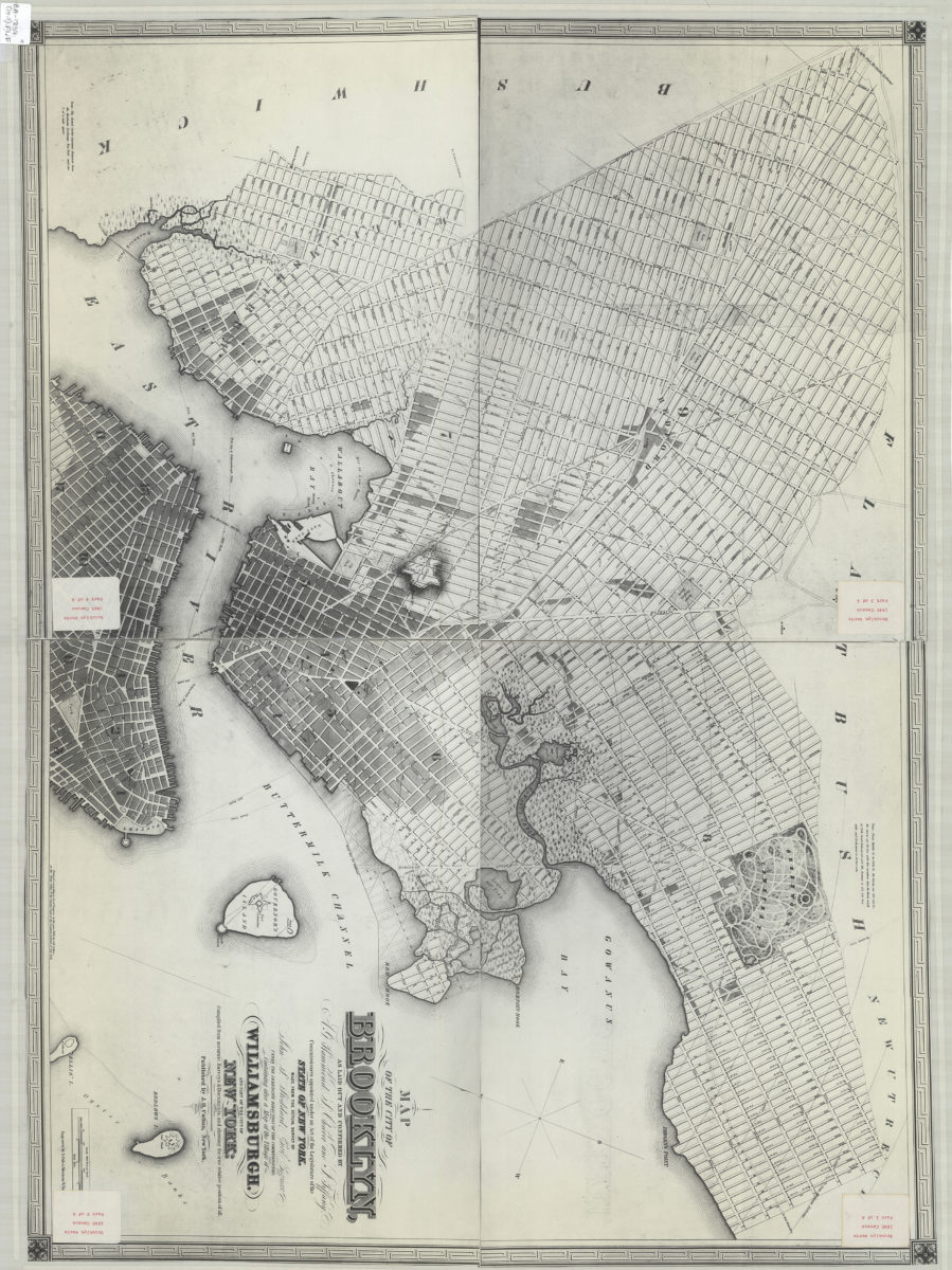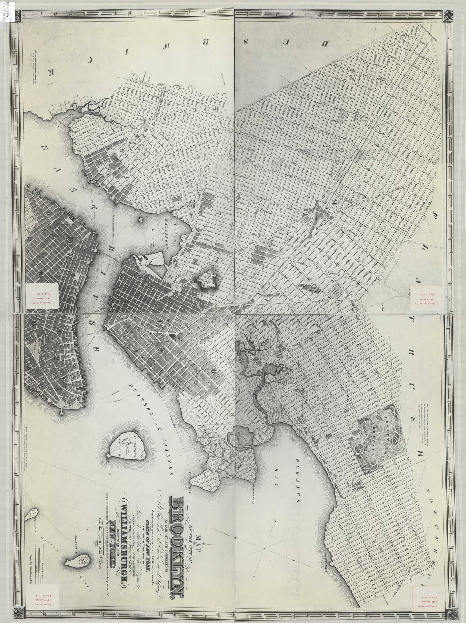

Map of the city of Brooklyn: as laid out and confirmed by A.G. Hammond, S. Cheever and J. Tiffany, commissioners appointed under an Act of the Legislature of the state of New York ; containing also a map of the village of Williamsburgh [19??]
Map No. B A-1839 (19--?).Fl.Folio
Covers Brooklyn north from 59th St. to Greepoint and east to Stone Ave. Shows wards, hospitals, cemeteries, railroads, ferry lines, names of landowners, and radial distances from the Merchants Exchange in Manhattan. Relief shown by hachures and spot heights. Depths shown by soundings. Oriented with north to the lower left. Includes notes and decorative border.
Map area shown
Genre
MapRelation
Full catalog recordSize
80 × 111 cmDownload
Low Resolution Image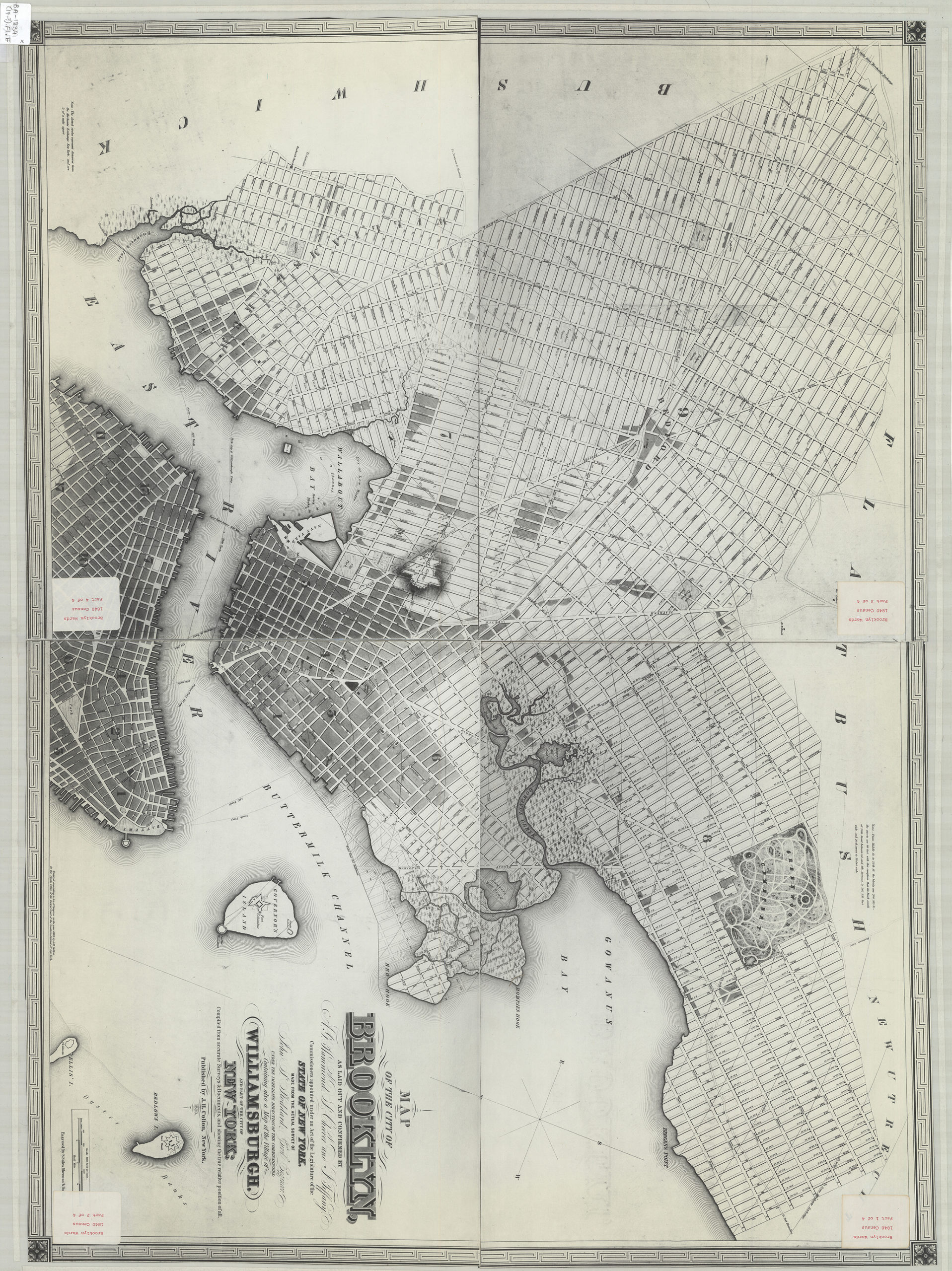
Creator
Stoddard, John S., Stoddard, John S.,Publisher
Brooklyn Historical Society, Brooklyn Historical SocietyCitation
Map of the city of Brooklyn: as laid out and confirmed by A.G. Hammond, S. Cheever and J. Tiffany, commissioners appointed under an Act of the Legislature of the state of New York ; containing also a map of the village of Williamsburgh; [19??], Map Collection, B A-1839 (19--?).Fl.Folio; Brooklyn Historical Society.Scale
Scale [ca. 1:9,600]Loading zoom image...