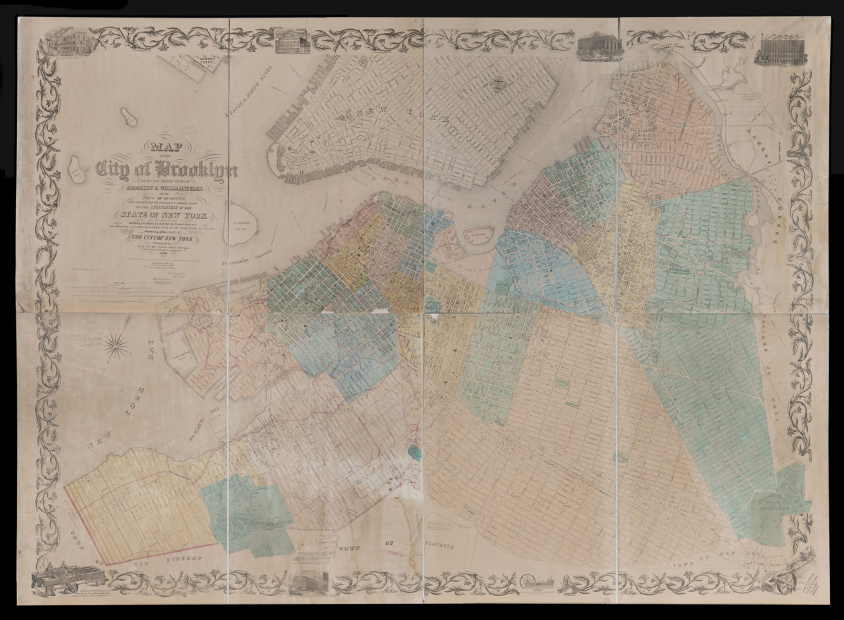
Map of the city of Brooklyn: being the former cities of Brooklyn & Williamsburgh and the town of Bushwick, as consolidated January 1st, 1855, by an Act of the Legislature of the State of New York, passed April 17th, 1854 1856
Map No. B A-1856.Fl
Cadastral map covering Brooklyn north from 60th St. to Green Point and east to the Cemetery of the Evergreens. Also covers portions of Jersey City, Queens, and Lower Manhattan. Shows wards, blocks and lots, names of landowners, ferry lines, piers, bulkhead lines, churches, and hospitals. “Reduced from the authoritative maps on file and compiled and drawn by J.M. Grumman, City Surveyor.” Oriented with north to the upper right. “Entered according to Act of Congress in the year 1856 by M. Dripps in the Clerks Office of the District Court of the Southern District of New York.” Includes decorative border, notes, ill., and advertisements.
Map area shown
Genre
Cadastral mapsRelation
Full catalog recordSize
66 × 160 cmDownload
Low Resolution Image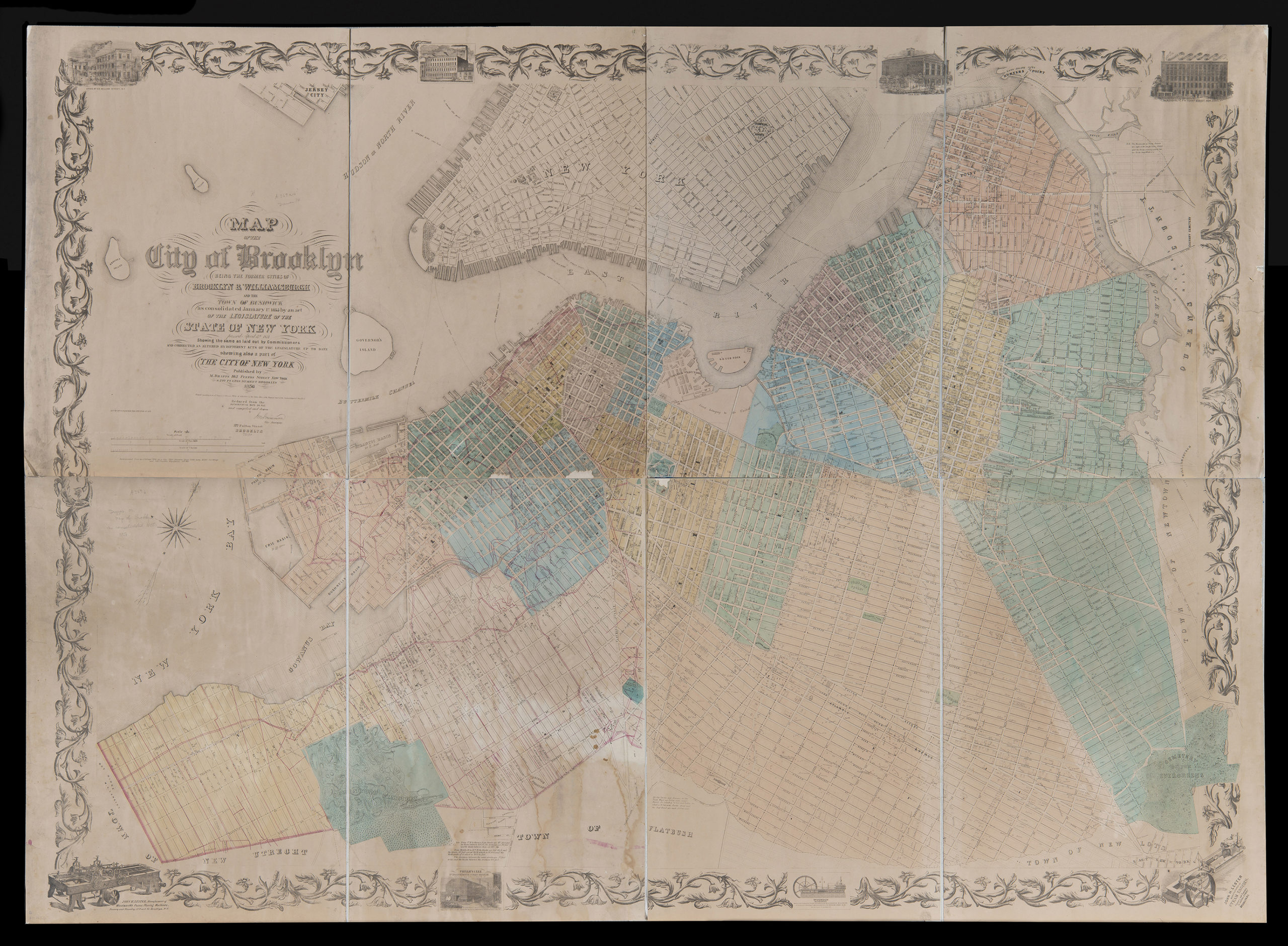
Creator
Dripps, M.,Publisher
Brooklyn Historical SocietyCitation
Map of the city of Brooklyn: being the former cities of Brooklyn & Williamsburgh and the town of Bushwick, as consolidated January 1st, 1855, by an Act of the Legislature of the State of New York, passed April 17th, 1854; 1856, Map Collection, B A-1856.Fl; Brooklyn Historical Society.Scale
Scale 1:7,200Loading zoom image...