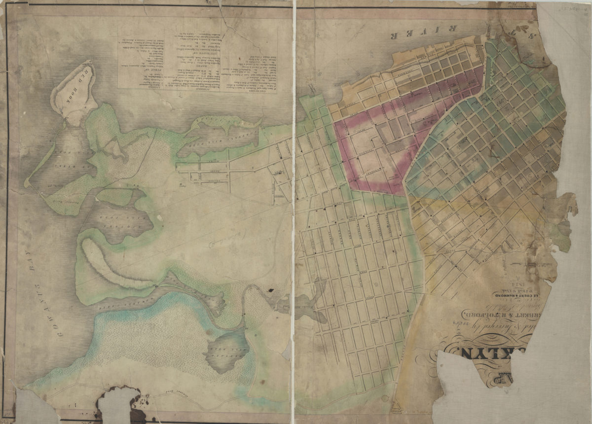
[Ma]p of [the city of Broo]klyn: [comp]iled & surveyed by [S.C.] Herbert & R. Tolford 1834
Map No. B A-1834.Fl
Covers Brooklyn north from Red Hook to the Navy Yard and east to Gowanus Rd. Shows wards, ponds, and marshes. Relief shown by hachures. Oriented with north to the lower left. “[ …] of the Southern District of N. York.” Includes index of churches, schools, banks, insurance offices, lodges, and public offices. Item is imperfect missing large portion of the map’s left side and some title information. Title and statement of responsibility inferred from: Herbert, S. C. Map of the City of Brooklyn / compiled & surveyed by S.C. Herbert & R. Tolford. [New York : s.n.], 1835. BHS copy annotated in pencil.
Map area shown
Genre
Cadastral mapsRelation
Full catalog recordSize
66 × 92 cmDownload
Low Resolution Image
Creator
Herbert, S. C.,Publisher
Brooklyn Historical SocietyCitation
[Ma]p of [the city of Broo]klyn: [comp]iled & surveyed by [S.C.] Herbert & R. Tolford; 1834, Map Collection, B A-1834.Fl; Brooklyn Historical Society.Scale
Scale [ca. 1:4,923]Loading zoom image...