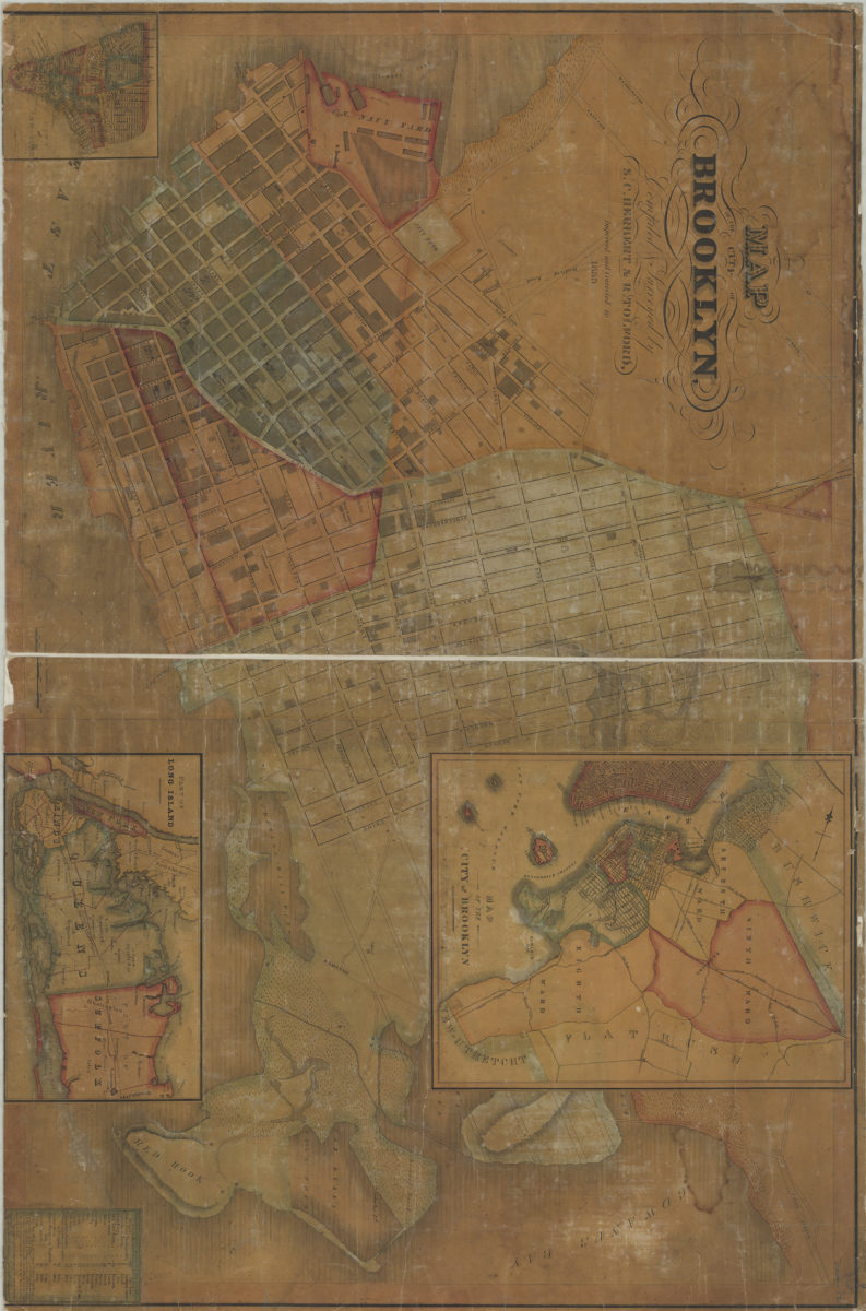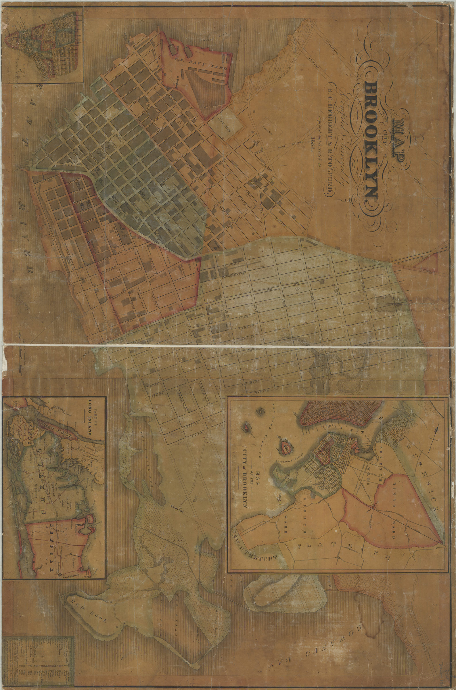
Map of the City of Brooklyn: compiled & surveyed by S.C. Herbert & R. Tolford 1835
Map No. B A-1835.Fl
Covers the area later bounded by the Brooklyn Navy Yard on the north and Red Hook on the south and extending eastward to 5th Avenue, Brooklyn, New York (N.Y.) Shows buildings. Also shows streams, ponds and wetlands. Shows relief by hachures. Oriented with north to the lower left of sheet. Includes insets: location map, “City of New York” and “Part of Long Island.” Includes table: “Comparative distances of Places in New York and Brooklyn, from the Merchant’s Exchange in New York.” NYHS copy frayed, soiled, foxed, shellacked and abraded. Mounted on cloth. Margins pierced for hanging. M009381
Subjects
Places
Map area shown
Genre
MapRelation
Full catalog recordSize
67 × 101 cmDownload
Low Resolution Image
Creator
Herbert, S. C.,Publisher
Brooklyn Historical SocietyCitation
Map of the City of Brooklyn: compiled & surveyed by S.C. Herbert & R. Tolford; 1835, Map Collection, B A-1835.Fl; Brooklyn Historical Society.Scale
Scale [1:5,000]Loading zoom image...