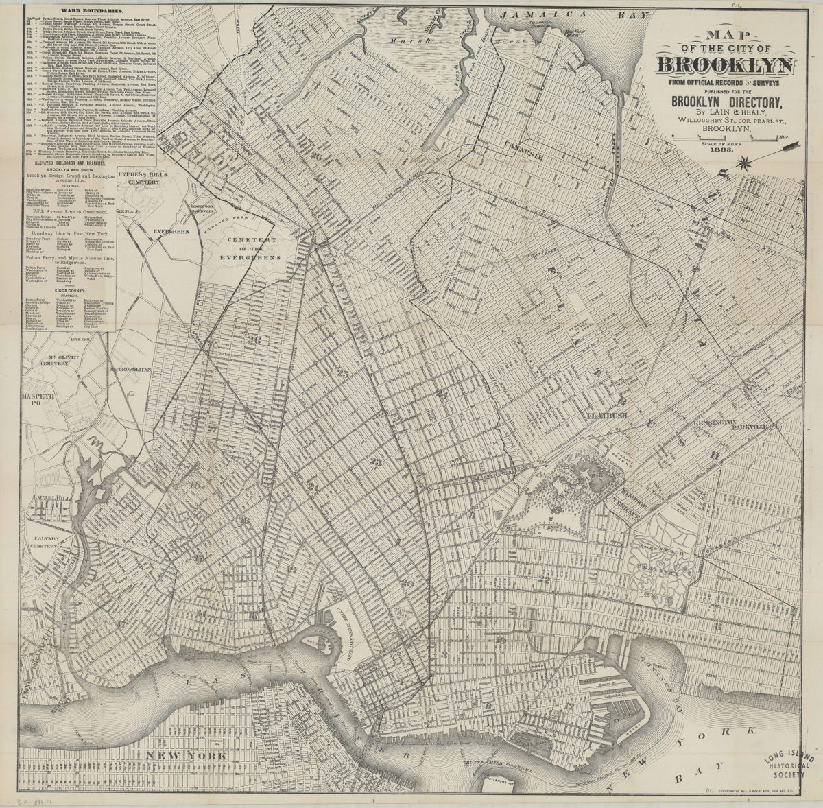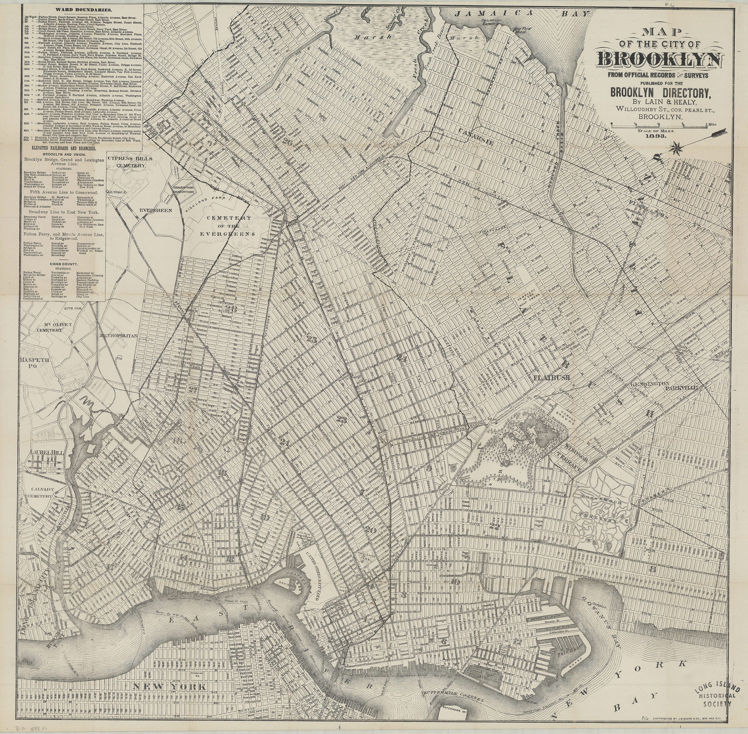
Map of the city of Brooklyn: from official records and surveys 1893
Map No. B A-1893.Fl
Covers the city of Brooklyn north from approximately 61st St. to Greenpoint and east to Jamaica Bay also covers portions of southern Queens, Manhattan, and Governors Isd. Shows wards, ferry lines, and elevated railroads. Oriented with north to the lower left. “Copyrighted by J.B. Beers & Co., 1876 and 1885.” Includes description of ward boundaries and elevated railroads. Pasted on cover of BHS copy: Paul Grosser, Stationer, Blank Books, &c., 328 Fulton St., Brooklyn, N.Y. BHS copy 2 folded to 21 x 12 advertisements on verso.
Map area shown
Genre
Zoning mapsRelation
Full catalog recordSize
65 × 64 cmDownload
Low Resolution Image
Creator
J.B. Beers & Co.,Publisher
Brooklyn Historical SocietyCitation
Map of the city of Brooklyn: from official records and surveys; 1893, Map Collection, B A-1893.Fl; Brooklyn Historical Society.Scale
Scale [ca. 1:18,773]Loading zoom image...