Map of the city of Brooklyn ; Latest improved map of New York City [ca. 1887]
Map No. NYC-1887.Fl
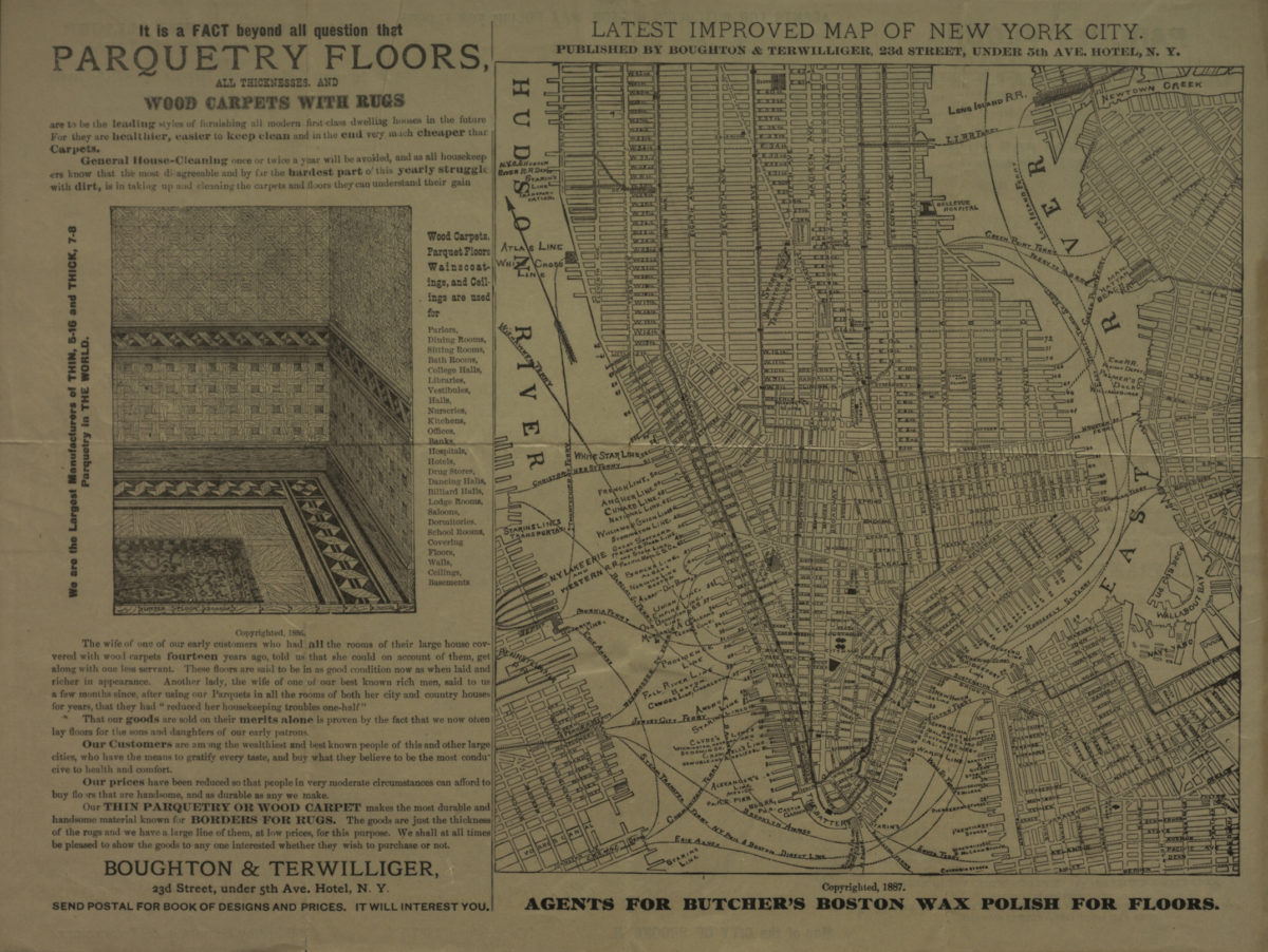
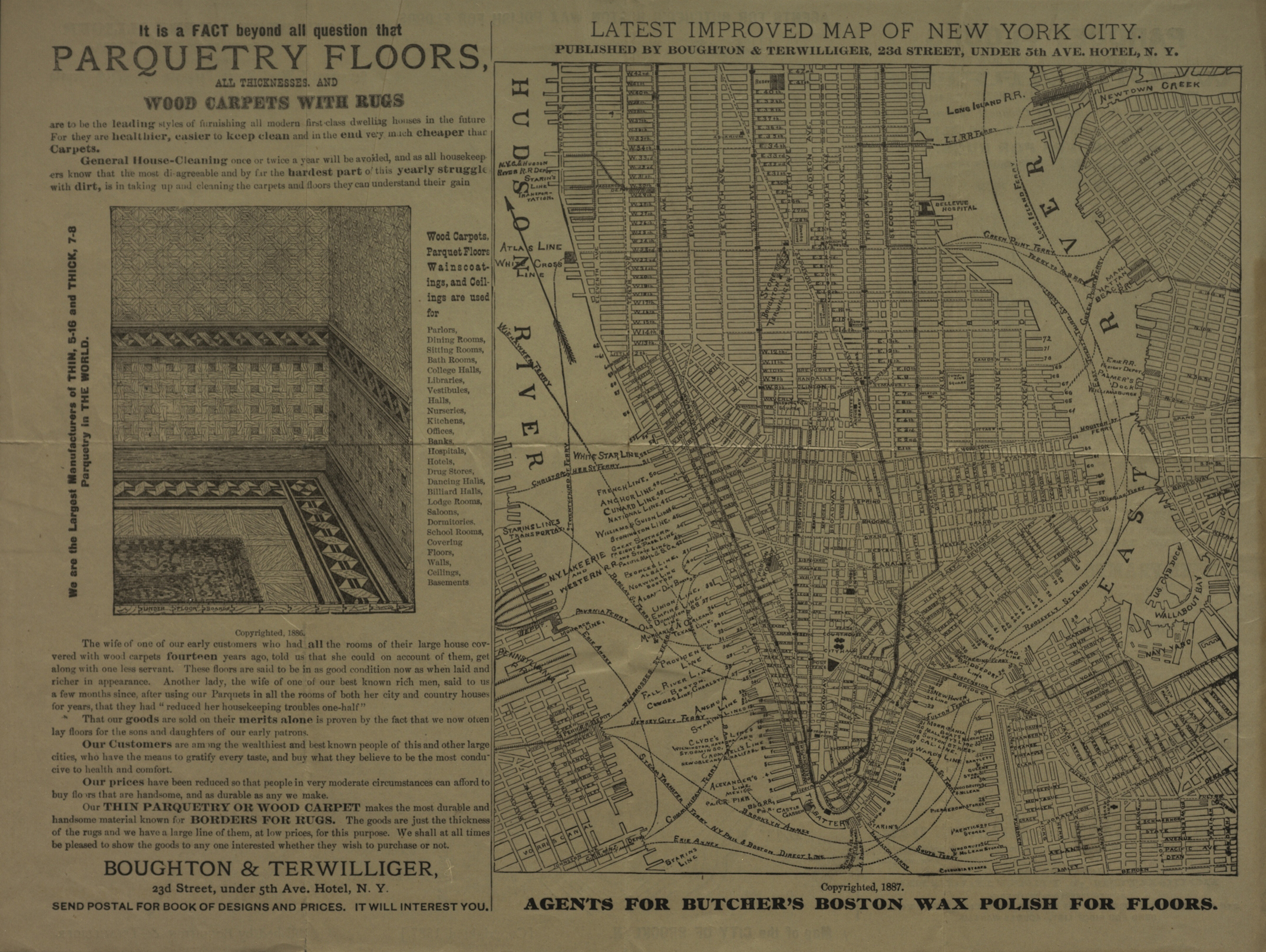
“Map of the city of Brooklyn” covers Brooklyn north from the Gowanus Bay to Greenpoint and east to Granite St. Also covers a portion of Lower Manhattan. Shows wards, railroads, piers, and ferry lines. “Latest improved map of New York City” covers Manhattan north from the Battery to 42nd St. Also covers portions of Brooklyn and Jersey City. Shows railroads, piers, and ferry lines. Includes advertisements.
Map area shown
Genre
MapRelation
Full catalog recordSize
23 × 21 cmDownload
Low Resolution ImageCreator
Boughton & Terwilliger (New York, N.Y.),Publisher
Brooklyn Historical SocietyCitation
Map of the city of Brooklyn ; Latest improved map of New York City; [ca. 1887], Map Collection, NYC-1887.Fl; Brooklyn Historical Society.Scale
Scale not givenLoading zoom image...