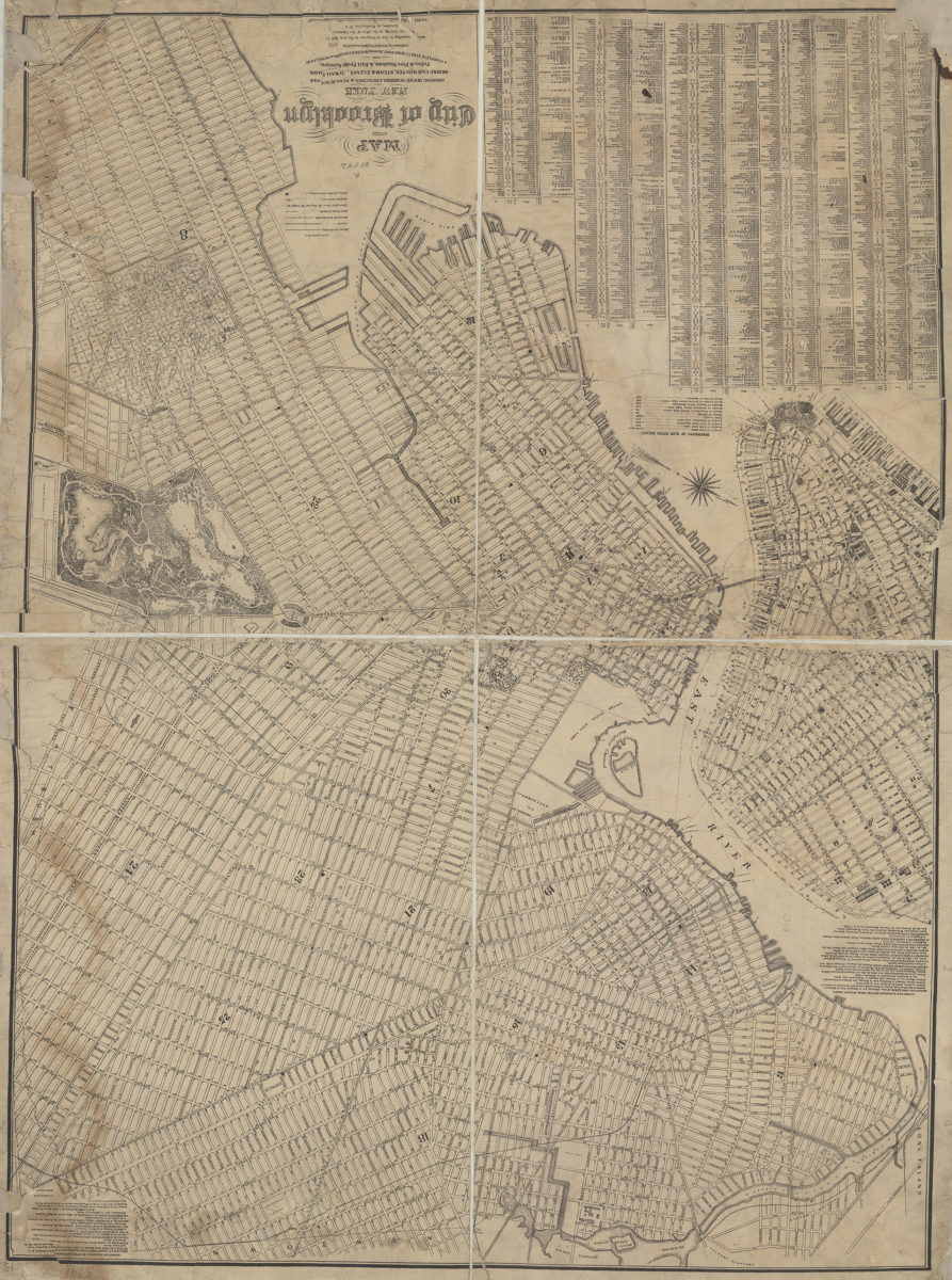
Map of the city of Brooklyn, New York: showing house numbers, churches & public schools, horse-car routes, steam & elevated railroads, police & fire stations, & exit from sewers, and a complete street directory, showing width & location of streets &c [1886]
Map No. B C-[1886?].Fl
Covers Brooklyn north from 65th St. to Greenpoint and east to Prospect Park. Also covers portions of Lower Manhattan. Shows wards, piers, and ferry lines. “Ent[ered] according to Act of Congress, in the year 18[8]6 by M[att]hew Dripps …” Includes key, street directory, and text. Text: Dimension of East River Bridge — Horse Car Railroad Routes From Fulton Ferry. BHS copy imperfect missing portion of copyright statement from which publication date is inferred. Date of publication conjectured based on manuscript note on map.
Map area shown
Genre
Transportation mapsRelation
Full catalog recordSize
110 × 80 cmDownload
Low Resolution Image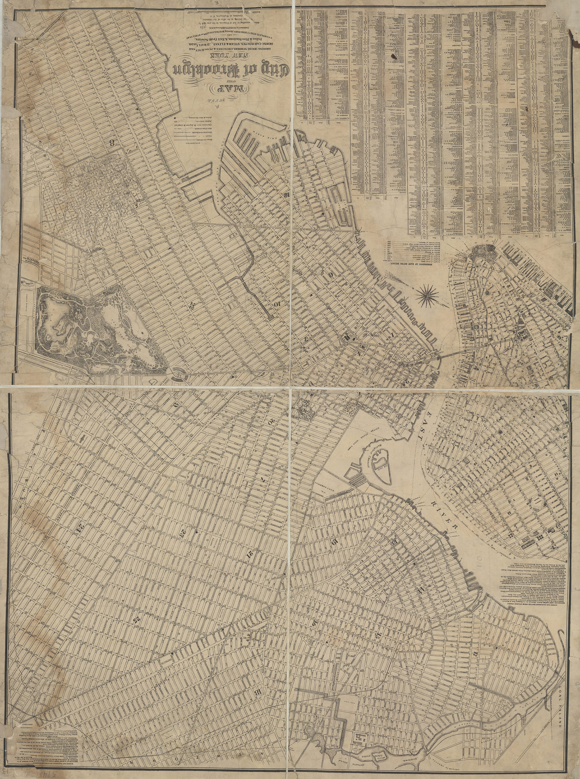
Creator
Dripps, M.,Publisher
Brooklyn Historical SocietyCitation
Map of the city of Brooklyn, New York: showing house numbers, churches & public schools, horse-car routes, steam & elevated railroads, police & fire stations, & exit from sewers, and a complete street directory, showing width & location of streets &c; [1886], Map Collection, B C-[1886?].Fl; Brooklyn Historical Society.Scale
Scale not givenLoading zoom image...