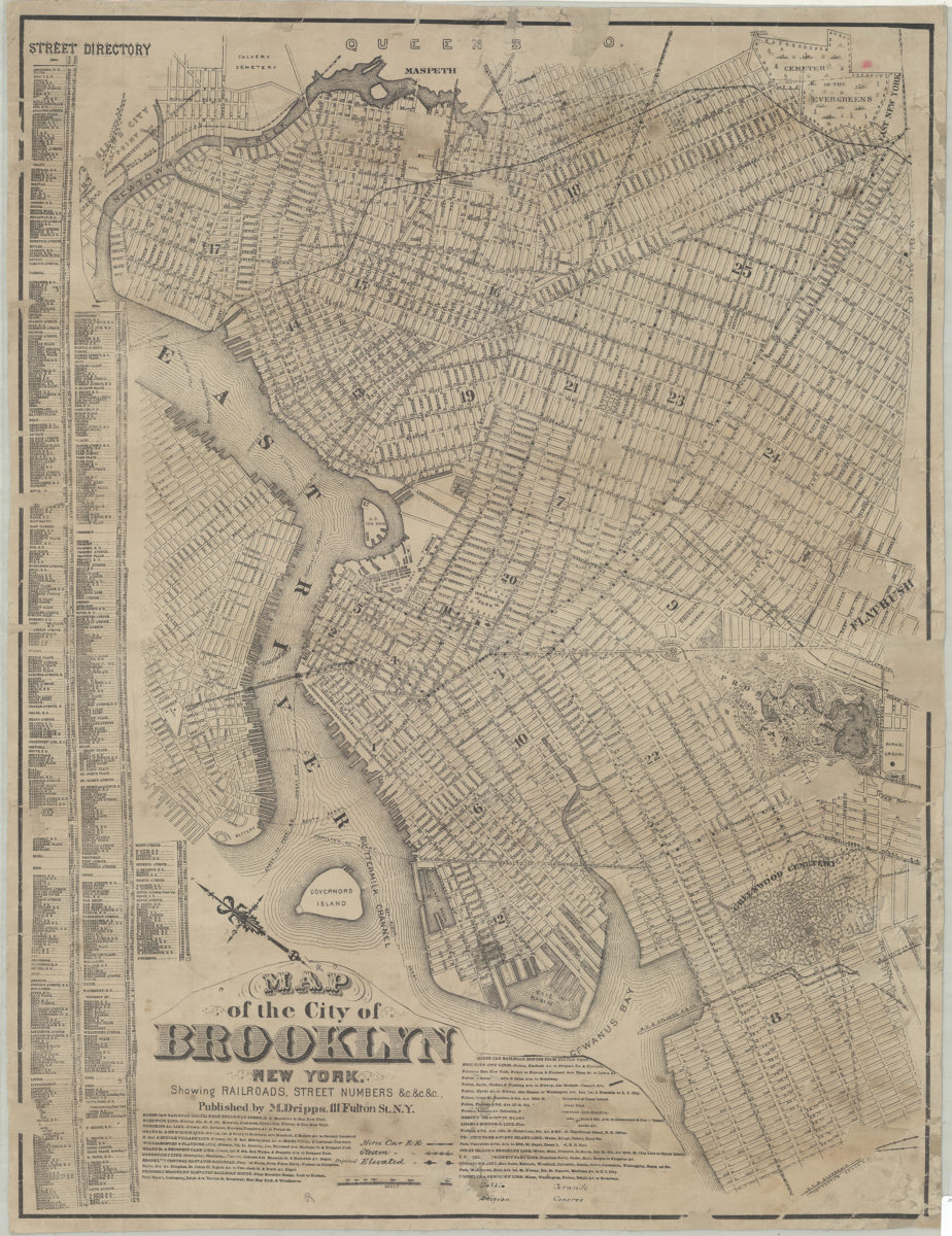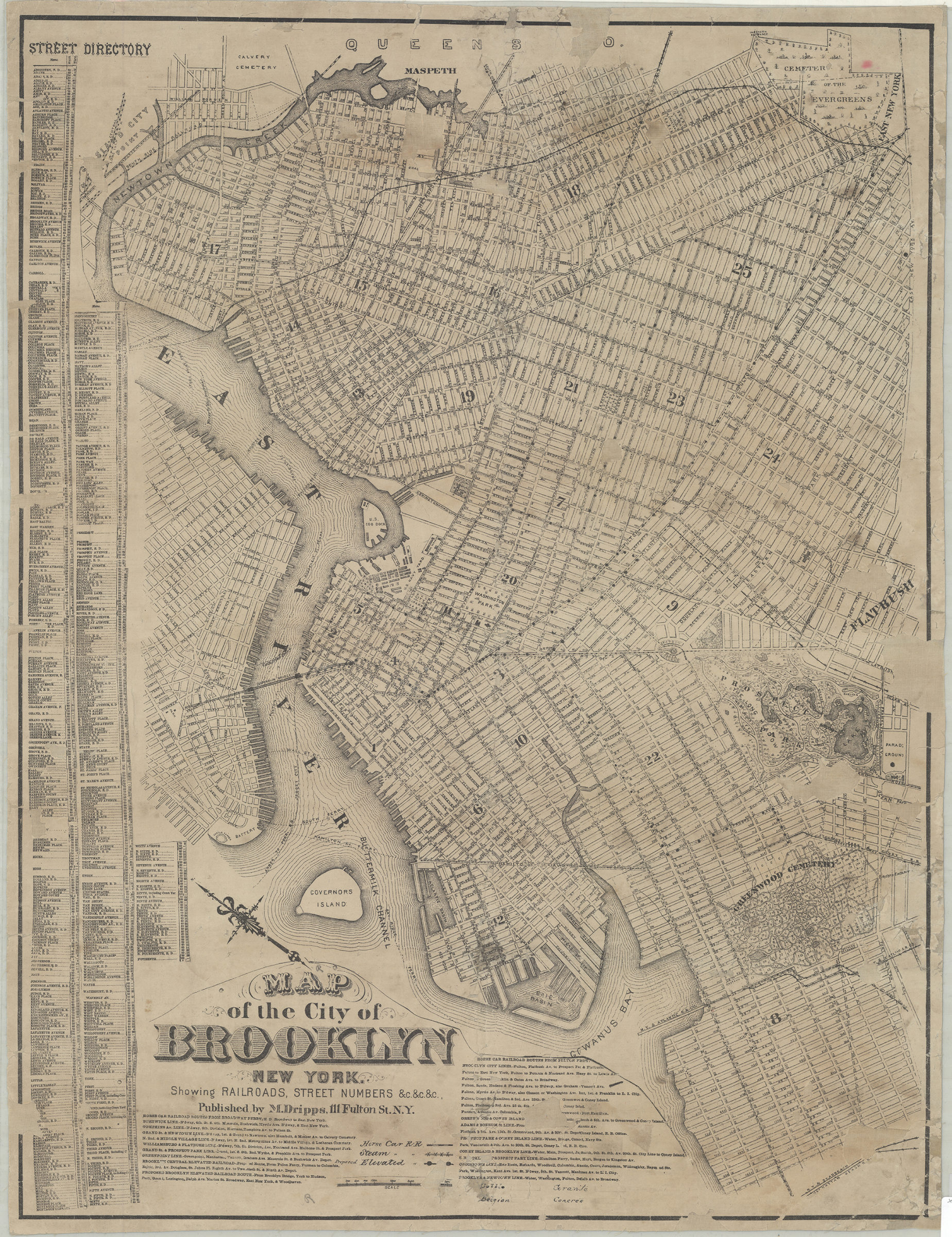
Map of the city of Brooklyn, New York: showing railroads, street numbers &c.&c.&c [18??]
Map No. B C-[18--?].Fl
Covers the city of Brooklyn north from approximately 60th St. to Green Point and east to East New York Av. Also covers Governors Island and portions of southern Queens and Lower Manhattan. Shows wards, ferry lines, horse car railroads, steam railroads, and elevated railroads. Oriented with north to the upper left. Includes street directory, two lists of railroad routes, and key. BHS copy annotated in black ink.
Map area shown
Genre
Transportation mapsRelation
Full catalog recordSize
66 × 51 cmDownload
Low Resolution Image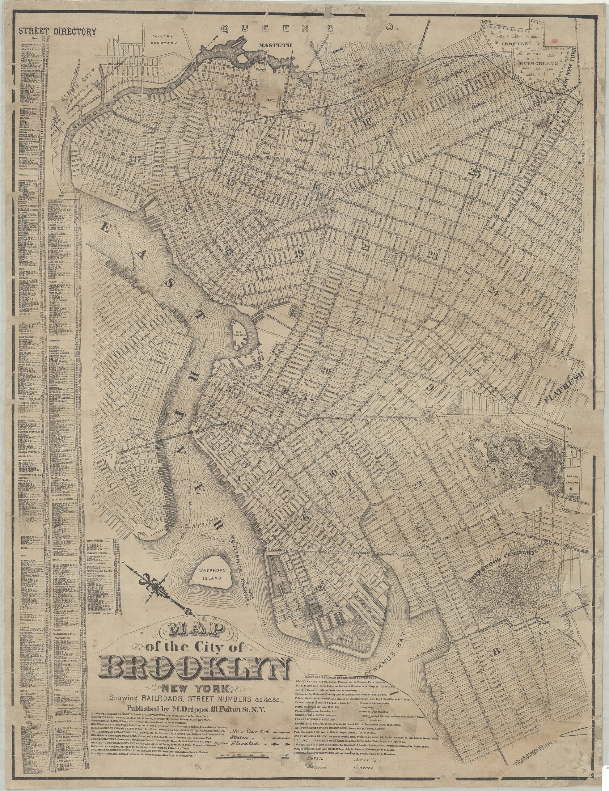
Creator
Dripps, M.,Publisher
Brooklyn Historical SocietyCitation
Map of the city of Brooklyn, New York: showing railroads, street numbers &c.&c.&c; [18??], Map Collection, B C-[18--?].Fl; Brooklyn Historical Society.Scale
Scale not givenLoading zoom image...