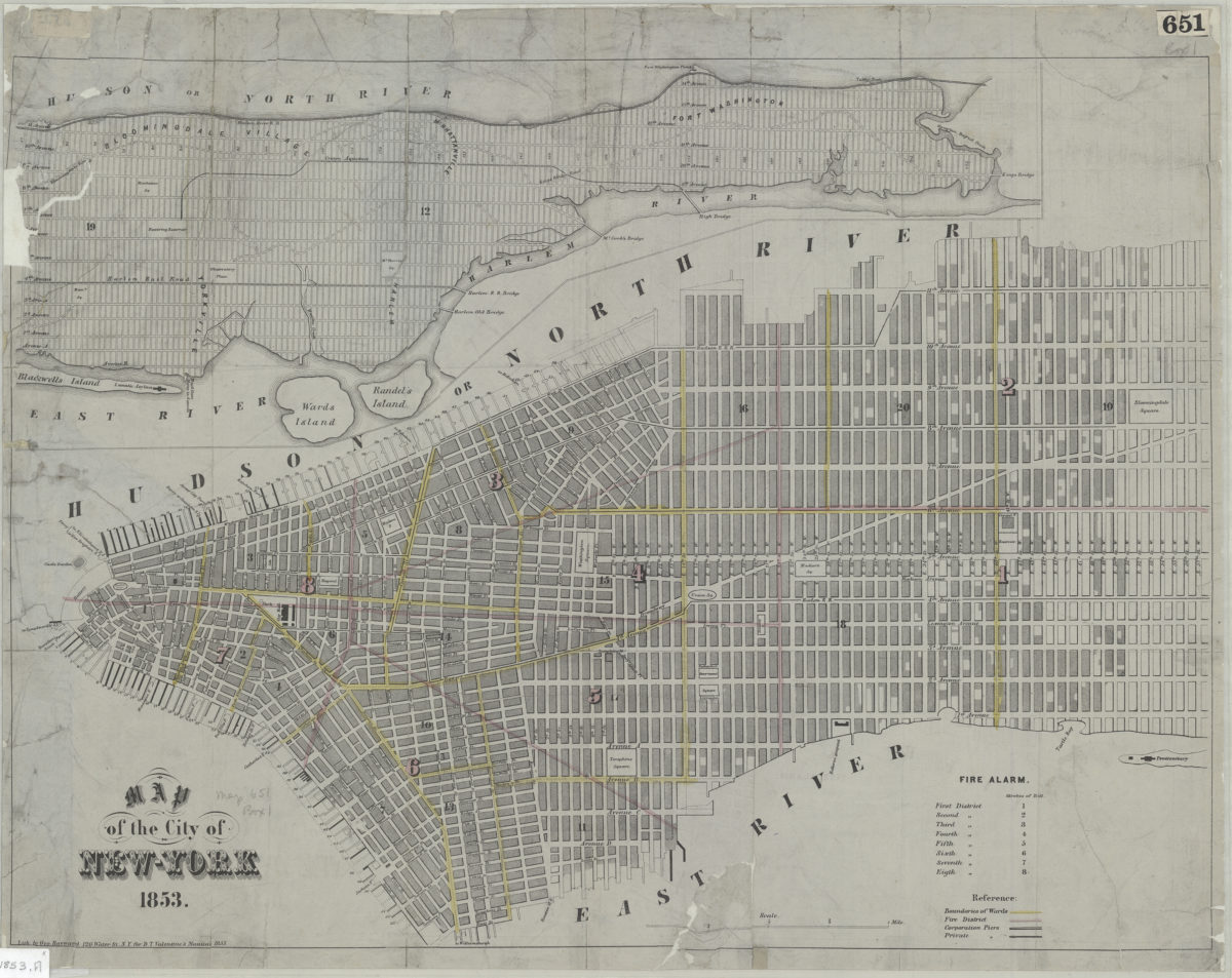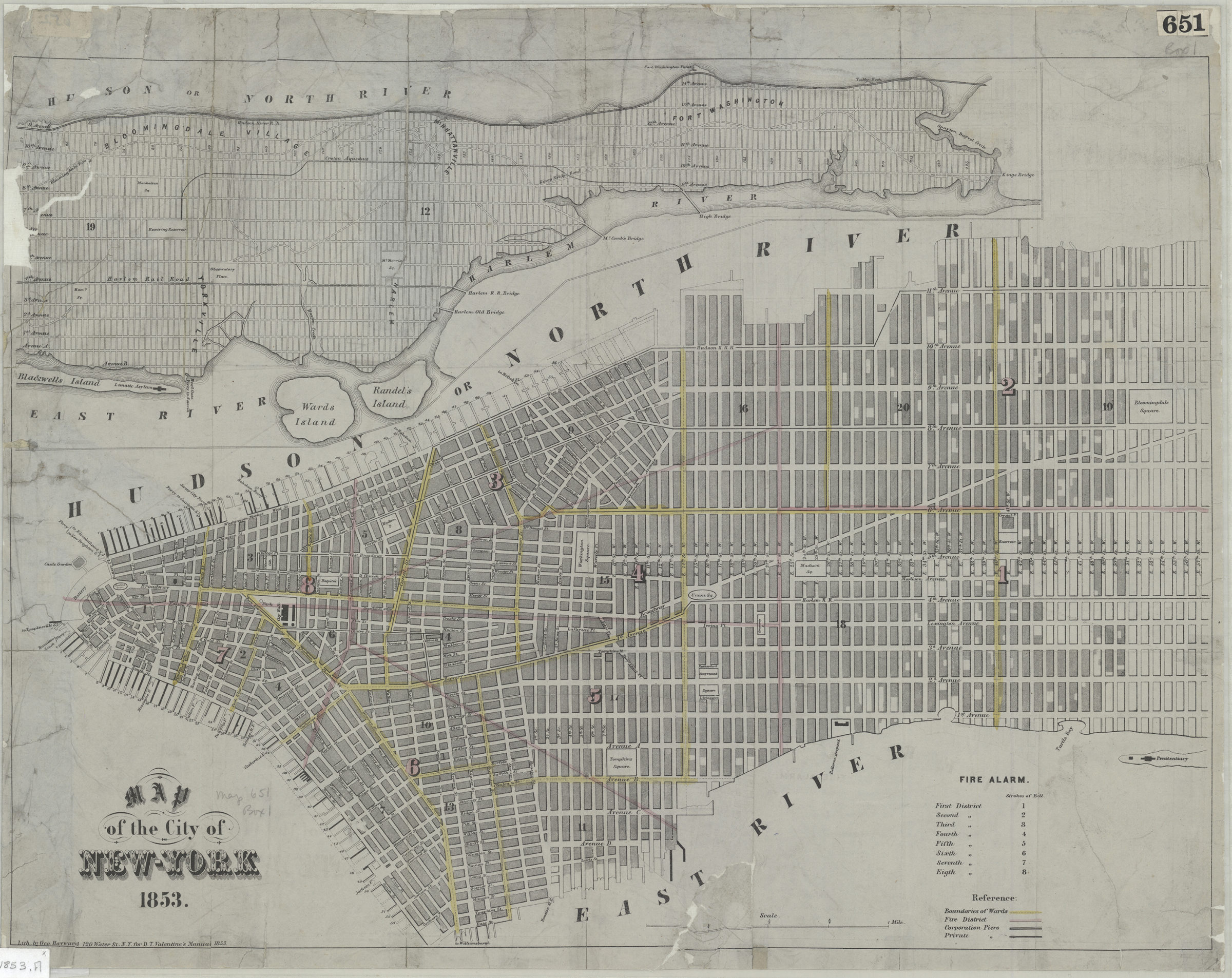
Map of the city of New York 1853 [1853]
Map No. M-1853.Fl
Covers Manhattan north to 57th St. Shows ward boundaries, fire districts, corporation piers, and private piers. Includes inset continuation map (at reduced scale from main map), and description of fire alarm bells by district.
Map area shown
Genre
MapRelation
Full catalog recordSize
43 × 54 cmDownload
Low Resolution Image
Creator
Hayward, George; Valentine, D. T.,Publisher
Brooklyn Historical SocietyCitation
Map of the city of New York 1853; [1853], Map Collection, M-1853.Fl; Brooklyn Historical Society.Scale
Scale [ca. 1:14,908]Loading zoom image...